خانه / مشخصات زلزله
Magnitude |
:3.1 |
| Date & Time (UTC) | 2018-11-01 15:30:46.7 |
| Date & Time (Local) | 1397/8/10 19:00:46.7 |
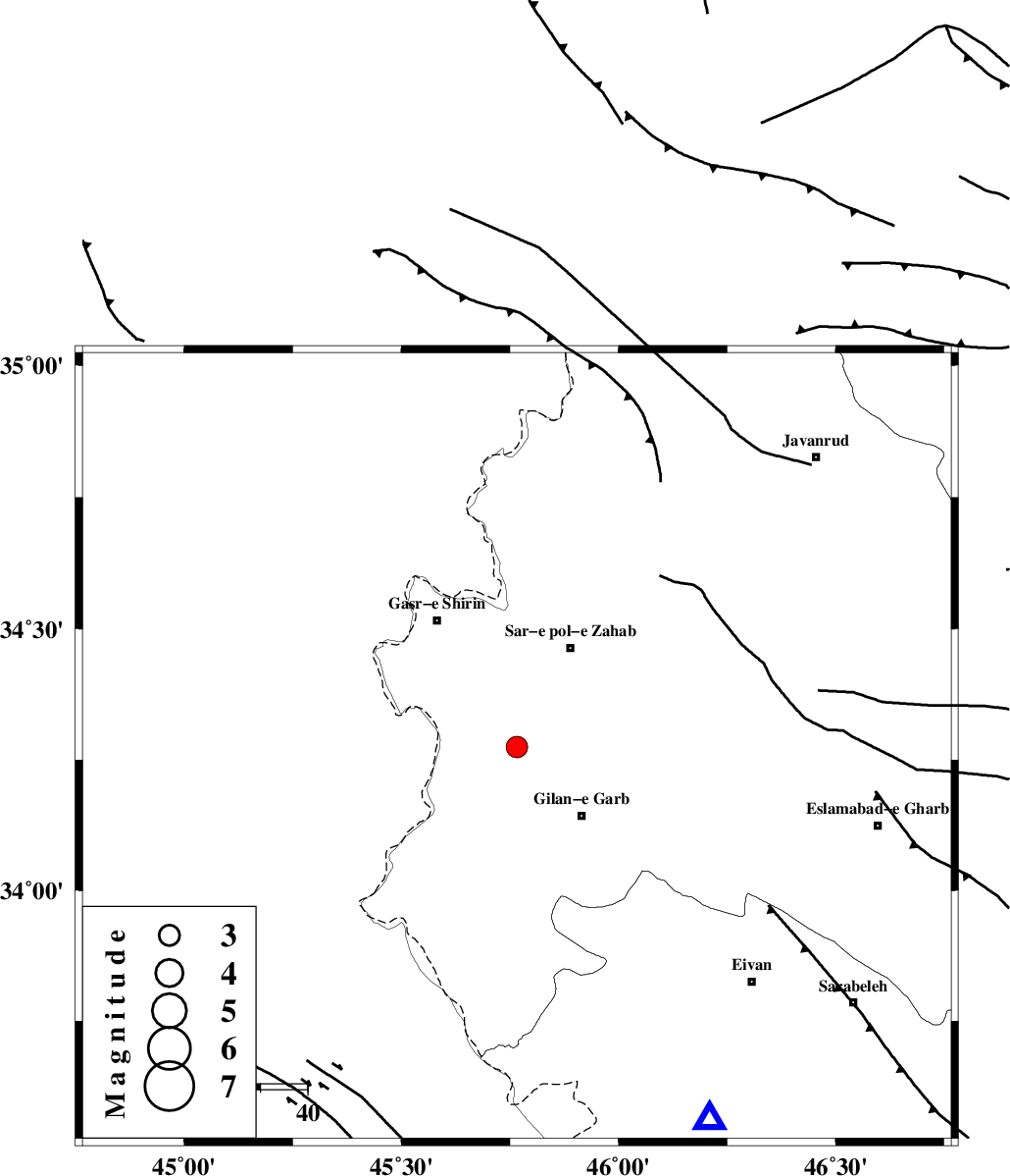
| Location | Lat:34.274 Lon: 45.766 |
| Region | Kermanshah Province, 20 km North-West of Gilan-E-Gharb |
Nearest Cities |
|
| 10 km of Chub baghan, Kermanshah Province | |
| 20 km North West of Gilan-E-Gharb, Kermanshah Province | |
| 20 km South West of Tarkveys, Kermanshah Province | |
| 24 km South of Qareh belagh, Kermanshah Province | |
| 24 km South West of Sar-e pol-e zahab, Kermanshah Province | |
| Depth | 14 km |
| Agency | |
Faults within 150 km: |
|
| MFF8 (Length: 48 km) , Distance to epicenter: 26 km | |
| MFF7 (Length: 99 km) , Distance to epicenter: 44 km | |
| ZFF4 (Length: 128 km) , Distance to epicenter: 46 km | |
| Number of Phases | 8 |
| RMS | 0.3 |
| Number of Stations | 6 |
| Error in Latitude | >2.3 km |
| Error in Longitude | 6 km |
| Error in Depth | 7.3 km |
Download waveform in seisan format
to download seisan software Click here
to access information about IIEES stations Click here
Amplitude | ||||||||
| UID | Agency | Station | Component | Amplitude | Period | Arrival Time | Proccessing Time | Signal Clip |
| 138190 | IIEES | ILBA | E | 614.3 | 0.33 | 2018-11-01 15:31:18 | 2018-11-03 10:30:00 | n |
| 138191 | IIEES | SNGE | N | 251.7 | 0.46 | 2018-11-01 15:31:40 | 2018-11-03 10:30:00 | n |
| 138192 | IIEES | SNGE | E | 208.2 | 0.33 | 2018-11-01 15:31:41 | 2018-11-03 10:30:00 | n |
Phase | ||||||||||||
| Agency | Station | Component | Phase Type | Phase Quality | First Motion | Observed Arrival Time | Time Residual | Loc. Flag | Input Weight | Distance | Azimuth | |
| IIEES | ILBA | Z | Pg | E | 2018-11-01 15:31:01 | 0.02 | y | 82.8 | 150 | |||
| IIEES | ILBA | N | Sg | E | 2018-11-01 15:31:11 | 0.03 | y | 82.8 | 150 | |||
| IIEES | SNGE | Z | Pg | E | 2018-11-01 15:31:14 | -0.67 | y | 171 | 57 | |||
| IIEES | SNGE | N | Sg | E | 2018-11-01 15:31:36 | 0.22 | y | 171 | 57 | |||
| IIEES | SRSL | Z | Pn | E | 2018-11-01 15:31:21 | -0.02 | y | 217 | 352 | |||
| IIEES | ZNJK | Z | Pn | E | 2018-11-01 15:31:41 | 0.34 | y | 375 | 44 | |||
| IIEES | KHMZ | Z | Pn | E | 2018-11-01 15:31:43 | 0.11 | y | 392 | 98 | |||
| IIEES | ASAO | Z | Pn | E | 2018-11-01 15:31:43 | 0.08 | y | 393 | 84 | |||
کلیه حقوق مادی و معنوی این سایت متعلق به پژوهشگاه بین المللی زلزله شناسی و مهندسی زلزله می باشد.
