خانه / مشخصات زلزله
Magnitude |
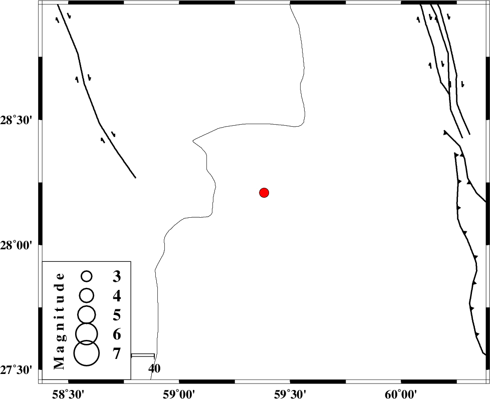
:2.7 |
| Date & Time (UTC) | 2018-10-30 18:34:03.3 |
| Date & Time (Local) | 1397/8/8 22:04:03.3 |
| Location | Lat:28.209 Lon: 59.382 |
| Region | Sistan va Baloochestan Province, 179 km -West of Khash |
Nearest Cities |
|
| 63 km South East of Hoseynabad, Kerman Province | |
| 75 km South East of Mohammadabad-e gonbaki, Kerman Province | |
| 84 km North of Kalemursi, Sistan va Baloochestan Province | |
| 87 km North West of Bozman, Sistan va Baloochestan Province | |
| 87 km North East of Borj-e abbasabad, Kerman Province | |
| Depth | 18 km |
| Agency | |
Faults within 150 km: |
|
| BAM_F (Length: 118 km) , Distance to epicenter: 57 km | |
| DAMAN_F (Length: 167 km) , Distance to epicenter: 84 km | |
| KASKIN_F (Length: 100 km) , Distance to epicenter: 85 km | |
| Number of Phases | 4 |
| RMS | 0 |
| Number of Stations | 3 |
| Error in Latitude | >2 km |
| Error in Longitude | 6.6 km |
| Error in Depth | 6.9 km |
Download waveform in seisan format
to download seisan software Click here
to access information about IIEES stations Click here
Amplitude | ||||||||
| UID | Agency | Station | Component | Amplitude | Period | Arrival Time | Proccessing Time | Signal Clip |
| 138228 | IIEES | BSRN | E | 10.7 | 0.16 | 2018-10-30 18:36:01 | 2018-11-04 04:17:00 | n |
| 138229 | IIEES | BSRN | N | 8.6 | 0.58 | 2018-10-30 18:36:08 | 2018-11-04 04:17:00 | n |
Phase | ||||||||||||
| Agency | Station | Component | Phase Type | Phase Quality | First Motion | Observed Arrival Time | Time Residual | Loc. Flag | Input Weight | Distance | Azimuth | |
| IIEES | ZHSF | Z | Pn | E | 2018-10-30 18:34:36 | 0 | y | 206 | 41 | |||
| IIEES | CHBR | Z | Pn | E | 2018-10-30 18:34:48 | 0.02 | y | 309 | 159 | |||
| IIEES | BSRN | Z | Pn | E | 2018-10-30 18:35:02 | -0.03 | y | 417 | 357 | |||
| IIEES | BSRN | N | Sg | E | 2018-10-30 18:35:59 | 0.02 | y | 417 | 357 | |||
کلیه حقوق مادی و معنوی این سایت متعلق به پژوهشگاه بین المللی زلزله شناسی و مهندسی زلزله می باشد.
