خانه / مشخصات زلزله
Magnitude |
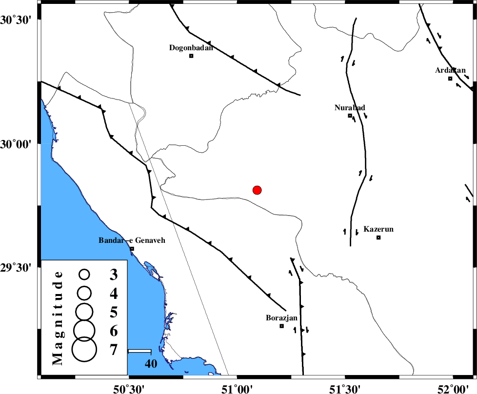
:2.5 |
| Date & Time (UTC) | 2018-11-04 15:22:23.1 |
| Date & Time (Local) | 1397/8/13 18:52:23.1 |
| Location | Lat:29.812 Lon: 51.092 |
| Region | Fars Province, 62 km North-West of Borazjan |
Nearest Cities |
|
| 30 km South West of Babamonir, Fars Province | |
| 36 km North West of Khesht, Fars Province | |
| 39 km North East of Dehkohneh, Bushehr Province | |
| 42 km North East of Chehar rustaee, Bushehr Province | |
| 42 km North West of Kamaraj, Fars Province | |
| Depth | 14 km |
| Agency | |
Faults within 150 km: |
|
| ZFF3 (Length: 125 km) , Distance to epicenter: 32 km | |
| BORAZJAN_F (Length: 168 km) , Distance to epicenter: 34 km | |
| KAZERUN_F (Length: 96 km) , Distance to epicenter: 44 km | |
| Number of Phases | 6 |
| RMS | 0.2 |
| Number of Stations | 4 |
| Error in Latitude | >3 km |
| Error in Longitude | 4.2 km |
| Error in Depth | 8.3 km |
Download waveform in seisan format
to download seisan software Click here
to access information about IIEES stations Click here
Amplitude | ||||||||
| UID | Agency | Station | Component | Amplitude | Period | Arrival Time | Proccessing Time | Signal Clip |
| 138268 | IIEES | AHRM | N | 138.4 | 0.36 | 2018-11-04 15:22:58 | 2018-11-05 04:41:00 | n |
Phase | ||||||||||||
| Agency | Station | Component | Phase Type | Phase Quality | First Motion | Observed Arrival Time | Time Residual | Loc. Flag | Input Weight | Distance | Azimuth | |
| IIEES | AHRM | Z | Pg | E | 2018-11-04 15:22:40 | -0.19 | y | 107 | 169 | |||
| IIEES | AHRM | N | Sg | E | 2018-11-04 15:22:54 | 0.04 | y | 107 | 169 | |||
| IIEES | GHIR | Z | Pn | E | 2018-11-04 15:23:02 | 0.33 | y | 250 | 132 | |||
| IIEES | GHIR | N | Sg | E | 2018-11-04 15:23:33 | -0.09 | y | 250 | 132 | |||
| IIEES | NASN | Z | Pn | E | 2018-11-04 15:23:16 | -0.01 | y | 369 | 26 | |||
| IIEES | YZKH | Z | Pn | E | 2018-11-04 15:23:25 | -0.11 | y | 439 | 49 | |||
کلیه حقوق مادی و معنوی این سایت متعلق به پژوهشگاه بین المللی زلزله شناسی و مهندسی زلزله می باشد.
