خانه / مشخصات زلزله
Magnitude |
:2.7 |
| Date & Time (UTC) | 2018-11-20 23:52:27.2 |
| Date & Time (Local) | 1397/8/30 03:22:27.2 |
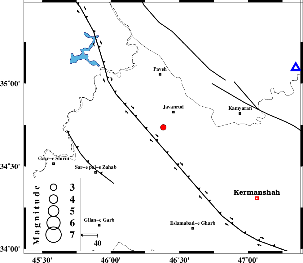
| Location | Lat:34.735 Lon: 46.382 |
| Region | Kermanshah Province, 12 km of Javanrud |
Nearest Cities |
|
| 7 km of Sarukhan, Kermanshah Province | |
| 9 km North of Mirabad, Kermanshah Province | |
| 10 km North of Dolatabad, Kermanshah Province | |
| 12 km of Javanrud, Kermanshah Province | |
| 16 km South East of Shervineh, Kermanshah Province | |
| Depth | 14 km |
| Agency | |
Faults within 150 km: |
|
| HZF4 (Length: 492 km) , Distance to epicenter: 14 km | |
| SARTAKHT_F (Length: 78 km) , Distance to epicenter: 44 km | |
| PIRANSHAHR_F (Length: 253 km) , Distance to epicenter: 49 km | |
| Number of Phases | 7 |
| RMS | 0.3 |
| Number of Stations | 5 |
| Error in Latitude | >5.9 km |
| Error in Longitude | 3.7 km |
| Error in Depth | 8.4 km |
Download waveform in seisan format
to download seisan software Click here
to access information about IIEES stations Click here
Amplitude | ||||||||
| UID | Agency | Station | Component | Amplitude | Period | Arrival Time | Proccessing Time | Signal Clip |
| 138524 | IIEES | SNGE | N | 195.7 | 0.47 | 2018-11-20 23:53:00 | 2018-11-21 08:50:00 | n |
| 138525 | IIEES | SNGE | E | 143.4 | 0.62 | 2018-11-20 23:53:00 | 2018-11-21 08:50:00 | n |
| 138526 | IIEES | SRSL | E | 105.4 | 0.41 | 2018-11-20 23:53:28 | 2018-11-21 08:50:00 | n |
| 138527 | IIEES | SRSL | N | 106.1 | 0.41 | 2018-11-20 23:53:28 | 2018-11-21 08:50:00 | n |
Phase | ||||||||||||
| Agency | Station | Component | Phase Type | Phase Quality | First Motion | Observed Arrival Time | Time Residual | Loc. Flag | Input Weight | Distance | Azimuth | |
| IIEES | SNGE | Z | Pg | E | 2018-11-20 23:52:43 | -0.15 | y | 96.7 | 66 | |||
| IIEES | SNGE | N | Sg | E | 2018-11-20 23:52:55 | -0.14 | y | 96.7 | 66 | |||
| IIEES | SRSL | Z | Pg | E | 2018-11-20 23:52:57 | -0.29 | y | 185 | 333 | |||
| IIEES | SRSL | N | Sg | E | 2018-11-20 23:53:20 | 0.07 | y | 185 | 333 | |||
| IIEES | ZNJK | Z | Pn | E | 2018-11-20 23:53:12 | 0.53 | y | 299 | 43 | |||
| IIEES | ASAO | Z | Pn | E | 2018-11-20 23:53:16 | 0.16 | y | 335 | 93 | |||
| IIEES | KHMZ | Z | Pn | E | 2018-11-20 23:53:18 | -0.15 | y | 348 | 107 | |||
کلیه حقوق مادی و معنوی این سایت متعلق به پژوهشگاه بین المللی زلزله شناسی و مهندسی زلزله می باشد.
