خانه / مشخصات زلزله
Magnitude |
:2.8 |
| Date & Time (UTC) | 2018-11-21 02:42:11.2 |
| Date & Time (Local) | 1397/8/30 06:12:11.2 |
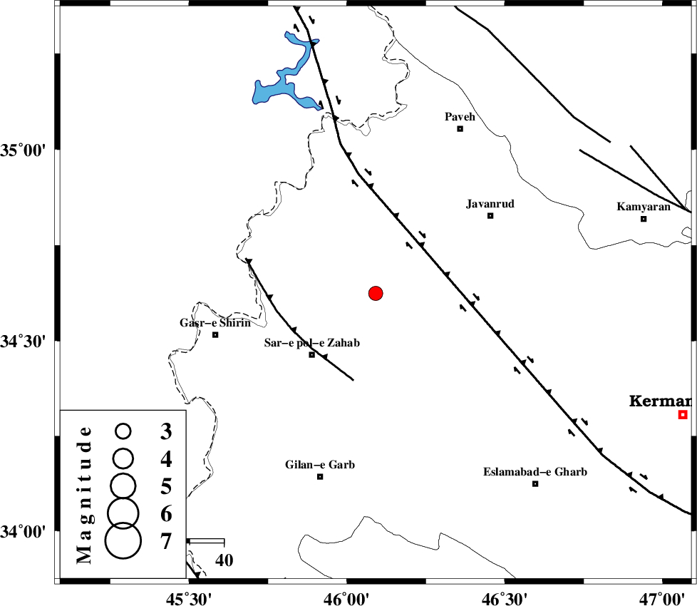
| Location | Lat:34.624 Lon: 46.091 |
| Region | Kermanshah Province, 26 km North-East of Sar-e pol-e zahab |
Nearest Cities |
|
| 13 km of Qolqoleh, Kermanshah Province | |
| 16 km East of Bazmirabad, Kermanshah Province | |
| 20 km North of Rijab, Kermanshah Province | |
| 21 km West of Mirabad, Kermanshah Province | |
| 25 km North West of Zavleh olia, Kermanshah Province | |
| Depth | 16 km |
| Agency | |
Faults within 150 km: |
|
| HZF4 (Length: 492 km) , Distance to epicenter: 19 km | |
| MFF8 (Length: 48 km) , Distance to epicenter: 25 km | |
| SARTAKHT_F (Length: 78 km) , Distance to epicenter: 72 km | |
| Number of Phases | 5 |
| RMS | 0 |
| Number of Stations | 4 |
| Error in Latitude | >6.1 km |
| Error in Longitude | 2.2 km |
| Error in Depth | 7.9 km |
Download waveform in seisan format
to download seisan software Click here
to access information about IIEES stations Click here
Amplitude | ||||||||
| UID | Agency | Station | Component | Amplitude | Period | Arrival Time | Proccessing Time | Signal Clip |
| 138546 | IIEES | SNGE | N | 92.4 | 0.41 | 2018-11-21 02:42:50 | 2018-11-21 08:50:00 | n |
| 138547 | IIEES | SRSL | N | 156.6 | 0.65 | 2018-11-21 02:43:11 | 2018-11-21 08:50:00 | n |
| 138548 | IIEES | SRSL | E | 150.8 | 0.41 | 2018-11-21 02:43:12 | 2018-11-21 08:50:00 | n |
Phase | ||||||||||||
| Agency | Station | Component | Phase Type | Phase Quality | First Motion | Observed Arrival Time | Time Residual | Loc. Flag | Input Weight | Distance | Azimuth | |
| IIEES | SNGE | Z | Pg | E | 2018-11-21 02:42:32 | 0.02 | y | 126 | 65 | |||
| IIEES | SNGE | N | Sg | E | 2018-11-21 02:42:47 | -0.01 | y | 126 | 65 | |||
| IIEES | SRSL | Z | Pg | E | 2018-11-21 02:42:41 | -0.01 | y | 186 | 341 | |||
| IIEES | ASAO | Z | Pn | E | 2018-11-21 02:43:03 | 0.04 | y | 361 | 90 | |||
| IIEES | KHMZ | Z | Pn | E | 2018-11-21 02:43:04 | -0.04 | y | 370 | 104 | |||
کلیه حقوق مادی و معنوی این سایت متعلق به پژوهشگاه بین المللی زلزله شناسی و مهندسی زلزله می باشد.
