خانه / مشخصات زلزله
Magnitude |
:3.4 |
| Date & Time (UTC) | 2018-11-28 05:34:19.9 |
| Date & Time (Local) | 1397/9/7 09:04:19.9 |
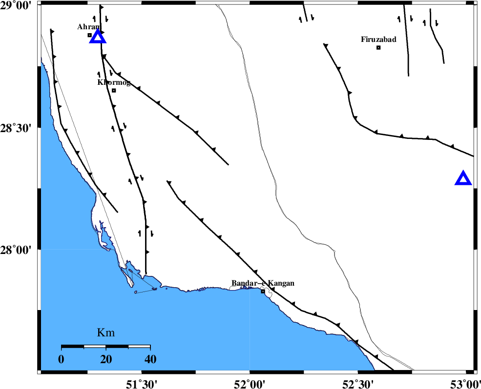
| Location | Lat:28.252 Lon: 52.035 |
| Region | Bushehr Province, 47 km North of Bandar-e kangan |
Nearest Cities |
|
| 23 km North of Riz, Bushehr Province | |
| 28 km North West of Dolatabad, Fars Province | |
| 31 km South East of Shanbeh, Bushehr Province | |
| 33 km North East of Abdan, Bushehr Province | |
| 38 km South West of Dahrom, Fars Province | |
| Depth | 9 km |
| Agency | |
Faults within 150 km: |
|
| MFF5 (Length: 74 km) , Distance to epicenter: 17 km | |
| MFF3 (Length: 292 km) , Distance to epicenter: 29 km | |
| BORAZJAN_F (Length: 168 km) , Distance to epicenter: 52 km | |
| Number of Phases | 5 |
| RMS | 0.2 |
| Number of Stations | 4 |
| Error in Latitude | >9.1 km |
| Error in Longitude | 5.3 km |
| Error in Depth | 4.9 km |
Download waveform in seisan format
to download seisan software Click here
to access information about IIEES stations Click here
Amplitude | ||||||||
| UID | Agency | Station | Component | Amplitude | Period | Arrival Time | Proccessing Time | Signal Clip |
| 138772 | IIEES | AHRM | E | 1187.3 | 0.72 | 2018-11-28 05:35:01 | 2018-11-28 08:20:00 | n |
| 138773 | IIEES | AHRM | N | 1366 | 0.54 | 2018-11-28 05:35:03 | 2018-11-28 08:20:00 | n |
| 138774 | IIEES | BNDS | N | 43.6 | 0.45 | 2018-11-28 05:36:39 | 2018-11-28 08:20:00 | n |
| 138775 | IIEES | BNDS | E | 32.2 | 0.75 | 2018-11-28 05:36:58 | 2018-11-28 08:20:00 | n |
| 138776 | IIEES | KRBR | E | 24.7 | 0.55 | 2018-11-28 05:36:27 | 2018-11-28 08:20:00 | n |
| 138777 | IIEES | KRBR | N | 30 | 0.34 | 2018-11-28 05:36:29 | 2018-11-28 08:20:00 | n |
Phase | ||||||||||||
| Agency | Station | Component | Phase Type | Phase Quality | First Motion | Observed Arrival Time | Time Residual | Loc. Flag | Input Weight | Distance | Azimuth | |
| IIEES | GHIR | Z | Pg | E | 2018-11-28 05:34:36 | 0.04 | y | 93.4 | 87 | |||
| IIEES | AHRM | Z | Pg | E | 2018-11-28 05:34:36 | -0.22 | y | 99.2 | 313 | |||
| IIEES | AHRM | N | Sg | E | 2018-11-28 05:34:49 | 0.17 | y | 99.2 | 313 | |||
| IIEES | BNDS | Z | Pn | E | 2018-11-28 05:35:20 | 0.16 | y | 418 | 102 | |||
| IIEES | KRBR | Z | Pn | E | 2018-11-28 05:35:30 | -0.17 | y | 498 | 66 | |||
کلیه حقوق مادی و معنوی این سایت متعلق به پژوهشگاه بین المللی زلزله شناسی و مهندسی زلزله می باشد.
