خانه / مشخصات زلزله
Magnitude |
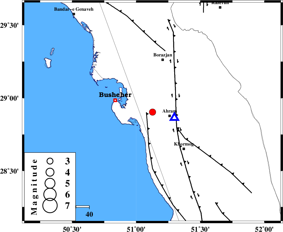
:3.2 |
| Date & Time (UTC) | 2018-12-02 21:49:36.1 |
| Date & Time (Local) | 1397/9/12 01:19:36.1 |
| Location | Lat:28.904 Lon: 51.127 |
| Region | Bushehr Province, 13 km -West of Ahram |
Nearest Cities |
|
| 13 km of Choghadak, Bushehr Province | |
| 13 km North West of Ahram, Bushehr Province | |
| 14 km West of Bazuei, Bushehr Province | |
| 17 km North of Delvar, Bushehr Province | |
| 30 km East of Busheher, Bushehr Province | |
| Depth | 14 km |
| Agency | |
Faults within 150 km: |
|
| ZFF2 (Length: 84 km) , Distance to epicenter: 5 km | |
| BORAZJAN_F (Length: 168 km) , Distance to epicenter: 18 km | |
| MFF5 (Length: 74 km) , Distance to epicenter: 22 km | |
| Number of Phases | 6 |
| RMS | 0 |
| Number of Stations | 5 |
| Error in Latitude | >4.7 km |
| Error in Longitude | 8.9 km |
| Error in Depth | 3.4 km |
Download waveform in seisan format
to download seisan software Click here
to access information about IIEES stations Click here
Amplitude | ||||||||
| UID | Agency | Station | Component | Amplitude | Period | Arrival Time | Proccessing Time | Signal Clip |
| 138900 | IIEES | KRBR | N | 9.8 | 0.45 | 2018-12-02 21:52:00 | 2018-12-03 08:55:00 | n |
| 138901 | IIEES | KRBR | E | 14.1 | 0.68 | 2018-12-02 21:52:20 | 2018-12-03 08:55:00 | n |
Phase | ||||||||||||
| Agency | Station | Component | Phase Type | Phase Quality | First Motion | Observed Arrival Time | Time Residual | Loc. Flag | Input Weight | Distance | Azimuth | |
| IIEES | AHRM | Z | Pg | E | 2018-12-02 21:49:40 | -0.05 | y | 17.1 | 104 | |||
| IIEES | GHIR | Z | Pg | E | 2018-12-02 21:50:08 | 0.03 | y | 194 | 110 | |||
| IIEES | NASN | Z | Pn | E | 2018-12-02 21:50:41 | -0.01 | y | 461 | 20 | |||
| IIEES | NASN | N | S | E | 2018-12-02 21:51:28 | -0.02 | y | 461 | 20 | |||
| IIEES | YZKH | Z | Pn | E | 2018-12-02 21:50:47 | 0.05 | y | 510 | 40 | |||
| IIEES | KRBR | Z | Pn | E | 2018-12-02 21:50:53 | 0.01 | y | 559 | 76 | |||
کلیه حقوق مادی و معنوی این سایت متعلق به پژوهشگاه بین المللی زلزله شناسی و مهندسی زلزله می باشد.
