خانه / مشخصات زلزله
Magnitude |
:2.7 |
| Date & Time (UTC) | 2018-12-04 16:32:22.0 |
| Date & Time (Local) | 1397/9/13 20:02:22.0 |
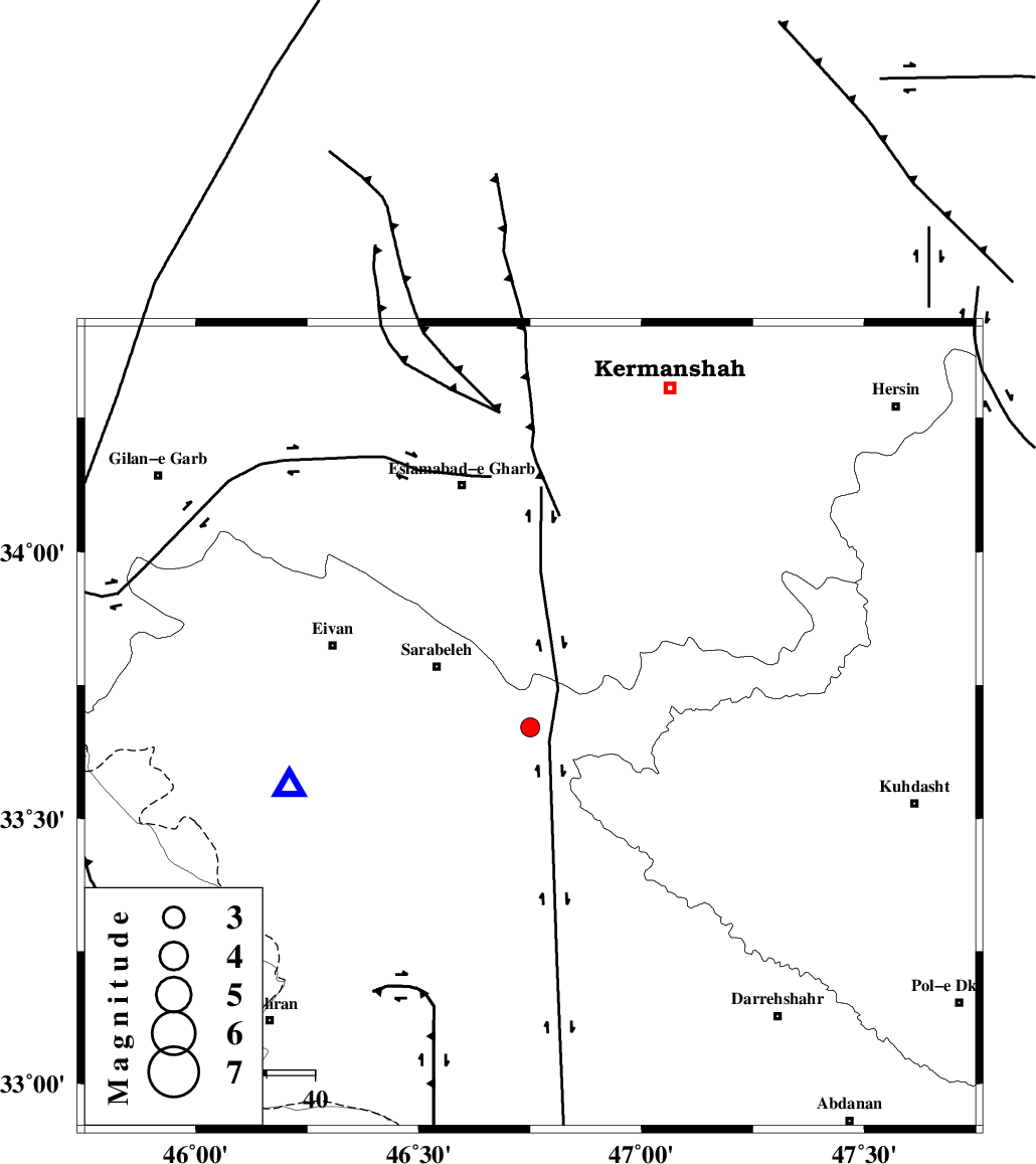
| Location | Lat:33.671 Lon: 46.75 |
| Region | Ilam Province, 23 km South-East of Sar Ableh |
Nearest Cities |
|
| 5 km North of Belaveh tare-e sofla, Ilam Province | |
| 6 km North of Sartang-e malehmaran, Ilam Province | |
| 23 km South East of Sar Ableh, Ilam Province | |
| 24 km South of Darbid-e mansuri, Kermanshah Province | |
| 24 km South West of Qale-ye harsam, Kermanshah Province | |
| Depth | 14 km |
| Agency | |
Faults within 150 km: |
|
| MFF7 (Length: 99 km) , Distance to epicenter: 45 km | |
| HZF4 (Length: 492 km) , Distance to epicenter: 52 km | |
| MFF6 (Length: 144 km) , Distance to epicenter: 61 km | |
| Number of Phases | 6 |
| RMS | 0.3 |
| Number of Stations | 4 |
| Error in Latitude | >4 km |
| Error in Longitude | 3.8 km |
| Error in Depth | 7.7 km |
Download waveform in seisan format
to download seisan software Click here
to access information about IIEES stations Click here
Amplitude | ||||||||
| UID | Agency | Station | Component | Amplitude | Period | Arrival Time | Proccessing Time | Signal Clip |
| 138994 | IIEES | ILBA | N | 780.9 | 0.37 | 2018-12-04 16:32:39 | 2018-12-05 10:00:00 | n |
| 138995 | IIEES | ILBA | E | 883.5 | 0.34 | 2018-12-04 16:32:40 | 2018-12-05 10:00:00 | n |
| 138996 | IIEES | SRSL | N | 25.4 | 0.54 | 2018-12-04 16:33:59 | 2018-12-05 10:00:00 | n |
| 138997 | IIEES | SRSL | E | 18.9 | 0.58 | 2018-12-04 16:34:04 | 2018-12-05 10:00:00 | n |
Phase | ||||||||||||
| Agency | Station | Component | Phase Type | Phase Quality | First Motion | Observed Arrival Time | Time Residual | Loc. Flag | Input Weight | Distance | Azimuth | |
| IIEES | ILBA | Z | Pg | E | 2018-12-04 16:32:31 | -0.08 | y | 50.6 | 264 | |||
| IIEES | ILBA | N | Sg | E | 2018-12-04 16:32:37 | 0.06 | y | 50.6 | 264 | |||
| IIEES | SNGE | Z | Pg | E | 2018-12-04 16:32:49 | -0.5 | y | 167 | 19 | |||
| IIEES | SNGE | E | Sg | E | 2018-12-04 16:33:10 | 0.2 | y | 167 | 19 | |||
| IIEES | KHMZ | Z | Pn | E | 2018-12-04 16:33:06 | 0.1 | y | 298 | 88 | |||
| IIEES | SRSL | Z | Pn | E | 2018-12-04 16:33:08 | 0.26 | y | 306 | 337 | |||
کلیه حقوق مادی و معنوی این سایت متعلق به پژوهشگاه بین المللی زلزله شناسی و مهندسی زلزله می باشد.
