خانه / مشخصات زلزله
Magnitude |
:2.8 |
| Date & Time (UTC) | 2018-12-21 20:34:12.5 |
| Date & Time (Local) | 1397/10/1 00:04:12.5 |
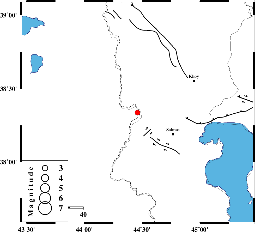
| Location | Lat:38.337 Lon: 44.46 |
| Region | Turkey, 32 km North-West of Salmas |
Nearest Cities |
|
| 16 km South of Gatur, Azarbaijan Gharbi Province | |
| 22 km North of Kuzeh rash, Azarbaijan Gharbi Province | |
| 22 km North West of Tazehshahr, Azarbaijan Gharbi Province | |
| 26 km North West of Saylab, Azarbaijan Gharbi Province | |
| 32 km North West of Salmas, Azarbaijan Gharbi Province | |
| Depth | 14 km |
| Agency | |
Faults within 150 km: |
|
| SALMAS (Length: 20 km) , Distance to epicenter: 16 km | |
| N_TABRIZ_F3 (Length: 66 km) , Distance to epicenter: 37 km | |
| KHOY (Length: 100 km) , Distance to epicenter: 45 km | |
| Number of Phases | 7 |
| RMS | 0.5 |
| Number of Stations | 5 |
| Error in Latitude | >3.5 km |
| Error in Longitude | 7.9 km |
| Error in Depth | 9.5 km |
Download waveform in seisan format
to download seisan software Click here
to access information about IIEES stations Click here
Amplitude | ||||||||
| UID | Agency | Station | Component | Amplitude | Period | Arrival Time | Proccessing Time | Signal Clip |
| 139533 | IIEES | SRSL | N | 52.8 | 0.61 | 2018-12-21 20:35:33 | 2018-12-22 09:58:00 | n |
| 139534 | IIEES | SRSL | E | 45.8 | 0.54 | 2018-12-21 20:35:36 | 2018-12-22 09:58:00 | n |
| 139535 | IIEES | GRMI | N | 22.4 | 0.46 | 2018-12-21 20:35:41 | 2018-12-22 09:58:00 | n |
Phase | ||||||||||||
| Agency | Station | Component | Phase Type | Phase Quality | First Motion | Observed Arrival Time | Time Residual | Loc. Flag | Input Weight | Distance | Azimuth | |
| IIEES | MAKU | Z | Pg | E | 2018-12-21 20:34:31 | -0.46 | y | 115 | 10 | |||
| IIEES | SRSL | Z | Pn | E | 2018-12-21 20:34:51 | 0.49 | y | 251 | 160 | |||
| IIEES | SRSL | N | Sg | E | 2018-12-21 20:35:22 | -0.65 | y | 251 | 160 | |||
| IIEES | GRMI | Z | Pn | E | 2018-12-21 20:34:58 | 0.09 | y | 304 | 79 | |||
| IIEES | GRMI | E | Sg | E | 2018-12-21 20:35:37 | -0.1 | y | 304 | 79 | |||
| IIEES | ZNJK | Z | Pn | E | 2018-12-21 20:35:12 | 0.73 | y | 417 | 115 | |||
| IIEES | SNGE | Z | Pn | E | 2018-12-21 20:35:15 | 0.1 | y | 443 | 144 | |||
کلیه حقوق مادی و معنوی این سایت متعلق به پژوهشگاه بین المللی زلزله شناسی و مهندسی زلزله می باشد.
