خانه / مشخصات زلزله
Magnitude |
:2.5 |
| Date & Time (UTC) | 2018-12-29 22:49:09.5 |
| Date & Time (Local) | 1397/10/9 02:19:09.5 |
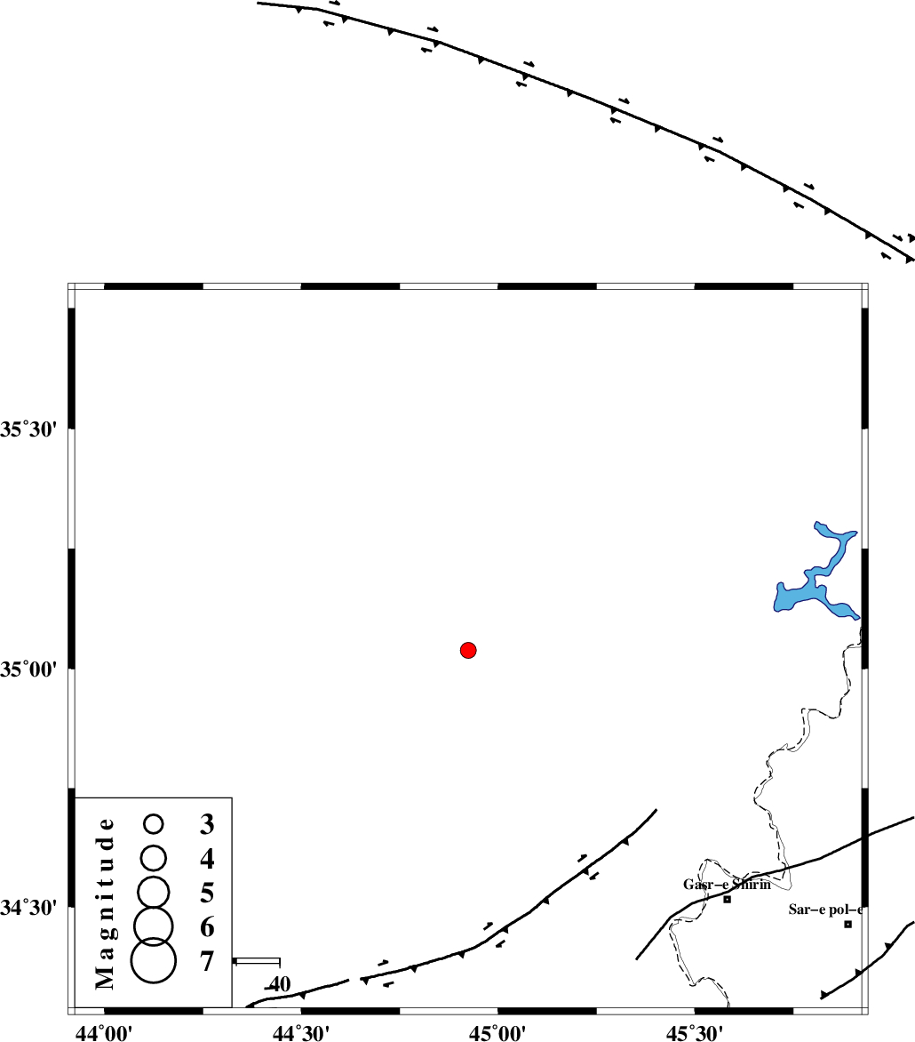
| Location | Lat:35.038 Lon: 44.924 |
| Region | Iraq, 75 km South-West of Sulaymaniyah |
Nearest Cities |
|
| 75 km South West of Sulaymaniyah, Iraq Province | |
| 79 km North West of Tappeh rash, Kermanshah Province | |
| 84 km North West of Qasr-E-Shirin, Kermanshah Province | |
| 87 km North West of Khosravi, Kermanshah Province | |
| 87 km North West of Aqabarar, Kermanshah Province | |
| Depth | 14 km |
| Agency | |
Faults within 150 km: |
|
| MFF8 (Length: 48 km) , Distance to epicenter: 78 km | |
| HZF4 (Length: 492 km) , Distance to epicenter: 89 km | |
| PIRANSHAHR_F (Length: 253 km) , Distance to epicenter: 127 km | |
| Number of Phases | 5 |
| RMS | 0.1 |
| Number of Stations | 3 |
| Error in Latitude | >1.6 km |
| Error in Longitude | 3.2 km |
| Error in Depth | 4.9 km |
Download waveform in seisan format
to download seisan software Click here
to access information about IIEES stations Click here
Amplitude | ||||||||
| UID | Agency | Station | Component | Amplitude | Period | Arrival Time | Proccessing Time | Signal Clip |
| 139690 | IIEES | ILBA | E | 38.6 | 0.42 | 2018-12-29 22:50:10 | 2018-12-30 07:11:00 | n |
Phase | ||||||||||||
| Agency | Station | Component | Phase Type | Phase Quality | First Motion | Observed Arrival Time | Time Residual | Loc. Flag | Input Weight | Distance | Azimuth | |
| IIEES | SRSL | Z | Pg | E | 2018-12-29 22:49:32 | 0.05 | y | 138 | 19 | |||
| IIEES | ILBA | Z | Pg | E | 2018-12-29 22:49:41 | -0.2 | y | 196 | 143 | |||
| IIEES | ILBA | N | Sg | E | 2018-12-29 22:50:05 | 0.16 | y | 196 | 143 | |||
| IIEES | SNGE | Z | Pn | E | 2018-12-29 22:49:44 | 0.04 | y | 221 | 88 | |||
| IIEES | SNGE | N | Sg | E | 2018-12-29 22:50:12 | -0.05 | y | 221 | 88 | |||
کلیه حقوق مادی و معنوی این سایت متعلق به پژوهشگاه بین المللی زلزله شناسی و مهندسی زلزله می باشد.
