خانه / مشخصات زلزله
Magnitude |
:3.5 |
| Date & Time (UTC) | 2019-01-03 08:50:06.8 |
| Date & Time (Local) | 1397/10/13 12:20:06.8 |
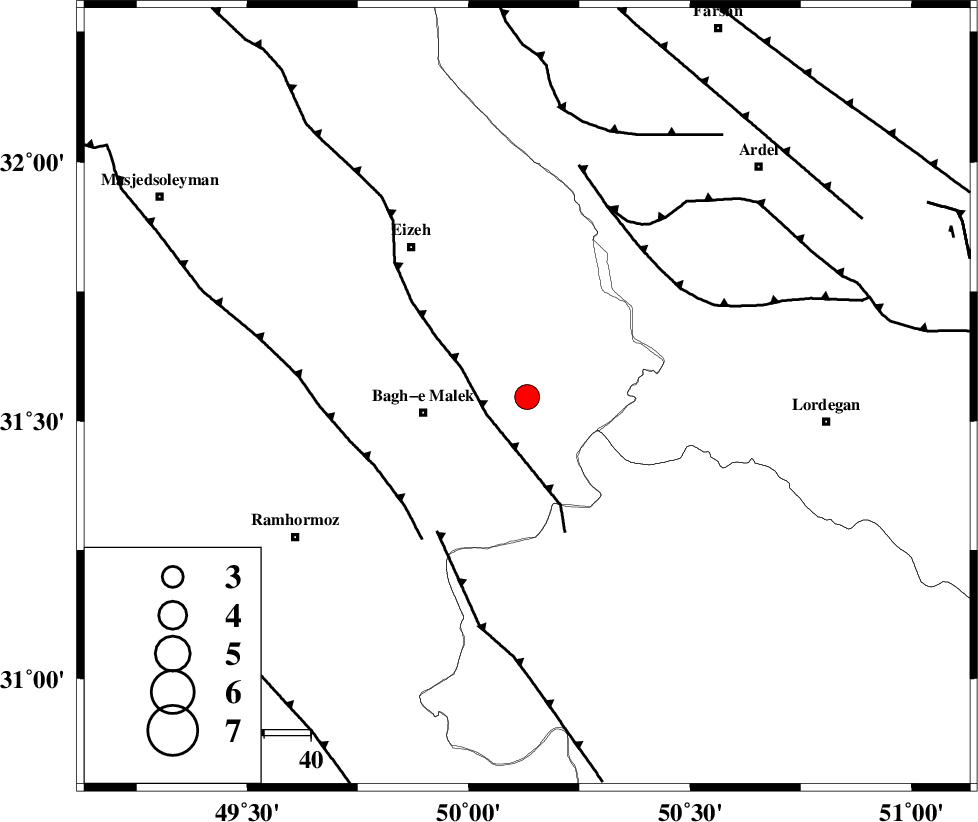
| Location | Lat:31.546 Lon: 50.132 |
| Region | Khoozestan Province, 22 km -East of Bagh Malek |
Nearest Cities |
|
| 14 km East of Abolabbas, Khoozestan Province | |
| 22 km North of Seidun, Khoozestan Province | |
| 22 km North East of Bagh Malek, Khoozestan Province | |
| 25 km East of Ghaleh tal, Khoozestan Province | |
| 26 km South West of Dehdez, Khoozestan Province | |
| Depth | 15 km |
| Agency | |
Faults within 150 km: |
|
| MFF2 (Length: 205 km) , Distance to epicenter: 9 km | |
| MFF4 (Length: 62 km) , Distance to epicenter: 35 km | |
| DEZFUL_EMBAYMENT (Length: 228 km) , Distance to epicenter: 35 km | |
| Number of Phases | 5 |
| RMS | 0.3 |
| Number of Stations | 5 |
| Error in Latitude | >3.6 km |
| Error in Longitude | 2.7 km |
| Error in Depth | 0 km |
Download waveform in seisan format
to download seisan software Click here
to access information about IIEES stations Click here
Amplitude | ||||||||
| UID | Agency | Station | Component | Amplitude | Period | Arrival Time | Proccessing Time | Signal Clip |
| 139801 | IIEES | AHRM | N | 79.3 | 0.49 | 2019-01-03 08:51:42 | 2019-01-05 10:36:00 | n |
| 139802 | IIEES | GHVR | N | 57 | 0.74 | 2019-01-03 08:51:58 | 2019-01-05 10:36:00 | n |
| 139803 | IIEES | ILBA | N | 80.2 | 0.59 | 2019-01-03 08:52:19 | 2019-01-05 10:36:00 | n |
| 139804 | IIEES | ILBA | E | 79.7 | 0.69 | 2019-01-03 08:52:30 | 2019-01-05 10:36:00 | n |
Phase | ||||||||||||
| Agency | Station | Component | Phase Type | Phase Quality | First Motion | Observed Arrival Time | Time Residual | Loc. Flag | Input Weight | Distance | Azimuth | |
| IIEES | AHRM | Z | Pn | E | 2019-01-03 08:50:54 | 0.18 | y | 318 | 159 | |||
| IIEES | GHVR | Z | Pn | E | 2019-01-03 08:50:57 | 0.39 | y | 342 | 17 | |||
| IIEES | YZKH | Z | Pn | E | 2019-01-03 08:51:07 | -0.43 | y | 432 | 76 | |||
| IIEES | ILBA | Z | Pn | E | 2019-01-03 08:51:08 | -0.25 | y | 435 | 303 | |||
| IIEES | SNGE | Z | Pn | E | 2019-01-03 08:51:13 | 0.01 | y | 471 | 327 | |||
کلیه حقوق مادی و معنوی این سایت متعلق به پژوهشگاه بین المللی زلزله شناسی و مهندسی زلزله می باشد.
