خانه / مشخصات زلزله
Magnitude |
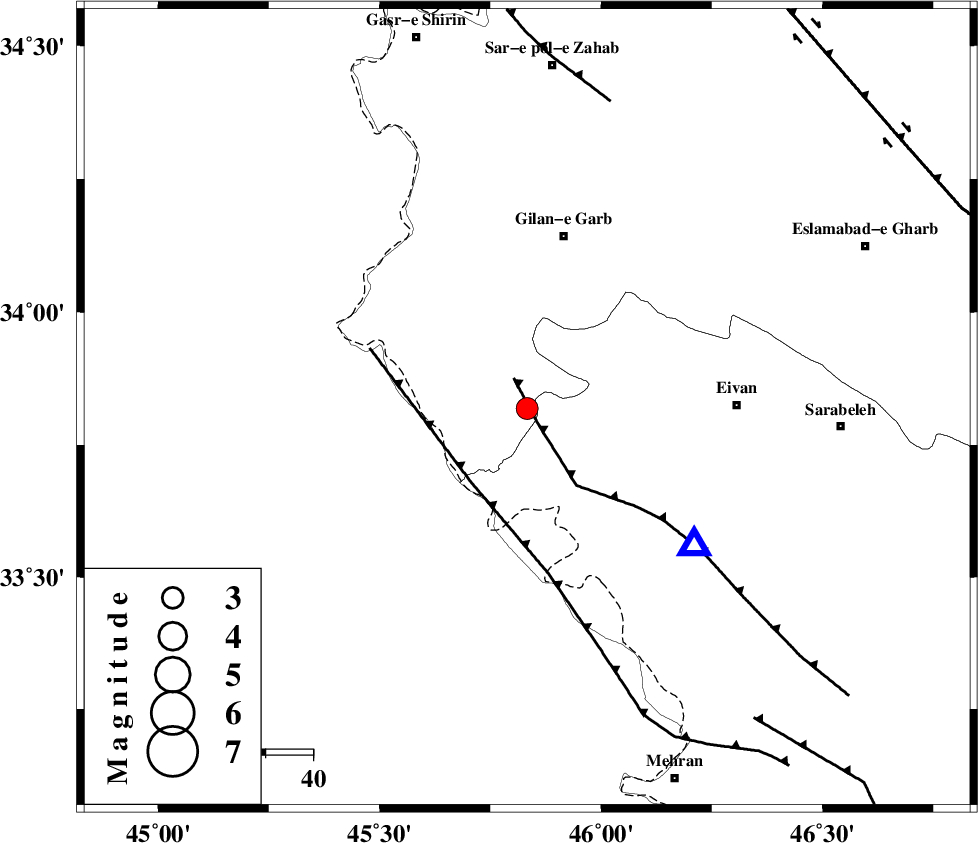
:3.1 |
| Date & Time (UTC) | 2019-01-11 23:27:31.9 |
| Date & Time (Local) | 1397/10/22 02:57:31.9 |
| Location | Lat:33.819 Lon: 45.833 |
| Region | Kermanshah Province, 37 km South of Gilan-E-Gharb |
Nearest Cities |
|
| 19 km East of Sumar, Kermanshah Province | |
| 26 km South West of Nian, Kermanshah Province | |
| 31 km South West of Teran, Ilam Province | |
| 34 km South West of Zarneh, Ilam Province | |
| 37 km South of Gilan-E-Gharb, Kermanshah Province | |
| Depth | 14 km |
| Agency | |
Faults within 150 km: |
|
| MFF7 (Length: 99 km) , Distance to epicenter: 3 km | |
| ZFF4 (Length: 128 km) , Distance to epicenter: 19 km | |
| MFF8 (Length: 48 km) , Distance to epicenter: 66 km | |
| Number of Phases | 7 |
| RMS | 0.2 |
| Number of Stations | 5 |
| Error in Latitude | >4.8 km |
| Error in Longitude | 8.6 km |
| Error in Depth | 4.5 km |
Download waveform in seisan format
to download seisan software Click here
to access information about IIEES stations Click here
Amplitude | ||||||||
| UID | Agency | Station | Component | Amplitude | Period | Arrival Time | Proccessing Time | Signal Clip |
| 140104 | IIEES | SRSL | E | 87 | 0.34 | 2019-01-11 23:28:50 | 2019-01-12 12:11:00 | n |
| 140105 | IIEES | SRSL | N | 95 | 0.34 | 2019-01-11 23:28:52 | 2019-01-12 12:11:00 | n |
Phase | ||||||||||||
| Agency | Station | Component | Phase Type | Phase Quality | First Motion | Observed Arrival Time | Time Residual | Loc. Flag | Input Weight | Distance | Azimuth | |
| IIEES | ILBA | Z | Pg | E | 2019-01-11 23:27:39 | -0.24 | y | 40.9 | 122 | |||
| IIEES | ILBA | N | Sg | E | 2019-01-11 23:27:45 | -0.02 | y | 40.9 | 122 | |||
| IIEES | SRSL | Z | Pn | E | 2019-01-11 23:28:13 | 0.18 | y | 268 | 352 | |||
| IIEES | SRSL | N | Sg | E | 2019-01-11 23:28:47 | -0.18 | y | 268 | 352 | |||
| IIEES | KHMZ | Z | Pn | E | 2019-01-11 23:28:27 | 0 | y | 383 | 90 | |||
| IIEES | ASAO | Z | Pn | E | 2019-01-11 23:28:29 | 0.39 | y | 395 | 77 | |||
| IIEES | ZNJK | Z | Pn | E | 2019-01-11 23:28:30 | -0.08 | y | 409 | 39 | |||
کلیه حقوق مادی و معنوی این سایت متعلق به پژوهشگاه بین المللی زلزله شناسی و مهندسی زلزله می باشد.
