خانه / مشخصات زلزله
Magnitude |
:2.7 |
| Date & Time (UTC) | 2019-01-15 23:05:09.3 |
| Date & Time (Local) | 1397/10/26 02:35:09.3 |
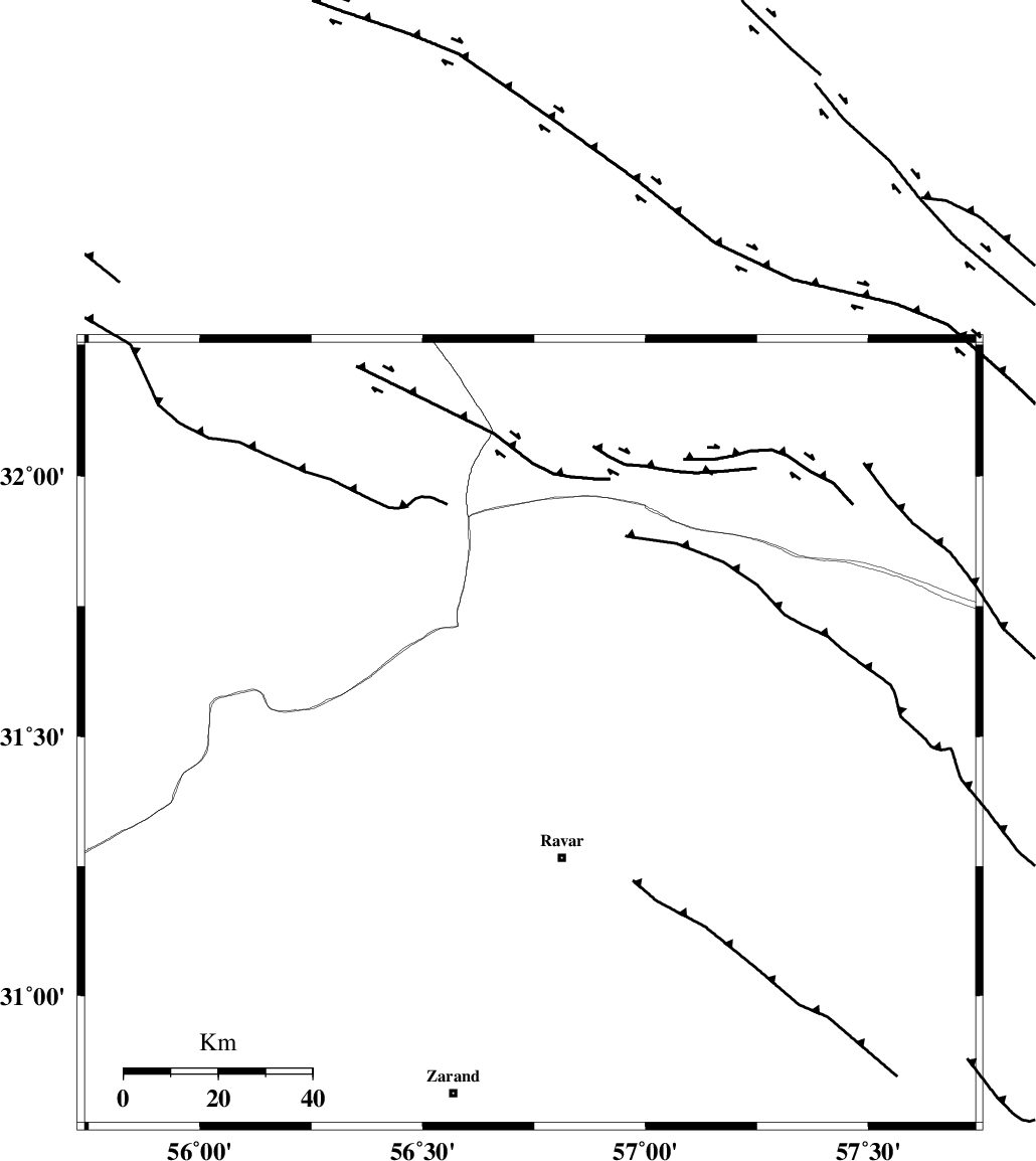
| Location | Lat:31.505 Lon: 56.741 |
| Region | Kerman Province, 27 km North of Ravar |
Nearest Cities |
|
| 21 km North of Dehali, Kerman Province | |
| 27 km North of Ravar, Kerman Province | |
| 44 km North East of Kuhbanan, Kerman Province | |
| 46 km North East of Jor, Kerman Province | |
| 50 km North East of Toghroljerd, Kerman Province | |
| Depth | 14 km |
| Agency | |
Faults within 150 km: |
|
| LAKARKUH_F (Length: 138 km) , Distance to epicenter: 25 km | |
| KUHBANAN_F (Length: 189 km) , Distance to epicenter: 48 km | |
| JAFARABAD_F (Length: 60 km) , Distance to epicenter: 51 km | |
| Number of Phases | 7 |
| RMS | 0.3 |
| Number of Stations | 5 |
| Error in Latitude | >2.2 km |
| Error in Longitude | 3.1 km |
| Error in Depth | 6.2 km |
Download waveform in seisan format
to download seisan software Click here
to access information about IIEES stations Click here
Amplitude | ||||||||
| UID | Agency | Station | Component | Amplitude | Period | Arrival Time | Proccessing Time | Signal Clip |
| 140190 | IIEES | TABS | N | 43.8 | 0.42 | 2019-01-15 23:06:24 | 2019-01-16 07:21:00 | n |
Phase | ||||||||||||
| Agency | Station | Component | Phase Type | Phase Quality | First Motion | Observed Arrival Time | Time Residual | Loc. Flag | Input Weight | Distance | Azimuth | |
| IIEES | KRBR | Z | Pg | E | 2019-01-15 23:05:37 | -0.04 | y | 169 | 179 | |||
| IIEES | YZKH | Z | Pn | E | 2019-01-15 23:05:45 | 0.05 | y | 226 | 296 | |||
| IIEES | YZKH | N | Sg | E | 2019-01-15 23:06:13 | -0.08 | y | 226 | 296 | |||
| IIEES | TABS | Z | Pn | E | 2019-01-15 23:05:47 | 0.48 | y | 240 | 8 | |||
| IIEES | TABS | N | Sg | E | 2019-01-15 23:06:17 | -0.32 | y | 240 | 8 | |||
| IIEES | SHRT | Z | Pn | E | 2019-01-15 23:06:08 | 0.25 | y | 409 | 54 | |||
| IIEES | ZHSF | Z | Pn | E | 2019-01-15 23:06:11 | -0.37 | y | 440 | 117 | |||
کلیه حقوق مادی و معنوی این سایت متعلق به پژوهشگاه بین المللی زلزله شناسی و مهندسی زلزله می باشد.
