خانه / مشخصات زلزله
Magnitude |
:3 |
| Date & Time (UTC) | 2019-01-19 05:48:29.4 |
| Date & Time (Local) | 1397/10/29 09:18:29.4 |
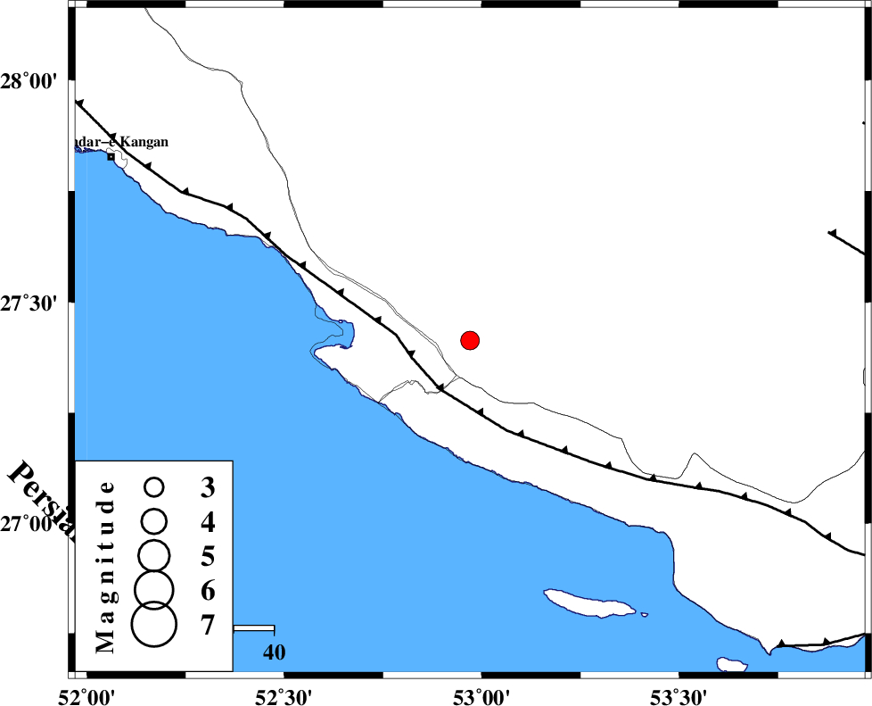
| Location | Lat:27.413 Lon: 52.97 |
| Region | Fars Province, 17 km South of Mehr |
Nearest Cities |
|
| 4 km of Khoozi, Fars Province | |
| 17 km South of Mehr, Fars Province | |
| 19 km North East of Chah-e mobarak, Bushehr Province | |
| 21 km North West of Lamerd, Fars Province | |
| 23 km South of Alamarvdasht, Fars Province | |
| Depth | 15 km |
| Agency | |
Faults within 150 km: |
|
| MFF3 (Length: 292 km) , Distance to epicenter: 14 km | |
| LAR_F (Length: 99 km) , Distance to epicenter: 93 km | |
| QIR_F (Length: 130 km) , Distance to epicenter: 101 km | |
| Number of Phases | 5 |
| RMS | 0 |
| Number of Stations | 4 |
| Error in Latitude | >6 km |
| Error in Longitude | 3.4 km |
| Error in Depth | 5.5 km |
Download waveform in seisan format
to download seisan software Click here
to access information about IIEES stations Click here
Amplitude | ||||||||
| UID | Agency | Station | Component | Amplitude | Period | Arrival Time | Proccessing Time | Signal Clip |
| 140427 | IIEES | AHRM | N | 94.2 | 0.62 | 2019-01-19 05:49:50 | 2019-01-20 10:25:00 | n |
| 140428 | IIEES | BNDS | N | 46.4 | 0.41 | 2019-01-19 05:50:04 | 2019-01-20 10:25:00 | n |
| 140429 | IIEES | BNDS | E | 40 | 0.57 | 2019-01-19 05:50:18 | 2019-01-20 10:25:00 | n |
Phase | ||||||||||||
| Agency | Station | Component | Phase Type | Phase Quality | First Motion | Observed Arrival Time | Time Residual | Loc. Flag | Input Weight | Distance | Azimuth | |
| IIEES | GHIR | Z | Pg | E | 2019-01-19 05:48:45 | -0.03 | y | 96.7 | 1 | |||
| IIEES | AHRM | Z | Pn | E | 2019-01-19 05:49:05 | 0.04 | y | 230 | 315 | |||
| IIEES | BNDS | Z | Pn | E | 2019-01-19 05:49:16 | -0.07 | y | 317 | 90 | |||
| IIEES | BNDS | N | Sg | E | 2019-01-19 05:49:58 | 0.04 | y | 317 | 90 | |||
| IIEES | KRBR | Z | Pn | E | 2019-01-19 05:49:35 | 0.03 | y | 467 | 52 | |||
کلیه حقوق مادی و معنوی این سایت متعلق به پژوهشگاه بین المللی زلزله شناسی و مهندسی زلزله می باشد.
