خانه / مشخصات زلزله
Magnitude |
:2.7 |
| Date & Time (UTC) | 2019-01-28 15:08:18.8 |
| Date & Time (Local) | 1397/11/8 18:38:18.8 |
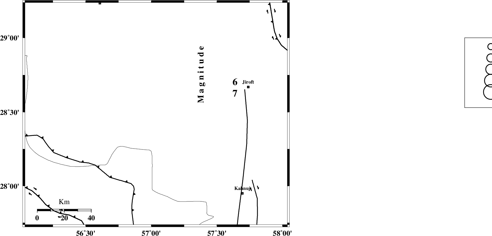
| Location | Lat:28.487 Lon: 57.037 |
| Region | Kerman Province, 71 km South-West of Jiroft |
Nearest Cities |
|
| 22 km North East of Sarkhan, Kerman Province | |
| 26 km South of Dolatabad, Kerman Province | |
| 42 km North West of Hurpasefid, Kerman Province | |
| 52 km North West of Faryab, Kerman Province | |
| 57 km North West of Mehrueye-e paeen, Kerman Province | |
| Depth | 14 km |
| Agency | |
Faults within 150 km: |
|
| MAIN_ZAGROS_R_F (Length: 1106 km) , Distance to epicenter: 56 km | |
| SABZEVARAN_F (Length: 190 km) , Distance to epicenter: 68 km | |
| JIROFT_F (Length: 144 km) , Distance to epicenter: 87 km | |
| Number of Phases | 5 |
| RMS | 0.2 |
| Number of Stations | 4 |
| Error in Latitude | >2.7 km |
| Error in Longitude | 6 km |
| Error in Depth | 5.1 km |
Download waveform in seisan format
to download seisan software Click here
to access information about IIEES stations Click here
Amplitude | ||||||||
| UID | Agency | Station | Component | Amplitude | Period | Arrival Time | Proccessing Time | Signal Clip |
| 140638 | IIEES | BNDS | E | 168.2 | 0.41 | 2019-01-28 15:09:07 | 2019-01-30 08:05:00 | n |
| 140639 | IIEES | BNDS | N | 93.9 | 0.29 | 2019-01-28 15:09:08 | 2019-01-30 08:05:00 | n |
| 140640 | IIEES | KRBR | E | 74.8 | 0.25 | 2019-01-28 15:09:21 | 2019-01-30 08:05:00 | n |
Phase | ||||||||||||
| Agency | Station | Component | Phase Type | Phase Quality | First Motion | Observed Arrival Time | Time Residual | Loc. Flag | Input Weight | Distance | Azimuth | |
| IIEES | BNDS | Z | Pg | E | 2019-01-28 15:08:43 | -0.25 | y | 148 | 215 | |||
| IIEES | BNDS | N | Sg | E | 2019-01-28 15:09:01 | 0.19 | y | 148 | 215 | |||
| IIEES | KRBR | Z | Pg | E | 2019-01-28 15:08:46 | 0 | y | 168 | 351 | |||
| IIEES | GHIR | Z | Pn | E | 2019-01-28 15:09:15 | -0.01 | y | 398 | 268 | |||
| IIEES | BSRN | Z | Pn | E | 2019-01-28 15:09:20 | 0.1 | y | 435 | 27 | |||
کلیه حقوق مادی و معنوی این سایت متعلق به پژوهشگاه بین المللی زلزله شناسی و مهندسی زلزله می باشد.
