خانه / مشخصات زلزله
Magnitude |
:2.7 |
| Date & Time (UTC) | 2019-02-02 11:38:22.4 |
| Date & Time (Local) | 1397/11/13 15:08:22.4 |
| Location | Lat:30.598 Lon: 50.342 |
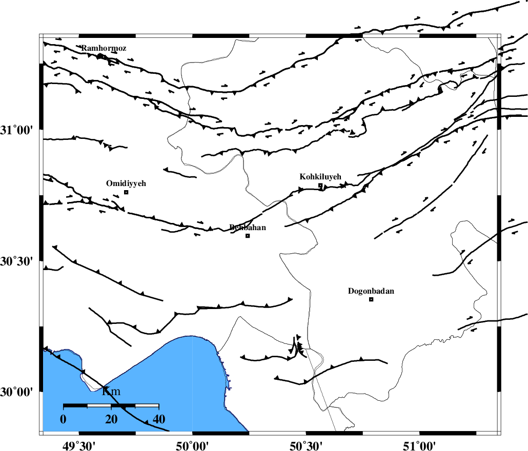
| Region | Khoozestan Province, 9 km of Behbahan |
Nearest Cities |
|
| 6 km of Mansuriyeh, Khoozestan Province | |
| 9 km North of Behbahan, Khoozestan Province | |
| 20 km South East of Dodange-ye bozorg, Khoozestan Province | |
| 30 km South West of Dehdasht, Kohkiluieh va boyerahmad Province | |
| 33 km North East of Sardasht, Khoozestan Province | |
| Depth | 15 km |
| Agency | |
Faults within 150 km: |
|
| MFF4 (Length: 62 km) , Distance to epicenter: 23 km | |
| MISHAN_F (Length: 76 km) , Distance to epicenter: 31 km | |
| AGHAJARI_F (Length: 88 km) , Distance to epicenter: 45 km | |
| Number of Phases | 5 |
| RMS | 0.5 |
| Number of Stations | 5 |
| Error in Latitude | >5.1 km |
| Error in Longitude | 6.4 km |
| Error in Depth | 0 km |
Download waveform in seisan format
to download seisan software Click here
to access information about IIEES stations Click here
Amplitude | ||||||||
| UID | Agency | Station | Component | Amplitude | Period | Arrival Time | Proccessing Time | Signal Clip |
| 140919 | IIEES | AHRM | N | 62.6 | 0.3 | 2019-02-02 11:39:23 | 2019-02-03 09:21:00 | n |
| 140920 | IIEES | GHIR | N | 14.8 | 0.4 | 2019-02-02 11:40:15 | 2019-02-03 09:21:00 | n |
| 140921 | IIEES | YZKH | N | 5.2 | 0.29 | 2019-02-02 11:40:12 | 2019-02-03 09:21:00 | n |
Phase | ||||||||||||
| Agency | Station | Component | Phase Type | Phase Quality | First Motion | Observed Arrival Time | Time Residual | Loc. Flag | Input Weight | Distance | Azimuth | |
| IIEES | AHRM | Z | EPn | E | 2019-02-02 11:38:56 | -0.31 | y | 213 | 154 | |||
| IIEES | NASN | Z | EPn | E | 2019-02-02 11:39:11 | -0.69 | y | 338 | 43 | |||
| IIEES | GHIR | Z | EPn | E | 2019-02-02 11:39:15 | 0.33 | y | 363 | 134 | |||
| IIEES | YZKH | Z | EPn | E | 2019-02-02 11:39:26 | 0.66 | y | 450 | 63 | |||
| IIEES | SNGE | Z | EPn | E | 2019-02-02 11:39:41 | 0.27 | y | 572 | 331 | |||
کلیه حقوق مادی و معنوی این سایت متعلق به پژوهشگاه بین المللی زلزله شناسی و مهندسی زلزله می باشد.
