خانه / مشخصات زلزله
Magnitude |
:2.5 |
| Date & Time (UTC) | 2019-02-19 05:43:05.6 |
| Date & Time (Local) | 1397/11/30 09:13:05.6 |
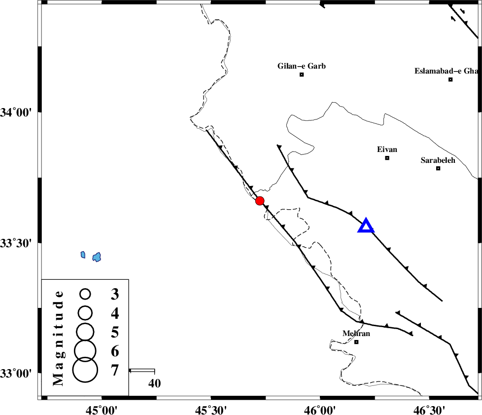
| Location | Lat:33.661 Lon: 45.723 |
| Region | Ilam Province, 56 km South-West of Gilan-E-Gharb |
Nearest Cities |
|
| 25 km South of Sumar, Kermanshah Province | |
| 47 km South West of Nian, Kermanshah Province | |
| 48 km North West of Salehabad, Ilam Province | |
| 49 km South West of Teran, Ilam Province | |
| 51 km West of Chavar, Ilam Province | |
| Depth | 14 km |
| Agency | |
Faults within 150 km: |
|
| ZFF4 (Length: 128 km) , Distance to epicenter: 2 km | |
| MFF7 (Length: 99 km) , Distance to epicenter: 19 km | |
| MFF6 (Length: 144 km) , Distance to epicenter: 75 km | |
| Number of Phases | 7 |
| RMS | 0.2 |
| Number of Stations | 5 |
| Error in Latitude | >2.9 km |
| Error in Longitude | 4.2 km |
| Error in Depth | 5.2 km |
Download waveform in seisan format
to download seisan software Click here
to access information about IIEES stations Click here
Amplitude | ||||||||
| UID | Agency | Station | Component | Amplitude | Period | Arrival Time | Proccessing Time | Signal Clip |
| 141257 | IIEES | SNGE | N | 35.3 | 0.66 | 2019-02-19 05:44:11 | 2019-02-20 08:55:00 | n |
| 141258 | IIEES | SNGE | E | 25 | 0.43 | 2019-02-19 05:44:14 | 2019-02-20 08:55:00 | n |
| 141259 | IIEES | SRSL | N | 22.4 | 0.59 | 2019-02-19 05:44:31 | 2019-02-20 08:55:00 | n |
| 141260 | IIEES | SRSL | E | 17.8 | 0.48 | 2019-02-19 05:44:31 | 2019-02-20 08:55:00 | n |
Phase | ||||||||||||
| Agency | Station | Component | Phase Type | Phase Quality | First Motion | Observed Arrival Time | Time Residual | Loc. Flag | Input Weight | Distance | Azimuth | |
| IIEES | ILBA | Z | EPg | E | 2019-02-19 05:43:13 | -0.22 | y | 45.1 | 95 | |||
| IIEES | SNGE | Z | EPn | E | 2019-02-19 05:43:40 | 0.31 | y | 218 | 43 | |||
| IIEES | SNGE | N | ESg | E | 2019-02-19 05:44:07 | 0.03 | y | 218 | 43 | |||
| IIEES | SRSL | Z | EPn | E | 2019-02-19 05:43:48 | 0.06 | y | 284 | 355 | |||
| IIEES | SRSL | N | ESg | E | 2019-02-19 05:44:25 | -0.18 | y | 284 | 355 | |||
| IIEES | KHMZ | Z | EPn | E | 2019-02-19 05:44:02 | -0.1 | y | 393 | 88 | |||
| IIEES | ASAO | Z | EPn | E | 2019-02-19 05:44:04 | 0.1 | y | 409 | 75 | |||
کلیه حقوق مادی و معنوی این سایت متعلق به پژوهشگاه بین المللی زلزله شناسی و مهندسی زلزله می باشد.
