خانه / مشخصات زلزله
Magnitude |
:2.9 |
| Date & Time (UTC) | 2019-02-23 05:39:25.5 |
| Date & Time (Local) | 1397/12/4 09:09:25.5 |
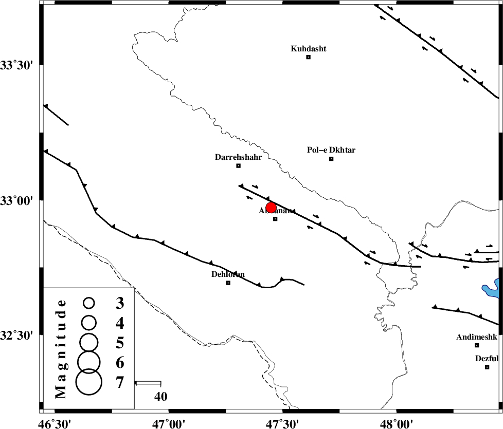
| Location | Lat:32.972 Lon: 47.449 |
| Region | Ilam Province, 5 km of Abdanan |
Nearest Cities |
|
| 5 km North of Abdanan, Ilam Province | |
| 14 km North West of Sarabbagh, Ilam Province | |
| 22 km South East of Darreh Shahr, Ilam Province | |
| 24 km South East of Dashtabad-e olia, Ilam Province | |
| 26 km South West of Sarab hammam, Lorestan Province | |
| Depth | 14 km |
| Agency | |
Faults within 150 km: |
|
| BALARUD_F_Z1 (Length: 87 km) , Distance to epicenter: 16 km | |
| MFF6 (Length: 144 km) , Distance to epicenter: 30 km | |
| BALARUD_F_Z3 (Length: 53 km) , Distance to epicenter: 58 km | |
| Number of Phases | 7 |
| RMS | 0.2 |
| Number of Stations | 5 |
| Error in Latitude | >3.7 km |
| Error in Longitude | 3.2 km |
| Error in Depth | 7.3 km |
Download waveform in seisan format
to download seisan software Click here
to access information about IIEES stations Click here
Amplitude | ||||||||
| UID | Agency | Station | Component | Amplitude | Period | Arrival Time | Proccessing Time | Signal Clip |
| 141301 | IIEES | ILBA | E | 300.5 | 0.33 | 2019-02-23 05:40:12 | 2019-02-23 11:47:00 | n |
| 141302 | IIEES | ILBA | N | 327 | 0.5 | 2019-02-23 05:40:12 | 2019-02-23 11:47:00 | n |
| 141303 | IIEES | SRSL | N | 11.6 | 0.49 | 2019-02-23 05:41:11 | 2019-02-23 11:47:00 | n |
| 141304 | IIEES | SRSL | E | 11.7 | 0.59 | 2019-02-23 05:41:12 | 2019-02-23 11:47:00 | n |
Phase | ||||||||||||
| Agency | Station | Component | Phase Type | Phase Quality | First Motion | Observed Arrival Time | Time Residual | Loc. Flag | Input Weight | Distance | Azimuth | |
| IIEES | ILBA | Z | EPg | E | 2019-02-23 05:39:47 | -0.33 | y | 136 | 302 | |||
| IIEES | ILBA | N | ESg | E | 2019-02-23 05:40:05 | 0.21 | y | 136 | 302 | |||
| IIEES | SNGE | Z | EPn | E | 2019-02-23 05:40:02 | 0.07 | y | 235 | 358 | |||
| IIEES | SNGE | N | ESg | E | 2019-02-23 05:40:32 | -0.1 | y | 235 | 358 | |||
| IIEES | KHMZ | Z | EPn | E | 2019-02-23 05:40:04 | -0.1 | y | 249 | 69 | |||
| IIEES | ASAO | Z | EPn | E | 2019-02-23 05:40:10 | 0.2 | y | 296 | 53 | |||
| IIEES | SRSL | Z | EPn | E | 2019-02-23 05:40:23 | 0.08 | y | 404 | 333 | |||
کلیه حقوق مادی و معنوی این سایت متعلق به پژوهشگاه بین المللی زلزله شناسی و مهندسی زلزله می باشد.
