خانه / مشخصات زلزله
Magnitude |
:2.8 |
| Date & Time (UTC) | 2019-02-24 17:04:30.3 |
| Date & Time (Local) | 1397/12/5 20:34:30.3 |
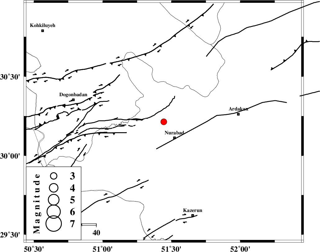
| Location | Lat:30.214 Lon: 51.444 |
| Region | Fars Province, 14 km North of Nurabad |
Nearest Cities |
|
| 3 km North of Fahlian-e olia, Fars Province | |
| 7 km of Masiri, Fars Province | |
| 11 km North of Ahangari, Fars Province | |
| 12 km of Dehnumoqimi, Fars Province | |
| 14 km North of Nurabad, Fars Province | |
| Depth | 9 km |
| Agency | |
Faults within 150 km: |
|
| KAZERUN_F (Length: 96 km) , Distance to epicenter: 8 km | |
| MISHAN_F (Length: 76 km) , Distance to epicenter: 15 km | |
| HZF3 (Length: 197 km) , Distance to epicenter: 51 km | |
| Number of Phases | 6 |
| RMS | 0 |
| Number of Stations | 4 |
| Error in Latitude | >2.4 km |
| Error in Longitude | 3.9 km |
| Error in Depth | 6.3 km |
Download waveform in seisan format
to download seisan software Click here
to access information about IIEES stations Click here
Amplitude | ||||||||
| UID | Agency | Station | Component | Amplitude | Period | Arrival Time | Proccessing Time | Signal Clip |
| 141332 | IIEES | AHRM | N | 133.6 | 0.36 | 2019-02-24 17:05:18 | 2019-02-25 08:46:00 | n |
Phase | ||||||||||||
| Agency | Station | Component | Phase Type | Phase Quality | First Motion | Observed Arrival Time | Time Residual | Loc. Flag | Input Weight | Distance | Azimuth | |
| IIEES | AHRM | Z | EPg | E | 2019-02-24 17:04:56 | 0.03 | y | 150 | 185 | |||
| IIEES | AHRM | N | ESg | E | 2019-02-24 17:05:15 | -0.01 | y | 150 | 185 | |||
| IIEES | NASN | Z | EPn | E | 2019-02-24 17:05:18 | 0.02 | y | 315 | 24 | |||
| IIEES | NASN | N | ES | E | 2019-02-24 17:05:52 | 0.03 | y | 315 | 24 | |||
| IIEES | YZKH | Z | EPn | E | 2019-02-24 17:05:26 | -0.05 | y | 385 | 50 | |||
| IIEES | KHMZ | Z | EPn | E | 2019-02-24 17:05:30 | -0.02 | y | 415 | 341 | |||
کلیه حقوق مادی و معنوی این سایت متعلق به پژوهشگاه بین المللی زلزله شناسی و مهندسی زلزله می باشد.
