خانه / مشخصات زلزله
Magnitude |
:3 |
| Date & Time (UTC) | 2019-03-12 19:36:45.2 |
| Date & Time (Local) | 1397/12/21 23:06:45.2 |
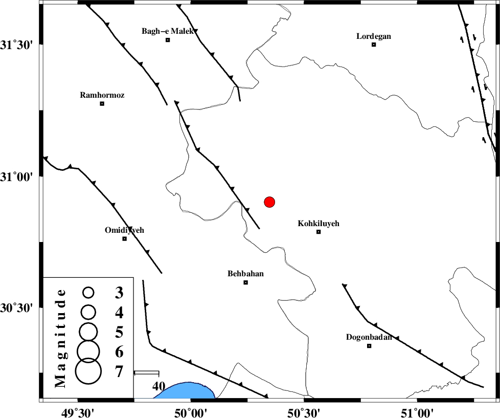
| Location | Lat:30.902 Lon: 50.347 |
| Region | Kohkiluieh va boyerahmad Province, 24 km North-West of Dehdasht |
Nearest Cities |
|
| 11 km of Lendeh, Kohkiluieh va boyerahmad Province | |
| 24 km North West of Dehdasht, Kohkiluieh va boyerahmad Province | |
| 27 km North East of Dodange-ye bozorg, Khoozestan Province | |
| 30 km North of Mansuriyeh, Khoozestan Province | |
| 33 km South of Qale-ye raiesi, Kohkiluieh va boyerahmad Province | |
| Depth | 15 km |
| Agency | |
Faults within 150 km: |
|
| MFF4 (Length: 62 km) , Distance to epicenter: 12 km | |
| MFF2 (Length: 205 km) , Distance to epicenter: 44 km | |
| MISHAN_F (Length: 76 km) , Distance to epicenter: 46 km | |
| Number of Phases | 6 |
| RMS | 0.1 |
| Number of Stations | 6 |
| Error in Latitude | >1.7 km |
| Error in Longitude | 1.7 km |
| Error in Depth | 0 km |
Download waveform in seisan format
to download seisan software Click here
to access information about IIEES stations Click here
Amplitude | ||||||||
| UID | Agency | Station | Component | Amplitude | Period | Arrival Time | Proccessing Time | Signal Clip |
| 141642 | IIEES | ASAO | N | 16.2 | 0.75 | 2019-03-12 19:38:33 | 2019-03-13 07:35:00 | n |
| 141643 | IIEES | SNGE | N | 9.1 | 0.29 | 2019-03-12 19:38:59 | 2019-03-13 07:35:00 | n |
| 141644 | IIEES | SNGE | E | 7.4 | 0.7 | 2019-03-12 19:38:59 | 2019-03-13 07:35:00 | n |
Phase | ||||||||||||
| Agency | Station | Component | Phase Type | Phase Quality | First Motion | Observed Arrival Time | Time Residual | Loc. Flag | Input Weight | Distance | Azimuth | |
| IIEES | AHRM | Z | EPn | E | 2019-03-12 19:37:23 | 0.01 | y | 244 | 158 | |||
| IIEES | NASN | Z | EPn | E | 2019-03-12 19:37:32 | 0.07 | y | 314 | 47 | |||
| IIEES | KHMZ | Z | EPn | E | 2019-03-12 19:37:32 | 0.15 | y | 317 | 354 | |||
| IIEES | ASAO | Z | EPn | E | 2019-03-12 19:37:43 | -0.18 | y | 405 | 356 | |||
| IIEES | YZKH | Z | EPn | E | 2019-03-12 19:37:47 | -0.07 | y | 435 | 67 | |||
| IIEES | SNGE | Z | EPn | E | 2019-03-12 19:38:00 | -0.02 | y | 543 | 330 | |||
کلیه حقوق مادی و معنوی این سایت متعلق به پژوهشگاه بین المللی زلزله شناسی و مهندسی زلزله می باشد.
