خانه / مشخصات زلزله
Magnitude |
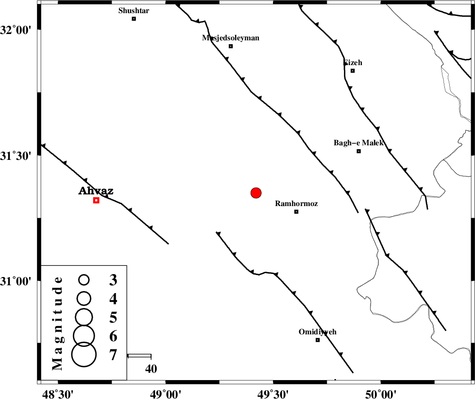
:3.1 |
| Date & Time (UTC) | 2019-06-23 14:39:10.5 |
| Date & Time (Local) | 1398/4/2 19:09:10.5 |
| Location | Lat:31.35 Lon: 49.42 |
| Region | Khoozestan Province, 20 km -West of Ramhormoz |
Nearest Cities |
|
| 9 km North of Marbacheh, Khoozestan Province | |
| 15 km West of Haftgol, Khoozestan Province | |
| 20 km North West of Ramhormoz, Khoozestan Province | |
| 23 km South of Gazin, Khoozestan Province | |
| 25 km South West of Jaru, Khoozestan Province | |
| Depth | 10 km |
| Agency | |
Faults within 150 km: |
|
| AGHAJARI_F (Length: 88 km) , Distance to epicenter: 25 km | |
| DEZFUL_EMBAYMENT (Length: 228 km) , Distance to epicenter: 31 km | |
| AHVAZ_F (Length: 99 km) , Distance to epicenter: 45 km | |
| Number of Phases | 10 |
| RMS | 0.7 |
| Number of Stations | 6 |
| Error in Latitude | >5 km |
| Error in Longitude | 0 km |
| Error in Depth | 40 km |
Download waveform in seisan format
to download seisan software Click here
to access information about IIEES stations Click here
Amplitude | ||||||||
| UID | Agency | Station | Component | Amplitude | Period | Arrival Time | Proccessing Time | Signal Clip |
| 143346 | IIEES SC | GTMR | Z | 380 | 1 | 2019-06-23 14:40:01 | 2019-06-24 11:10:00 | n |
| 143347 | IIEES SC | KLNJ | Z | 120 | 1 | 2019-06-23 14:40:18 | 2019-06-24 11:10:00 | n |
| 143348 | IIEES SC | KHMZ | Z | 76 | 1 | 2019-06-23 14:40:31 | 2019-06-24 11:10:00 | n |
| 143349 | IIEES SC | ASAO | Z | 54 | 1 | 2019-06-23 14:41:04 | 2019-06-24 11:10:00 | n |
Phase | ||||||||||||
| Agency | Station | Component | Phase Type | Phase Quality | First Motion | Observed Arrival Time | Time Residual | Loc. Flag | Input Weight | Distance | Azimuth | |
| IIEES SC | GTMR | N | IS | I | 2019-06-23 14:39:47 | -0.7 | y | 122 | 347 | |||
| IIEES SC | GTMR | Z | IP | I | 2019-06-23 14:39:32 | 0.6 | y | 122 | 347 | |||
| IIEES SC | KLNJ | N | IS | I | 2019-06-23 14:40:11 | 0.4 | y | 211 | 100 | |||
| IIEES SC | KLNJ | Z | IP | I | 2019-06-23 14:39:44 | -0.8 | y | 211 | 100 | |||
| IIEES SC | KHMZ | Z | IP | I | 2019-06-23 14:39:53 | 1 | y | 266 | 11 | |||
| IIEES SC | ASAO | Z | IP | I | 2019-06-23 14:40:03 | -0.2 | y | 355 | 9 | |||
| IIEES SC | GTMR | 1439 | 2019-06-23 14:39:52 | y | 122 | 347 | ||||||
| IIEES SC | KLNJ | 1440 | 2019-06-23 14:40:16 | y | 211 | 100 | ||||||
| IIEES SC | KHMZ | 1440 | 2019-06-23 14:40:36 | y | 266 | 11 | ||||||
| IIEES SC | ASAO | 1441 | 2019-06-23 14:41:03 | y | 355 | 9 | ||||||
کلیه حقوق مادی و معنوی این سایت متعلق به پژوهشگاه بین المللی زلزله شناسی و مهندسی زلزله می باشد.
