خانه / مشخصات زلزله
Magnitude |
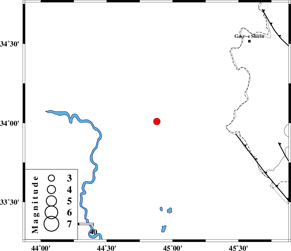
:3.2 |
| Date & Time (UTC) | 2019-07-01 09:16:09.8 |
| Date & Time (Local) | 1398/4/10 13:46:09.8 |
| Location | Lat:34.01 Lon: 44.88 |
| Region | Iraq, 87 km North-East of Bagdad |
Nearest Cities |
|
| 70 km South West of Khosravi, Kermanshah Province | |
| 72 km North West of Sumar, Kermanshah Province | |
| 81 km South West of Seyyed sohrab, Kermanshah Province | |
| 86 km South West of Qasr-E-Shirin, Kermanshah Province | |
| 87 km North East of Bagdad, Iraq Province | |
| Depth | 14 km |
| Agency | |
Faults within 150 km: |
|
| ZFF4 (Length: 128 km) , Distance to epicenter: 56 km | |
| MFF7 (Length: 99 km) , Distance to epicenter: 86 km | |
| MFF8 (Length: 48 km) , Distance to epicenter: 104 km | |
| Number of Phases | 9 |
| RMS | 0 |
| Number of Stations | 5 |
| Error in Latitude | >0 km |
| Error in Longitude | 0 km |
| Error in Depth | 0 km |
Download waveform in seisan format
to download seisan software Click here
to access information about IIEES stations Click here
Amplitude | ||||||||
| UID | Agency | Station | Component | Amplitude | Period | Arrival Time | Proccessing Time | Signal Clip |
| 143582 | IIEES SC | KGS1 | Z | 1100 | 1 | 2019-07-01 09:17:04 | 2019-07-02 09:35:00 | n |
| 143583 | IIEES SC | ILBA | Z | 360 | 1 | 2019-07-01 09:16:54 | 2019-07-02 09:35:00 | n |
| 143584 | IIEES SC | SRSL | Z | 56 | 1 | 2019-07-01 09:17:23 | 2019-07-02 09:35:00 | n |
| 143585 | IIEES SC | SNGE | Z | 110 | 1 | 2019-07-01 09:17:32 | 2019-07-02 09:35:00 | n |
Phase | ||||||||||||
| Agency | Station | Component | Phase Type | Phase Quality | First Motion | Observed Arrival Time | Time Residual | Loc. Flag | Input Weight | Distance | Azimuth | |
| IIEES SC | KGS1 | Z | IP | I | 2019-07-01 09:16:24 | 0 | y | 88 | 50 | |||
| IIEES SC | ILBA | N | IS | I | 2019-07-01 09:16:47 | 0 | y | 133 | 109 | |||
| IIEES SC | ILBA | Z | IP | I | 2019-07-01 09:16:31 | 0 | y | 133 | 109 | |||
| IIEES SC | SRSL | Z | IP | I | 2019-07-01 09:16:48 | 0 | y | 244 | 12 | |||
| IIEES SC | SNGE | Z | IP | I | 2019-07-01 09:16:49 | 0 | y | 255 | 62 | |||
| IIEES SC | KGS1 | 916 | 2019-07-01 09:16:50 | y | 88 | 50 | ||||||
| IIEES SC | ILBA | 916 | 2019-07-01 09:16:43 | y | 133 | 109 | ||||||
| IIEES SC | SRSL | 917 | 2019-07-01 09:17:26 | y | 244 | 12 | ||||||
| IIEES SC | SNGE | 918 | 2019-07-01 09:18:17 | y | 255 | 62 | ||||||
کلیه حقوق مادی و معنوی این سایت متعلق به پژوهشگاه بین المللی زلزله شناسی و مهندسی زلزله می باشد.
