خانه / مشخصات زلزله
Magnitude |
:3.5 |
| Date & Time (UTC) | 2019-07-15 20:51:43.2 |
| Date & Time (Local) | 1398/4/25 01:21:43.2 |
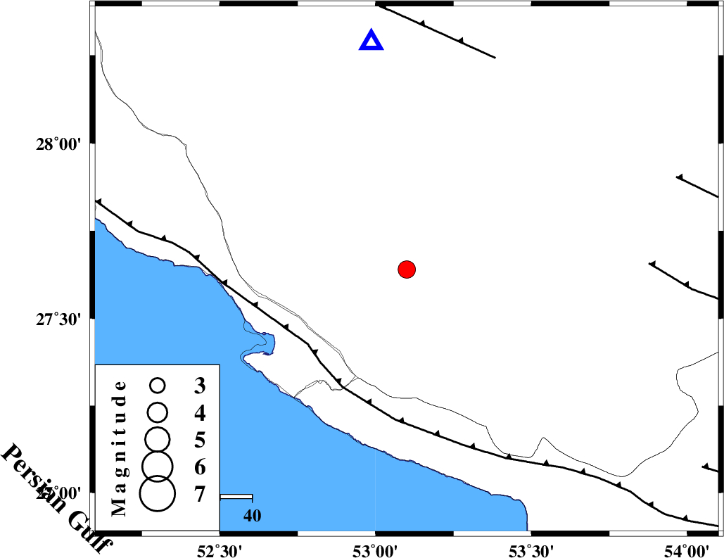
| Location | Lat:27.64 Lon: 53.1 |
| Region | Fars Province, 23 km -East of Mehr |
Nearest Cities |
|
| 14 km North East of Alamarvdasht, Fars Province | |
| 23 km North East of Mehr, Fars Province | |
| 25 km North East of Khoozi, Fars Province | |
| 30 km North East of Ardavan-e olia, Fars Province | |
| 35 km North of Lamerd, Fars Province | |
| Depth | 10 km |
| Agency | |
Faults within 150 km: |
|
| MFF3 (Length: 292 km) , Distance to epicenter: 39 km | |
| QIR_F (Length: 130 km) , Distance to epicenter: 73 km | |
| LAR_F (Length: 99 km) , Distance to epicenter: 77 km | |
| Number of Phases | 8 |
| RMS | 1 |
| Number of Stations | 4 |
| Error in Latitude | >0 km |
| Error in Longitude | 0 km |
| Error in Depth | 0 km |
Download waveform in seisan format
to download seisan software Click here
to access information about IIEES stations Click here
Amplitude | ||||||||
| UID | Agency | Station | Component | Amplitude | Period | Arrival Time | Proccessing Time | Signal Clip |
| 144262 | IIEES SC | LMD1 | Z | 7700 | 1 | 2019-07-15 20:52:07 | 2019-07-16 08:16:00 | n |
| 144263 | IIEES SC | GHIR | Z | 420 | 1 | 2019-07-15 20:52:16 | 2019-07-16 08:16:00 | n |
| 144264 | IIEES SC | BNDS | Z | 120 | 1 | 2019-07-15 20:53:10 | 2019-07-16 08:16:00 | n |
| 144265 | IIEES SC | KRBR | Z | 59 | 1 | 2019-07-15 20:55:03 | 2019-07-16 08:16:00 | n |
Phase | ||||||||||||
| Agency | Station | Component | Phase Type | Phase Quality | First Motion | Observed Arrival Time | Time Residual | Loc. Flag | Input Weight | Distance | Azimuth | |
| IIEES SC | LMD1 | Z | IP | I | 2019-07-15 20:51:49 | -0.1 | y | 33 | 168 | |||
| IIEES SC | GHIR | Z | IP | I | 2019-07-15 20:51:56 | 0.1 | y | 77 | 351 | |||
| IIEES SC | BNDS | N | IP | I | 2019-07-15 20:52:30 | 1.4 | y | 300 | 95 | |||
| IIEES SC | KRBR | N | IP | I | 2019-07-15 20:52:44 | -1.8 | y | 444 | 54 | |||
| IIEES SC | LMD1 | 2052 | 2019-07-15 20:52:02 | y | 33 | 168 | ||||||
| IIEES SC | GHIR | 2052 | 2019-07-15 20:52:25 | y | 77 | 351 | ||||||
| IIEES SC | BNDS | 2053 | 2019-07-15 20:53:30 | y | 300 | 95 | ||||||
| IIEES SC | KRBR | 2053 | 2019-07-15 20:53:46 | y | 444 | 54 | ||||||
کلیه حقوق مادی و معنوی این سایت متعلق به پژوهشگاه بین المللی زلزله شناسی و مهندسی زلزله می باشد.
