خانه / مشخصات زلزله
Magnitude |
:2.9 |
| Date & Time (UTC) | 2019-10-06 00:17:52.8 |
| Date & Time (Local) | 1398/7/14 03:47:52.8 |
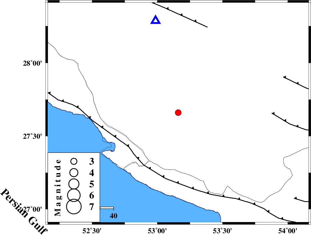
| Location | Lat:27.66 Lon: 53.16 |
| Region | Fars Province, 36 km North of Lamerd |
Nearest Cities |
|
| 20 km North East of Alamarvdasht, Fars Province | |
| 30 km North East of Mehr, Fars Province | |
| 30 km North East of Khoozi, Fars Province | |
| 35 km South West of Khonj, Fars Province | |
| 36 km North East of Ardavan-e olia, Fars Province | |
| Depth | 16 km |
| Agency | |
Faults within 150 km: |
|
| MFF3 (Length: 292 km) , Distance to epicenter: 45 km | |
| QIR_F (Length: 130 km) , Distance to epicenter: 68 km | |
| LAR_F (Length: 99 km) , Distance to epicenter: 71 km | |
| Number of Phases | 6 |
| RMS | 0 |
| Number of Stations | 5 |
| Error in Latitude | >1 km |
| Error in Longitude | 0 km |
| Error in Depth | 1 km |
Download waveform in seisan format
to download seisan software Click here
to access information about IIEES stations Click here
Amplitude | ||||||||
| UID | Agency | Station | Component | Amplitude | Period | Arrival Time | Proccessing Time | Signal Clip |
| 146292 | IIEES SC | LMD1 | Z | 2200 | 1 | 2019-10-06 00:18:20 | 2019-10-06 11:40:00 | n |
| 146293 | IIEES SC | GHIR | Z | 190 | 1 | 2019-10-06 00:18:22 | 2019-10-06 11:40:00 | n |
| 146294 | IIEES SC | KRBR | Z | 27 | 1 | 2019-10-06 00:18:56 | 2019-10-06 11:40:00 | n |
| 146295 | IIEES SC | YZKH | Z | 9.8 | 1 | 2019-10-06 00:20:58 | 2019-10-06 11:40:00 | n |
| 146296 | IIEES SC | NASN | Z | 8.2 | 1 | 2019-10-06 00:20:14 | 2019-10-06 11:40:00 | n |
Phase | ||||||||||||
| Agency | Station | Component | Phase Type | Phase Quality | First Motion | Observed Arrival Time | Time Residual | Loc. Flag | Input Weight | Distance | Azimuth | |
| IIEES SC | LMD1 | Z | IP | I | 2019-10-06 00:17:59 | 0 | y | 33 | 179 | |||
| IIEES SC | GHIR | Z | IP | I | 2019-10-06 00:18:05 | 0 | y | 66 | 346 | |||
| IIEES SC | KRBR | Z | IP | I | 2019-10-06 00:18:54 | 0 | y | 433 | 54 | |||
| IIEES SC | YZKH | N | IP | I | 2019-10-06 00:19:07 | 0.1 | y | 544 | 15 | |||
| IIEES SC | NASN | N | IP | I | 2019-10-06 00:19:11 | -0.1 | y | 567 | 357 | |||
| IIEES SC | GHIR | 018 | 2019-10-06 00:18:29 | y | 66 | 346 | ||||||
کلیه حقوق مادی و معنوی این سایت متعلق به پژوهشگاه بین المللی زلزله شناسی و مهندسی زلزله می باشد.
