خانه / مشخصات زلزله
Magnitude |
:2.7 |
| Date & Time (UTC) | 2019-10-07 22:38:10.1 |
| Date & Time (Local) | 1398/7/16 02:08:10.1 |
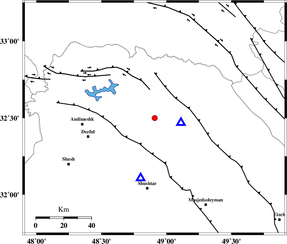
| Location | Lat:32.5 Lon: 48.91 |
| Region | Khoozestan Province, 22 km North-West of Lali |
Nearest Cities |
|
| 7 km of Sardasht, Khoozestan Province | |
| 22 km North West of Lali, Khoozestan Province | |
| 26 km North East of Mahur berenji, Khoozestan Province | |
| 30 km North of Gatvand, Khoozestan Province | |
| 32 km North West of Jaefarabad, Khoozestan Province | |
| Depth | 10 km |
| Agency | |
Faults within 150 km: |
|
| MFF2 (Length: 205 km) , Distance to epicenter: 21 km | |
| BALARUD_F_Z2 (Length: 58 km) , Distance to epicenter: 21 km | |
| DEZFUL_EMBAYMENT (Length: 228 km) , Distance to epicenter: 22 km | |
| Number of Phases | 4 |
| RMS | 0.2 |
| Number of Stations | 4 |
| Error in Latitude | >0 km |
| Error in Longitude | 0 km |
| Error in Depth | 0 km |
Download waveform in seisan format
to download seisan software Click here
to access information about IIEES stations Click here
Amplitude | ||||||||
| UID | Agency | Station | Component | Amplitude | Period | Arrival Time | Proccessing Time | Signal Clip |
| 146363 | IIEES SC | KHMZ | Z | 110 | 1 | 2019-10-07 22:39:01 | 2019-10-08 07:51:00 | n |
| 146364 | IIEES SC | ASAO | Z | 31 | 1 | 2019-10-07 22:39:31 | 2019-10-08 07:51:00 | n |
| 146365 | IIEES SC | KLNJ | Z | 30 | 1 | 2019-10-07 22:39:48 | 2019-10-08 07:51:00 | n |
| 146366 | IIEES SC | SNGE | Z | 17 | 1 | 2019-10-07 22:39:51 | 2019-10-08 07:51:00 | n |
Phase | ||||||||||||
| Agency | Station | Component | Phase Type | Phase Quality | First Motion | Observed Arrival Time | Time Residual | Loc. Flag | Input Weight | Distance | Azimuth | |
| IIEES SC | KHMZ | Z | IP | I | 2019-10-07 22:38:38 | 0.3 | y | 166 | 35 | |||
| IIEES SC | ASAO | Z | IP | I | 2019-10-07 22:38:49 | -0.4 | y | 244 | 24 | |||
| IIEES SC | KLNJ | Z | IP | I | 2019-10-07 22:38:56 | 0 | y | 300 | 123 | |||
| IIEES SC | SNGE | Z | IP | I | 2019-10-07 22:38:58 | 0.1 | y | 322 | 333 | |||
کلیه حقوق مادی و معنوی این سایت متعلق به پژوهشگاه بین المللی زلزله شناسی و مهندسی زلزله می باشد.
