خانه / مشخصات زلزله
Magnitude |
:3.2 |
| Date & Time (UTC) | 2019-10-13 01:53:11.6 |
| Date & Time (Local) | 1398/7/21 05:23:11.6 |
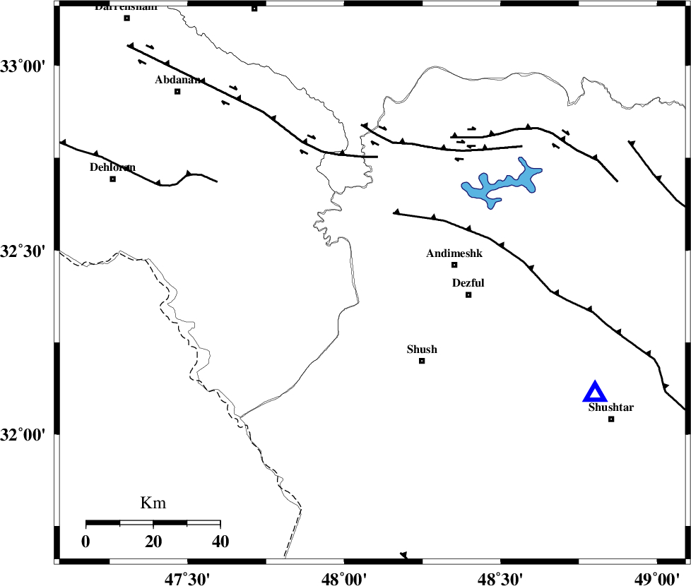
| Location | Lat:32.41 Lon: 48.09 |
| Region | Khoozestan Province, 25 km -West of Andimeshk |
Nearest Cities |
|
| 25 km West of Andimeshk, Khoozestan Province | |
| 28 km North West of Shush, Khoozestan Province | |
| 29 km North West of Dezful, Khoozestan Province | |
| 31 km North West of Amaleh teimur, Khoozestan Province | |
| 33 km South West of Hoseinieh, Khoozestan Province | |
| Depth | 14 km |
| Agency | |
Faults within 150 km: |
|
| DEZFUL_EMBAYMENT (Length: 228 km) , Distance to epicenter: 22 km | |
| BALARUD_F_Z1 (Length: 87 km) , Distance to epicenter: 38 km | |
| BALARUD_F_Z3 (Length: 53 km) , Distance to epicenter: 43 km | |
| Number of Phases | 6 |
| RMS | 0.3 |
| Number of Stations | 6 |
| Error in Latitude | >4 km |
| Error in Longitude | 0 km |
| Error in Depth | 527 km |
Download waveform in seisan format
to download seisan software Click here
to access information about IIEES stations Click here
Amplitude | ||||||||
| UID | Agency | Station | Component | Amplitude | Period | Arrival Time | Proccessing Time | Signal Clip |
| 146548 | IIEES SC | KHMZ | Z | 90 | 1 | 2019-10-13 01:54:31 | 2019-10-13 08:23:00 | n |
| 146549 | IIEES SC | ASAO | Z | 75 | 1 | 2019-10-13 01:54:49 | 2019-10-13 08:23:00 | n |
| 146550 | IIEES SC | KGS1 | Z | 320 | 1 | 2019-10-13 01:55:38 | 2019-10-13 08:23:00 | n |
| 146551 | IIEES SC | KLNJ | Z | 34 | 1 | 2019-10-13 01:55:38 | 2019-10-13 08:23:00 | n |
| 146552 | IIEES SC | GHVR | Z | 50 | 1 | 2019-10-13 01:54:16 | 2019-10-13 08:23:00 | n |
| 146553 | IIEES SC | QABG | Z | 7.6 | 1 | 2019-10-13 01:55:16 | 2019-10-13 08:23:00 | n |
Phase | ||||||||||||
| Agency | Station | Component | Phase Type | Phase Quality | First Motion | Observed Arrival Time | Time Residual | Loc. Flag | Input Weight | Distance | Azimuth | |
| IIEES SC | KHMZ | Z | IP | I | 2019-10-13 01:53:48 | 0.2 | y | 233 | 50 | |||
| IIEES SC | ASAO | Z | IP | I | 2019-10-13 01:53:55 | -0.6 | y | 300 | 37 | |||
| IIEES SC | KGS1 | N | IP | I | 2019-10-13 01:54:00 | 0 | y | 333 | 315 | |||
| IIEES SC | KLNJ | Z | IP | I | 2019-10-13 01:54:05 | -0.1 | y | 366 | 115 | |||
| IIEES SC | GHVR | Z | IP | I | 2019-10-13 01:54:06 | 0.7 | y | 378 | 52 | |||
| IIEES SC | QABG | N | IP | I | 2019-10-13 01:54:08 | -0.1 | y | 389 | 21 | |||
کلیه حقوق مادی و معنوی این سایت متعلق به پژوهشگاه بین المللی زلزله شناسی و مهندسی زلزله می باشد.
