خانه / مشخصات زلزله
Magnitude |
:2.8 |
| Date & Time (UTC) | 2019-11-03 12:15:21.5 |
| Date & Time (Local) | 1398/8/12 15:45:21.5 |
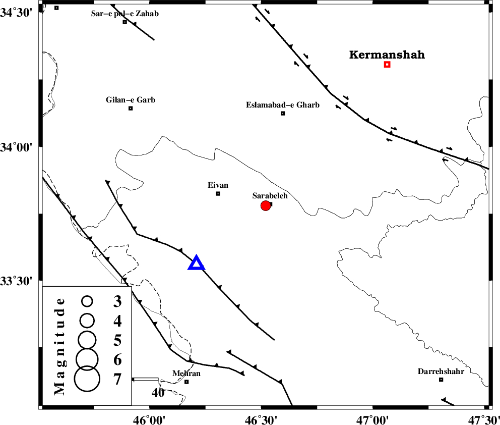
| Location | Lat:33.78 Lon: 46.52 |
| Region | Ilam Province, 2 km of Sar Ableh |
Nearest Cities |
|
| 2 km of Sar Ableh, Ilam Province | |
| 5 km of Mohammadqoli, Ilam Province | |
| 18 km North of Ilam, Ilam Province | |
| 20 km East of Eyvan, Ilam Province | |
| 22 km North West of Sartang-e malehmaran, Ilam Province | |
| Depth | 14 km |
| Agency | |
Faults within 150 km: |
|
| MFF7 (Length: 99 km) , Distance to epicenter: 37 km | |
| HZF4 (Length: 492 km) , Distance to epicenter: 54 km | |
| MFF6 (Length: 144 km) , Distance to epicenter: 63 km | |
| Number of Phases | 5 |
| RMS | 0.6 |
| Number of Stations | 5 |
| Error in Latitude | >1 km |
| Error in Longitude | 0 km |
| Error in Depth | 20 km |
Download waveform in seisan format
to download seisan software Click here
to access information about IIEES stations Click here
Amplitude | ||||||||
| UID | Agency | Station | Component | Amplitude | Period | Arrival Time | Proccessing Time | Signal Clip |
| 147380 | IIEES SC | KGS1 | Z | 1100 | 1 | 2019-11-03 12:16:30 | 2019-11-04 11:44:00 | n |
| 147381 | IIEES SC | SNGE | Z | 450 | 1 | 2019-11-03 12:16:13 | 2019-11-04 11:44:00 | n |
| 147382 | IIEES SC | SRSL | Z | 90 | 1 | 2019-11-03 12:16:51 | 2019-11-04 11:44:00 | n |
| 147383 | IIEES SC | KHMZ | Z | 33 | 1 | 2019-11-03 12:17:15 | 2019-11-04 11:44:00 | n |
| 147384 | IIEES SC | QABG | Z | 7.2 | 1 | 2019-11-03 12:17:16 | 2019-11-04 11:44:00 | n |
Phase | ||||||||||||
| Agency | Station | Component | Phase Type | Phase Quality | First Motion | Observed Arrival Time | Time Residual | Loc. Flag | Input Weight | Distance | Azimuth | |
| IIEES SC | KGS1 | Z | IP | I | 2019-11-03 12:15:40 | -0.4 | y | 122 | 313 | |||
| IIEES SC | SNGE | Z | IP | I | 2019-11-03 12:15:48 | 0.1 | y | 166 | 28 | |||
| IIEES SC | SRSL | Z | IP | I | 2019-11-03 12:16:05 | 0.8 | y | 289 | 340 | |||
| IIEES SC | KHMZ | Z | IP | I | 2019-11-03 12:16:09 | 0.3 | y | 322 | 91 | |||
| IIEES SC | QABG | Z | IP | I | 2019-11-03 12:16:12 | -0.9 | y | 355 | 53 | |||
کلیه حقوق مادی و معنوی این سایت متعلق به پژوهشگاه بین المللی زلزله شناسی و مهندسی زلزله می باشد.
