خانه / مشخصات زلزله
Magnitude |
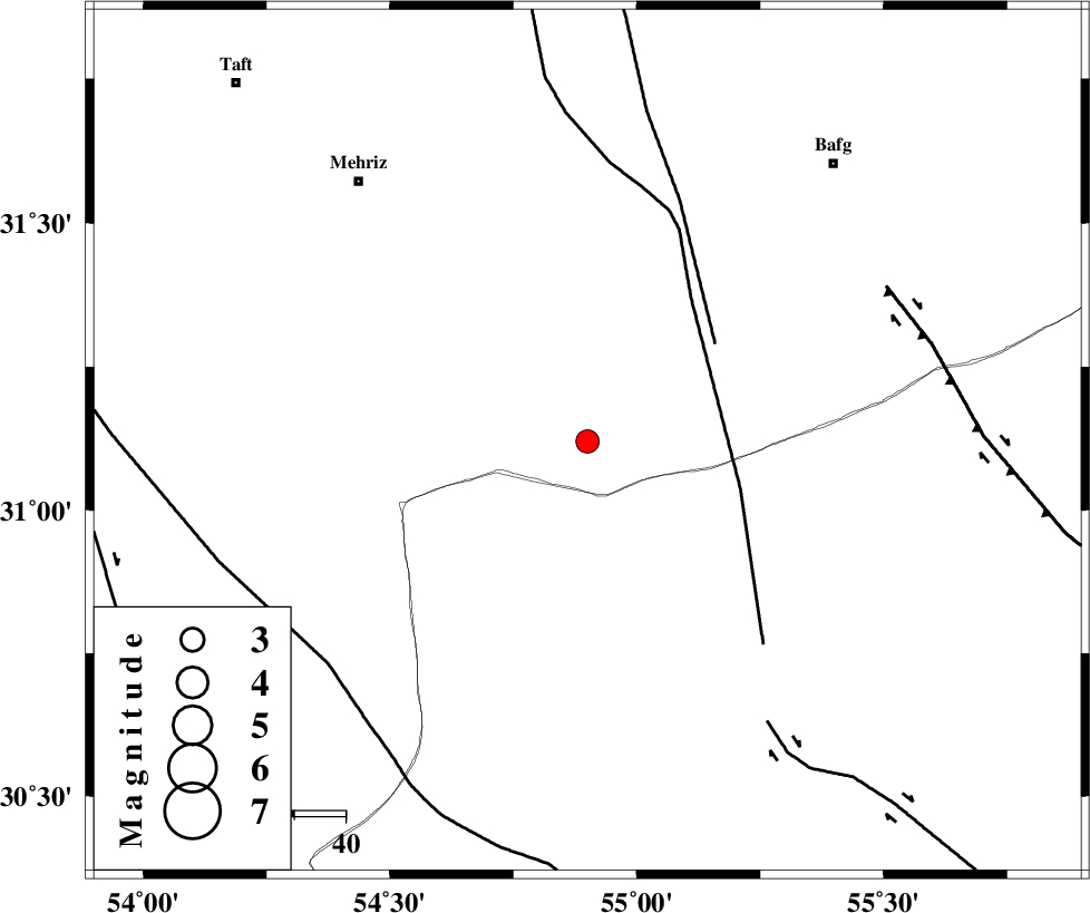
:2.9 |
| Date & Time (UTC) | 2019-11-11 08:09:19.5 |
| Date & Time (Local) | 1398/8/20 11:39:19.5 |
| Location | Lat:31.12 Lon: 54.9 |
| Region | Yazd Province, 67 km South-East of Mehriz |
Nearest Cities |
|
| 23 km South of Bahadoran, Yazd Province | |
| 44 km North West of Anar, Kerman Province | |
| 47 km North of Dehaj, Kerman Province | |
| 53 km North West of Hoseiynabad-e amin, Kerman Province | |
| 67 km South East of Mehriz, Yazd Province | |
| Depth | 10 km |
| Agency | |
Faults within 150 km: |
|
| ANAR_F (Length: 127 km) , Distance to epicenter: 31 km | |
| ANAR_F (Length: 91 km) , Distance to epicenter: 31 km | |
| RAFSANJAN_F (Length: 129 km) , Distance to epicenter: 64 km | |
| Number of Phases | 6 |
| RMS | 0.4 |
| Number of Stations | 6 |
| Error in Latitude | >1 km |
| Error in Longitude | 0 km |
| Error in Depth | 6 km |
Download waveform in seisan format
to download seisan software Click here
to access information about IIEES stations Click here
Amplitude | ||||||||
| UID | Agency | Station | Component | Amplitude | Period | Arrival Time | Proccessing Time | Signal Clip |
| 148122 | IIEES SC | YZKH | Z | 95 | 1 | 2019-11-11 08:10:05 | 2019-11-11 12:29:00 | n |
| 148123 | IIEES SC | KRBR | Z | 120 | 1 | 2019-11-11 08:10:26 | 2019-11-11 12:29:00 | n |
| 148124 | IIEES SC | NASN | Z | 37 | 1 | 2019-11-11 08:10:39 | 2019-11-11 12:29:00 | n |
| 148125 | IIEES SC | KLNJ | Z | 13 | 1 | 2019-11-11 08:11:04 | 2019-11-11 12:29:00 | n |
| 148126 | IIEES SC | TABS | Z | 16 | 1 | 2019-11-11 08:11:14 | 2019-11-11 12:29:00 | n |
| 148127 | IIEES SC | BSRN | Z | 11 | 1 | 2019-11-11 08:11:27 | 2019-11-11 12:29:00 | n |
Phase | ||||||||||||
| Agency | Station | Component | Phase Type | Phase Quality | First Motion | Observed Arrival Time | Time Residual | Loc. Flag | Input Weight | Distance | Azimuth | |
| IIEES SC | YZKH | Z | IP | I | 2019-11-11 08:09:42 | -0.8 | y | 144 | 348 | |||
| IIEES SC | KRBR | N | IP | I | 2019-11-11 08:09:54 | -0.2 | y | 222 | 125 | |||
| IIEES SC | NASN | N | IP | I | 2019-11-11 08:10:01 | 0.2 | y | 266 | 313 | |||
| IIEES SC | KLNJ | Z | IP | I | 2019-11-11 08:10:07 | 0.1 | y | 311 | 268 | |||
| IIEES SC | TABS | N | IP | I | 2019-11-11 08:10:11 | 0.8 | y | 344 | 37 | |||
| IIEES SC | BSRN | Z | IP | I | 2019-11-11 08:10:19 | 0.4 | y | 411 | 77 | |||
کلیه حقوق مادی و معنوی این سایت متعلق به پژوهشگاه بین المللی زلزله شناسی و مهندسی زلزله می باشد.
