خانه / مشخصات زلزله
Magnitude |
:2.5 |
| Date & Time (UTC) | 2019-11-22 11:25:10.9 |
| Date & Time (Local) | 1398/9/1 14:55:10.9 |
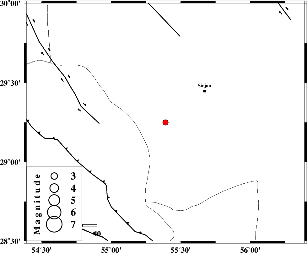
| Location | Lat:29.25 Lon: 55.39 |
| Region | Kerman Province, 35 km South-West of Sirjan |
Nearest Cities |
|
| 31 km South West of Sharifabad, Kerman Province | |
| 35 km South West of Sirjan, Kerman Province | |
| 35 km South West of Najafabad, Kerman Province | |
| 39 km South West of Mahmud Abad, Kerman Province | |
| 40 km South West of Zeydabad, Kerman Province | |
| Depth | 10 km |
| Agency | |
Faults within 150 km: |
|
| SHAHR_E_BABAK_F1 (Length: 392 km) , Distance to epicenter: 46 km | |
| MAIN_ZAGROS_R_F (Length: 1106 km) , Distance to epicenter: 60 km | |
| SHAHR_E_BABAK_F2 (Length: 272 km) , Distance to epicenter: 61 km | |
| Number of Phases | 4 |
| RMS | 0.3 |
| Number of Stations | 4 |
| Error in Latitude | >0 km |
| Error in Longitude | 0 km |
| Error in Depth | 0 km |
Download waveform in seisan format
to download seisan software Click here
to access information about IIEES stations Click here
Amplitude | ||||||||
| UID | Agency | Station | Component | Amplitude | Period | Arrival Time | Proccessing Time | Signal Clip |
| 148745 | IIEES SC | KRBR | Z | 100 | 1 | 2019-11-22 11:26:01 | 2019-11-23 02:45:00 | n |
| 148746 | IIEES SC | GHIR | Z | 1.9 | 1 | 2019-11-22 11:26:10 | 2019-11-23 02:45:00 | n |
| 148747 | IIEES SC | YZKH | Z | 5.2 | 1 | 2019-11-22 11:26:41 | 2019-11-23 02:45:00 | n |
Phase | ||||||||||||
| Agency | Station | Component | Phase Type | Phase Quality | First Motion | Observed Arrival Time | Time Residual | Loc. Flag | Input Weight | Distance | Azimuth | |
| IIEES SC | KRBR | N | IS | I | 2019-11-22 11:25:56 | 0.5 | y | 155 | 59 | |||
| IIEES SC | KRBR | Z | IP | I | 2019-11-22 11:25:36 | -0.6 | y | 155 | 59 | |||
| IIEES SC | GHIR | Z | IP | I | 2019-11-22 11:25:51 | 0.1 | y | 255 | 246 | |||
| IIEES SC | YZKH | Z | IP | I | 2019-11-22 11:26:03 | -0.1 | y | 355 | 348 | |||
کلیه حقوق مادی و معنوی این سایت متعلق به پژوهشگاه بین المللی زلزله شناسی و مهندسی زلزله می باشد.
