خانه / مشخصات زلزله
Magnitude |
:2.5 |
| Date & Time (UTC) | 2019-11-23 15:14:07.1 |
| Date & Time (Local) | 1398/9/2 18:44:07.1 |
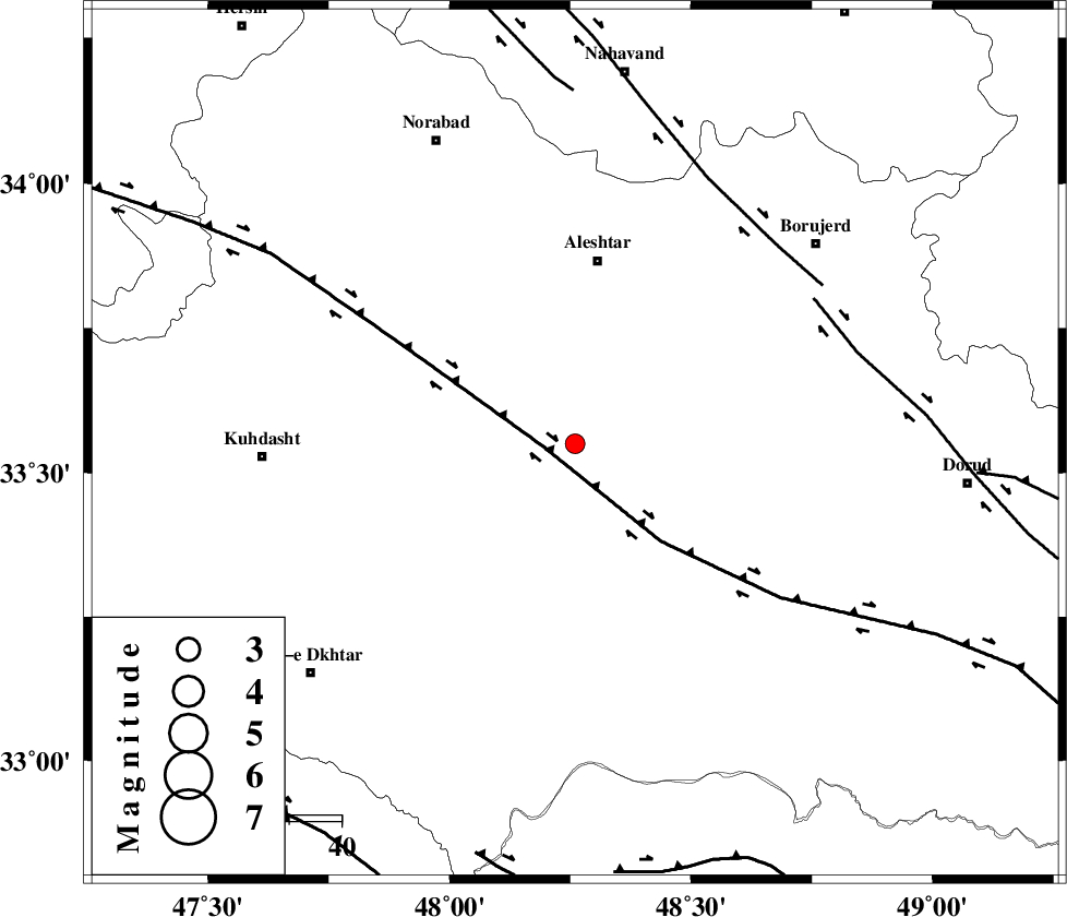
| Location | Lat:33.55 Lon: 48.26 |
| Region | Lorestan Province, 12 km -West of Khorramabad |
Nearest Cities |
|
| 10 km of Rebat namaki, Lorestan Province | |
| 12 km North West of Khorramabad, Lorestan Province | |
| 14 km North of Badrabad-e sofla, Lorestan Province | |
| 15 km North East of Godar-e mahmudvand, Lorestan Province | |
| 18 km North of Shoorab-e sofla, Lorestan Province | |
| Depth | 10 km |
| Agency | |
Faults within 150 km: |
|
| HZF4 (Length: 492 km) , Distance to epicenter: 6 km | |
| DORUD (Length: 100 km) , Distance to epicenter: 54 km | |
| NAHAVAND_F (Length: 102 km) , Distance to epicenter: 54 km | |
| Number of Phases | 5 |
| RMS | 0.7 |
| Number of Stations | 5 |
| Error in Latitude | >8 km |
| Error in Longitude | 0 km |
| Error in Depth | 39 km |
Download waveform in seisan format
to download seisan software Click here
to access information about IIEES stations Click here
Amplitude | ||||||||
| UID | Agency | Station | Component | Amplitude | Period | Arrival Time | Proccessing Time | Signal Clip |
| 148846 | IIEES SC | GTMR | Z | 66 | 1 | 2019-11-23 15:14:54 | 2019-11-24 12:30:00 | n |
| 148847 | IIEES SC | KHMZ | Z | 41 | 1 | 2019-11-23 15:15:01 | 2019-11-24 12:30:00 | n |
| 148848 | IIEES SC | SNGE | Z | 30 | 1 | 2019-11-23 15:15:06 | 2019-11-24 12:30:00 | n |
| 148849 | IIEES SC | ASAO | Z | 40 | 1 | 2019-11-23 15:15:08 | 2019-11-24 12:30:00 | n |
Phase | ||||||||||||
| Agency | Station | Component | Phase Type | Phase Quality | First Motion | Observed Arrival Time | Time Residual | Loc. Flag | Input Weight | Distance | Azimuth | |
| IIEES SC | GTMR | Z | IP | I | 2019-11-23 15:14:31 | 0.2 | y | 144 | 146 | |||
| IIEES SC | KHMZ | Z | IP | I | 2019-11-23 15:14:32 | -0.8 | y | 155 | 82 | |||
| IIEES SC | SNGE | Z | IP | I | 2019-11-23 15:14:37 | -0.6 | y | 189 | 334 | |||
| IIEES SC | ASAO | Z | IP | I | 2019-11-23 15:14:40 | 0.9 | y | 200 | 56 | |||
| IIEES SC | QABG | Z | IP | I | 2019-11-23 15:14:49 | 0.6 | y | 266 | 27 | |||
کلیه حقوق مادی و معنوی این سایت متعلق به پژوهشگاه بین المللی زلزله شناسی و مهندسی زلزله می باشد.
