خانه / مشخصات زلزله
Magnitude |
:2.6 |
| Date & Time (UTC) | 2019-12-05 21:27:13.5 |
| Date & Time (Local) | 1398/9/15 00:57:13.5 |
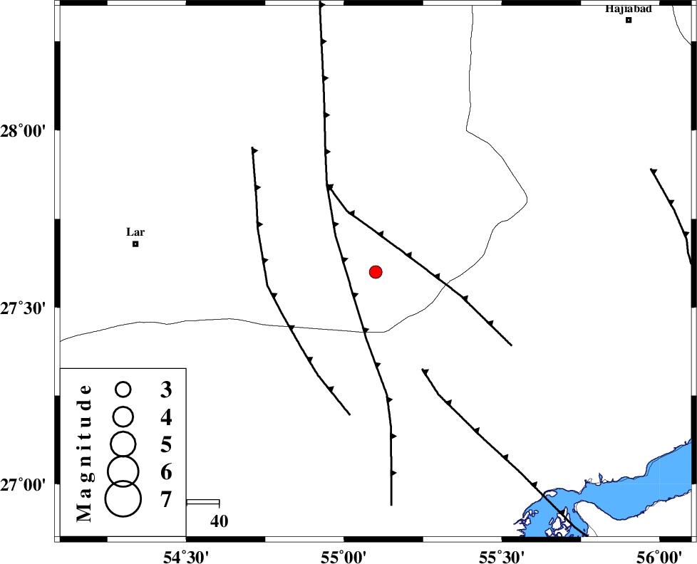
| Location | Lat:27.6 Lon: 55.1 |
| Region | Fars Province, 75 km -East of Lar |
Nearest Cities |
|
| 43 km South West of Darz, Fars Province | |
| 68 km South of Fadami, Fars Province | |
| 72 km East of Latifi, Fars Province | |
| 72 km South East of Dehkuyeh, Fars Province | |
| 75 km East of Lar, Fars Province | |
| Depth | 10 km |
| Agency | |
Faults within 150 km: |
|
| LAR_F (Length: 99 km) , Distance to epicenter: 27 km | |
| MFF1 (Length: 180 km) , Distance to epicenter: 60 km | |
| BERIZ_F (Length: 49 km) , Distance to epicenter: 68 km | |
| Number of Phases | 4 |
| RMS | 0.9 |
| Number of Stations | 4 |
| Error in Latitude | >0 km |
| Error in Longitude | 0 km |
| Error in Depth | 0 km |
Download waveform in seisan format
to download seisan software Click here
to access information about IIEES stations Click here
Amplitude | ||||||||
| UID | Agency | Station | Component | Amplitude | Period | Arrival Time | Proccessing Time | Signal Clip |
| 149405 | IIEES SC | BNDS | Z | 130 | 1 | 2019-12-05 21:27:58 | 2019-12-07 12:54:00 | n |
| 149406 | IIEES SC | GHIR | Z | 4.1 | 1 | 2019-12-05 21:28:16 | 2019-12-07 12:54:00 | n |
Phase | ||||||||||||
| Agency | Station | Component | Phase Type | Phase Quality | First Motion | Observed Arrival Time | Time Residual | Loc. Flag | Input Weight | Distance | Azimuth | |
| IIEES SC | BNDS | N | IS | I | 2019-12-05 21:27:47 | 1.1 | y | 111 | 102 | |||
| IIEES SC | BNDS | Z | IP | I | 2019-12-05 21:27:30 | -1.3 | y | 111 | 102 | |||
| IIEES SC | GHIR | Z | IP | I | 2019-12-05 21:27:49 | 0.3 | y | 222 | 290 | |||
| IIEES SC | YZKH | Z | IP | I | 2019-12-05 21:28:27 | -0.2 | y | 533 | 355 | |||
کلیه حقوق مادی و معنوی این سایت متعلق به پژوهشگاه بین المللی زلزله شناسی و مهندسی زلزله می باشد.
