خانه / مشخصات زلزله
Magnitude |
:2.8 |
| Date & Time (UTC) | 2019-12-07 06:34:26.0 |
| Date & Time (Local) | 1398/9/16 10:04:26.0 |
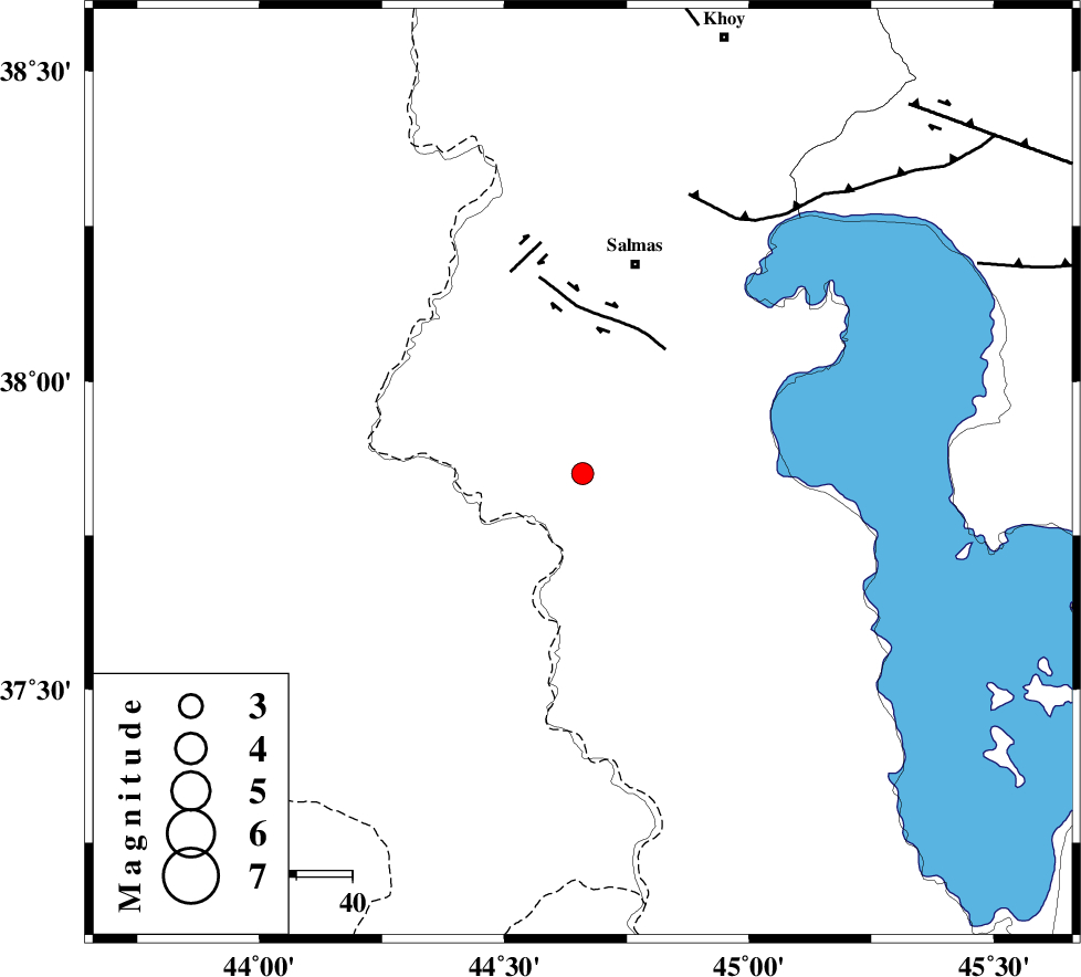
| Location | Lat:37.85 Lon: 44.66 |
| Region | Azarbaijan Gharbi Province, 39 km South-West of Salmas |
Nearest Cities |
|
| 4 km of Hashtyan, Azarbaijan Gharbi Province | |
| 13 km North of Sarv, Azarbaijan Gharbi Province | |
| 17 km North of Ravand sofla, Azarbaijan Gharbi Province | |
| 18 km South West of Mamkan, Azarbaijan Gharbi Province | |
| 23 km South East of Delzi, Azarbaijan Gharbi Province | |
| Depth | 10 km |
| Agency | |
Faults within 150 km: |
|
| SALMAS (Length: 20 km) , Distance to epicenter: 27 km | |
| N_TABRIZ_F3 (Length: 66 km) , Distance to epicenter: 53 km | |
| N_TABRIZ_F2 (Length: 52 km) , Distance to epicenter: 80 km | |
| Number of Phases | 5 |
| RMS | 0.4 |
| Number of Stations | 5 |
| Error in Latitude | >5 km |
| Error in Longitude | 0 km |
| Error in Depth | 22 km |
Download waveform in seisan format
to download seisan software Click here
to access information about IIEES stations Click here
Amplitude | ||||||||
| UID | Agency | Station | Component | Amplitude | Period | Arrival Time | Proccessing Time | Signal Clip |
| 149407 | IIEES SC | AZR | Z | 480 | 1 | 2019-12-07 06:35:13 | 2019-12-07 12:56:00 | n |
| 149408 | IIEES SC | SRSL | Z | 30 | 1 | 2019-12-07 06:35:33 | 2019-12-07 12:56:00 | n |
Phase | ||||||||||||
| Agency | Station | Component | Phase Type | Phase Quality | First Motion | Observed Arrival Time | Time Residual | Loc. Flag | Input Weight | Distance | Azimuth | |
| IIEES SC | AZR | N | IS | I | 2019-12-07 06:35:01 | -0.3 | y | 122 | 99 | |||
| IIEES SC | AZR | Z | IP | I | 2019-12-07 06:34:46 | 0 | y | 122 | 99 | |||
| IIEES SC | MAKU | Z | IP | I | 2019-12-07 06:34:53 | -0.3 | y | 166 | 1 | |||
| IIEES SC | SRSL | Z | IP | I | 2019-12-07 06:34:57 | -0.1 | y | 189 | 159 | |||
| IIEES SC | GRMI | Z | IP | I | 2019-12-07 06:35:12 | 0.8 | y | 300 | 69 | |||
کلیه حقوق مادی و معنوی این سایت متعلق به پژوهشگاه بین المللی زلزله شناسی و مهندسی زلزله می باشد.
