خانه / مشخصات زلزله
Magnitude |
:2.7 |
| Date & Time (UTC) | 2019-12-23 03:38:33.7 |
| Date & Time (Local) | 1398/10/2 07:08:33.7 |
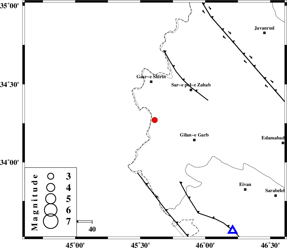
| Location | Lat:34.27 Lon: 45.61 |
| Region | Kermanshah Province, 27 km South of Qasr-E-Shirin |
Nearest Cities |
|
| 19 km South East of Khosravi, Kermanshah Province | |
| 19 km South of Seyyed sohrab, Kermanshah Province | |
| 23 km West of Chub baghan, Kermanshah Province | |
| 27 km South of Qasr-E-Shirin, Kermanshah Province | |
| 29 km South West of Qareh belagh, Kermanshah Province | |
| Depth | 10 km |
| Agency | |
Faults within 150 km: |
|
| MFF8 (Length: 48 km) , Distance to epicenter: 35 km | |
| ZFF4 (Length: 128 km) , Distance to epicenter: 39 km | |
| MFF7 (Length: 99 km) , Distance to epicenter: 47 km | |
| Number of Phases | 6 |
| RMS | 0.4 |
| Number of Stations | 6 |
| Error in Latitude | >0 km |
| Error in Longitude | 0 km |
| Error in Depth | 1 km |
Download waveform in seisan format
to download seisan software Click here
to access information about IIEES stations Click here
Amplitude | ||||||||
| UID | Agency | Station | Component | Amplitude | Period | Arrival Time | Proccessing Time | Signal Clip |
| 149891 | IIEES SC | SNGE | Z | 14 | 1 | 2019-12-23 03:40:05 | 2019-12-23 08:25:00 | n |
| 149892 | IIEES SC | SRSL | Z | 68 | 1 | 2019-12-23 03:39:36 | 2019-12-23 08:25:00 | n |
| 149893 | IIEES SC | MAHB | Z | 45 | 1 | 2019-12-23 03:39:56 | 2019-12-23 08:25:00 | n |
| 149894 | IIEES SC | GTMR | Z | 10 | 1 | 2019-12-23 03:40:27 | 2019-12-23 08:25:00 | n |
Phase | ||||||||||||
| Agency | Station | Component | Phase Type | Phase Quality | First Motion | Observed Arrival Time | Time Residual | Loc. Flag | Input Weight | Distance | Azimuth | |
| IIEES SC | SNGE | Z | IP | I | 2019-12-23 03:39:03 | -0.1 | y | 189 | 60 | |||
| IIEES SC | SRSL | N | IS | I | 2019-12-23 03:39:35 | 0.3 | y | 211 | 356 | |||
| IIEES SC | SRSL | Z | IP | I | 2019-12-23 03:39:08 | -0.6 | y | 211 | 356 | |||
| IIEES SC | MAHB | N | IS | I | 2019-12-23 03:39:49 | 0.5 | y | 278 | 2 | |||
| IIEES SC | MAHB | Z | IP | I | 2019-12-23 03:39:16 | -0.5 | y | 278 | 2 | |||
| IIEES SC | GTMR | Z | IP | I | 2019-12-23 03:39:29 | 0.3 | y | 378 | 121 | |||
کلیه حقوق مادی و معنوی این سایت متعلق به پژوهشگاه بین المللی زلزله شناسی و مهندسی زلزله می باشد.
