خانه / مشخصات زلزله
Magnitude |
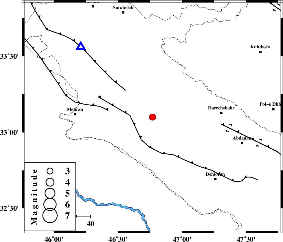
:3.3 |
| Date & Time (UTC) | 2020-01-18 06:35:19.5 |
| Date & Time (Local) | 1398/10/28 10:05:19.5 |
| Location | Lat:33.1 Lon: 46.77 |
| Region | Ilam Province, 50 km -West of Darreh Shahr |
Nearest Cities |
|
| 22 km South West of Meymeh, Ilam Province | |
| 26 km South East of Gonbad-e pirmohammad, Ilam Province | |
| 27 km South West of Badreh, Ilam Province | |
| 36 km North West of Bishehzar, Ilam Province | |
| 41 km South East of Galeh-yedarre-hemalakshahi, Ilam Province | |
| Depth | 12 km |
| Agency | |
Faults within 150 km: |
|
| MFF6 (Length: 144 km) , Distance to epicenter: 14 km | |
| MFF7 (Length: 99 km) , Distance to epicenter: 28 km | |
| ZFF4 (Length: 128 km) , Distance to epicenter: 33 km | |
| Number of Phases | 7 |
| RMS | 0.1 |
| Number of Stations | 7 |
| Error in Latitude | >5 km |
| Error in Longitude | 0 km |
| Error in Depth | 25 km |
Download waveform in seisan format
to download seisan software Click here
to access information about IIEES stations Click here
Amplitude | ||||||||
| UID | Agency | Station | Component | Amplitude | Period | Arrival Time | Proccessing Time | Signal Clip |
| 151106 | IIEES SC | ILBA | Z | 120 | 1 | 2020-01-18 06:36:00 | 2020-01-18 10:39:00 | n |
| 151107 | IIEES SC | GTMR | Z | 140 | 1 | 2020-01-18 06:36:36 | 2020-01-18 10:39:00 | n |
| 151108 | IIEES SC | KHMZ | Z | 55 | 1 | 2020-01-18 06:36:47 | 2020-01-18 10:39:00 | n |
| 151109 | IIEES SC | ASAO | Z | 91 | 1 | 2020-01-18 06:36:50 | 2020-01-18 10:39:00 | n |
| 151110 | IIEES SC | GHVR | Z | 350 | 1 | 2020-01-18 06:37:56 | 2020-01-18 10:39:00 | n |
Phase | ||||||||||||
| Agency | Station | Component | Phase Type | Phase Quality | First Motion | Observed Arrival Time | Time Residual | Loc. Flag | Input Weight | Distance | Azimuth | |
| IIEES SC | ILBA | Z | IP | I | 2020-01-18 06:35:33 | 0 | y | 77 | 318 | |||
| IIEES SC | GTMR | Z | IP | I | 2020-01-18 06:35:56 | 0 | y | 233 | 108 | |||
| IIEES SC | AMIS | Z | IP | I | 2020-01-18 06:36:02 | 0 | y | 289 | 124 | |||
| IIEES SC | KHMZ | Z | IP | I | 2020-01-18 06:36:05 | -0.1 | y | 300 | 77 | |||
| IIEES SC | ASAO | Z | IP | I | 2020-01-18 06:36:10 | 0.3 | y | 344 | 62 | |||
| IIEES SC | QABG | Z | IP | I | 2020-01-18 06:36:15 | 0 | y | 389 | 42 | |||
| IIEES SC | GHVR | Z | IP | I | 2020-01-18 06:36:22 | -0.4 | y | 444 | 70 | |||
کلیه حقوق مادی و معنوی این سایت متعلق به پژوهشگاه بین المللی زلزله شناسی و مهندسی زلزله می باشد.
