خانه / مشخصات زلزله
Magnitude |
:3.1 |
| Date & Time (UTC) | 2020-02-02 08:12:44.4 |
| Date & Time (Local) | 1398/11/13 11:42:44.4 |
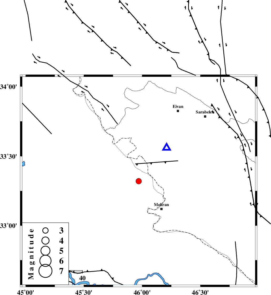
| Location | Lat:33.32 Lon: 45.97 |
| Region | Iraq, 29 km North-West of Mehran |
Nearest Cities |
|
| 26 km South West of Salehabad, Ilam Province | |
| 29 km North West of Mehran, Ilam Province | |
| 43 km West of Galeh-yedarre-hemalakshahi, Ilam Province | |
| 48 km South West of Mehr, Ilam Province | |
| 49 km South West of Chavar, Ilam Province | |
| Depth | 14 km |
| Agency | |
Faults within 150 km: |
|
| ZFF4 (Length: 128 km) , Distance to epicenter: 5 km | |
| MFF7 (Length: 99 km) , Distance to epicenter: 35 km | |
| MFF6 (Length: 144 km) , Distance to epicenter: 36 km | |
| Number of Phases | 6 |
| RMS | 1.1 |
| Number of Stations | 6 |
| Error in Latitude | >2 km |
| Error in Longitude | 0 km |
| Error in Depth | 29 km |
Download waveform in seisan format
to download seisan software Click here
to access information about IIEES stations Click here
Amplitude | ||||||||
| UID | Agency | Station | Component | Amplitude | Period | Arrival Time | Proccessing Time | Signal Clip |
| 151595 | IIEES SC | SNGE | Z | 96 | 1 | 2020-02-02 08:13:59 | 2020-02-03 08:48:00 | n |
| 151596 | IIEES SC | GTMR | Z | 28 | 1 | 2020-02-02 08:14:19 | 2020-02-03 08:48:00 | n |
| 151597 | IIEES SC | SRSL | Z | 42 | 1 | 2020-02-02 08:14:21 | 2020-02-03 08:48:00 | n |
| 151598 | IIEES SC | KHMZ | Z | 12 | 1 | 2020-02-02 08:14:45 | 2020-02-03 08:48:00 | n |
| 151599 | IIEES SC | ASAO | Z | 17 | 1 | 2020-02-02 08:14:51 | 2020-02-03 08:48:00 | n |
Phase | ||||||||||||
| Agency | Station | Component | Phase Type | Phase Quality | First Motion | Observed Arrival Time | Time Residual | Loc. Flag | Input Weight | Distance | Azimuth | |
| IIEES SC | SNGE | N | IS | I | 2020-02-02 08:13:48 | -0.5 | y | 233 | 33 | |||
| IIEES SC | SNGE | Z | IP | I | 2020-02-02 08:13:23 | 1.9 | y | 233 | 33 | |||
| IIEES SC | GTMR | Z | IP | I | 2020-02-02 08:13:29 | -0.8 | y | 311 | 108 | |||
| IIEES SC | SRSL | Z | IP | I | 2020-02-02 08:13:31 | -1 | y | 322 | 351 | |||
| IIEES SC | KHMZ | Z | IP | I | 2020-02-02 08:13:38 | -0.5 | y | 378 | 83 | |||
| IIEES SC | ASAO | Z | IP | I | 2020-02-02 08:13:42 | 1 | y | 400 | 70 | |||
کلیه حقوق مادی و معنوی این سایت متعلق به پژوهشگاه بین المللی زلزله شناسی و مهندسی زلزله می باشد.
