خانه / مشخصات زلزله
Magnitude |
:2.9 |
| Date & Time (UTC) | 2020-06-10 06:46:55.5 |
| Date & Time (Local) | 1399/3/21 11:16:55.5 |
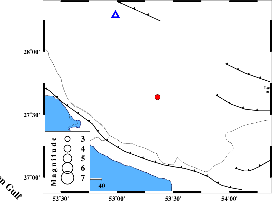
| Location | Lat:27.64 Lon: 53.36 |
| Region | Fars Province, 39 km North-East of Lamerd |
Nearest Cities |
|
| 17 km North West of Fedagh, Fars Province | |
| 26 km South of Khonj, Fars Province | |
| 28 km West of Ard, Fars Province | |
| 28 km North West of Beyram, Fars Province | |
| 37 km South West of Fishur, Fars Province | |
| Depth | 10 km |
| Agency | |
Faults within 150 km: |
|
| LAR_F (Length: 99 km) , Distance to epicenter: 51 km | |
| MFF3 (Length: 292 km) , Distance to epicenter: 56 km | |
| BERIZ_F (Length: 49 km) , Distance to epicenter: 66 km | |
| Number of Phases | 7 |
| RMS | 0.1 |
| Number of Stations | 5 |
| Error in Latitude | >1 km |
| Error in Longitude | 0 km |
| Error in Depth | 3 km |
Download waveform in seisan format
to download seisan software Click here
to access information about IIEES stations Click here
Amplitude | ||||||||
| UID | Agency | Station | Component | Amplitude | Period | Arrival Time | Proccessing Time | Signal Clip |
| 154367 | IIEES SC | LMD1 | Z | 1400 | 1 | 2020-06-10 06:47:16 | 2020-06-10 12:33:00 | n |
| 154368 | IIEES SC | GHIR | Z | 67 | 1 | 2020-06-10 06:47:23 | 2020-06-10 12:33:00 | n |
| 154369 | IIEES SC | AHRM | Z | 20 | 1 | 2020-06-10 06:48:23 | 2020-06-10 12:33:00 | n |
| 154370 | IIEES SC | BNDS | Z | 37 | 1 | 2020-06-10 06:48:52 | 2020-06-10 12:33:00 | n |
| 154371 | IIEES SC | NASN | Z | 4.2 | 1 | 2020-06-10 06:49:11 | 2020-06-10 12:33:00 | n |
| 154372 | IIEES SC | NASN | Z | 3.4 | 1.39 | 2020-06-10 06:48:36 | 2020-06-10 12:33:00 | n |
Phase | ||||||||||||
| Agency | Station | Component | Phase Type | Phase Quality | First Motion | Observed Arrival Time | Time Residual | Loc. Flag | Input Weight | Distance | Azimuth | |
| IIEES SC | LMD1 | Z | IP | I | 2020-06-10 06:47:02 | 0 | y | 33 | 210 | |||
| IIEES SC | GHIR | Z | IP | I | 2020-06-10 06:47:09 | 0 | y | 77 | 333 | |||
| IIEES SC | AHRM | Z | IP | I | 2020-06-10 06:47:33 | 0 | y | 244 | 304 | |||
| IIEES SC | BNDS | Z | IP | I | 2020-06-10 06:47:38 | 0 | y | 278 | 95 | |||
| IIEES SC | KRBR | Z | IP | I | 2020-06-10 06:47:50 | -6.3 | n | 4 | 422 | 52 | ||
| IIEES SC | YZKH | Z | IP | I | 2020-06-10 06:48:29 | 18.3 | n | 4 | 544 | 13 | ||
| IIEES SC | NASN | Z | IP | I | 2020-06-10 06:48:16 | 1.5 | y | 578 | 355 | |||
کلیه حقوق مادی و معنوی این سایت متعلق به پژوهشگاه بین المللی زلزله شناسی و مهندسی زلزله می باشد.
