خانه / مشخصات زلزله
Magnitude |
:2.8 |
| Date & Time (UTC) | 2020-06-19 02:37:29.1 |
| Date & Time (Local) | 1399/3/30 07:07:29.1 |
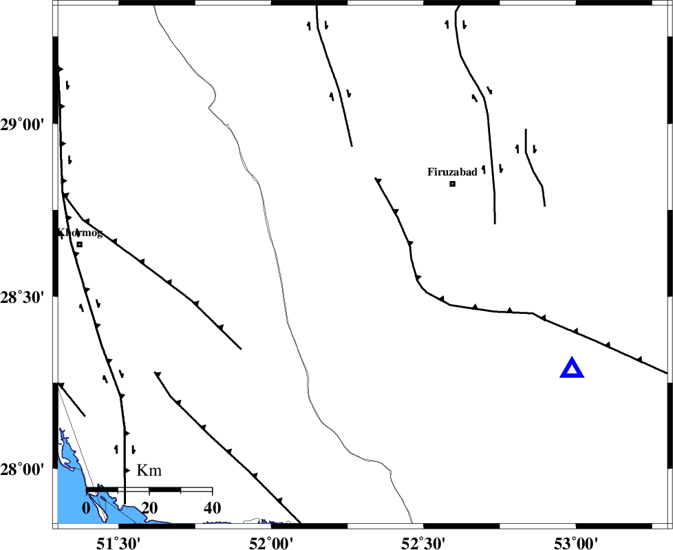
| Location | Lat:28.59 Lon: 52.3 |
| Region | Fars Province, 38 km South-East of Farashband |
Nearest Cities |
|
| 11 km North of Dahrom, Fars Province | |
| 33 km South West of Ahmadabad, Fars Province | |
| 38 km South East of Farashband, Fars Province | |
| 38 km South West of Jaydasht, Fars Province | |
| 39 km South West of Firuz Abad, Fars Province | |
| Depth | 15 km |
| Agency | |
Faults within 150 km: |
|
| QIR_F (Length: 130 km) , Distance to epicenter: 16 km | |
| KAREBASS_F (Length: 98 km) , Distance to epicenter: 38 km | |
| SABZ_PUSHAN_F_Z1 (Length: 69 km) , Distance to epicenter: 44 km | |
| Number of Phases | 6 |
| RMS | 0 |
| Number of Stations | 4 |
| Error in Latitude | >0 km |
| Error in Longitude | 0 km |
| Error in Depth | 0 km |
Download waveform in seisan format
to download seisan software Click here
to access information about IIEES stations Click here
Amplitude | ||||||||
| UID | Agency | Station | Component | Amplitude | Period | Arrival Time | Proccessing Time | Signal Clip |
| 154759 | IIEES SC | GHIR | Z | 21 | 1 | 2020-06-19 02:38:19 | 2020-06-20 01:50:00 | n |
| 154760 | IIEES SC | KLNJ | Z | 15 | 1 | 2020-06-19 02:39:00 | 2020-06-20 01:50:00 | n |
| 154761 | IIEES SC | YZKH | Z | 3.6 | 1 | 2020-06-19 02:39:35 | 2020-06-20 01:50:00 | n |
| 154762 | IIEES SC | GTMR | Z | 6.7 | 1 | 2020-06-19 02:40:31 | 2020-06-20 01:50:00 | n |
Phase | ||||||||||||
| Agency | Station | Component | Phase Type | Phase Quality | First Motion | Observed Arrival Time | Time Residual | Loc. Flag | Input Weight | Distance | Azimuth | |
| IIEES SC | GHIR | Z | IP | I | 2020-06-19 02:37:42 | 0 | y | 77 | 116 | |||
| IIEES SC | AHRM | N | IS | I | 2020-06-19 02:38:01 | 2.3 | n | 4 | 100 | 287 | ||
| IIEES SC | AHRM | Z | IP | I | 2020-06-19 02:37:48 | 2.4 | n | 4 | 100 | 287 | ||
| IIEES SC | KLNJ | Z | IP | I | 2020-06-19 02:38:11 | 0 | y | 278 | 346 | |||
| IIEES SC | YZKH | Z | IP | I | 2020-06-19 02:38:36 | 0 | y | 478 | 28 | |||
| IIEES SC | GTMR | Z | IP | I | 2020-06-19 02:38:42 | 0 | y | 533 | 325 | |||
کلیه حقوق مادی و معنوی این سایت متعلق به پژوهشگاه بین المللی زلزله شناسی و مهندسی زلزله می باشد.
