خانه / مشخصات زلزله
Magnitude |
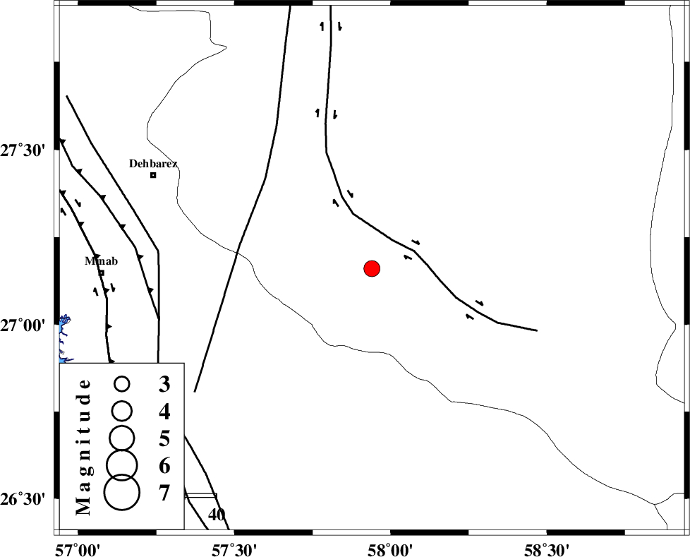
:3.3 |
| Date & Time (UTC) | 2021-01-13 12:55:09.2 |
| Date & Time (Local) | 1399/10/24 16:25:09.2 |
| Location | Lat:27.16 Lon: 57.94 |
| Region | Kerman Province, 52 km South-East of Manujan |
Nearest Cities |
|
| 6 km North of Keshmiran, Kerman Province | |
| 41 km South of Qalehy-eganj, Kerman Province | |
| 52 km South East of Manujan, Kerman Province | |
| 60 km South East of Bargah, Kerman Province | |
| 63 km North East of Sanadrak, Hormozgan Province | |
| Depth | 10 km |
| Agency | |
Faults within 150 km: |
|
| JIROFT_F (Length: 144 km) , Distance to epicenter: 11 km | |
| SABZEVARAN_F (Length: 190 km) , Distance to epicenter: 42 km | |
| ZENDAN_MINAB_F_Z1 (Length: 183 km) , Distance to epicenter: 67 km | |
| Number of Phases | 4 |
| RMS | 0.3 |
| Number of Stations | 4 |
| Error in Latitude | >0 km |
| Error in Longitude | 0 km |
| Error in Depth | 0 km |
Download waveform in seisan format
to download seisan software Click here
to access information about IIEES stations Click here
Amplitude | ||||||||
| UID | Agency | Station | Component | Amplitude | Period | Arrival Time | Proccessing Time | Signal Clip |
| 160947 | IIEES SC | BNDS | Z | 100 | 1 | 2021-01-13 12:56:06 | 2021-01-16 01:28:00 | n |
| 160948 | IIEES SC | CHBR | Z | 61 | 1 | 2021-01-13 12:56:49 | 2021-01-16 01:28:00 | n |
| 160949 | IIEES SC | KRBR | Z | 89 | 1 | 2021-01-13 12:56:44 | 2021-01-16 01:28:00 | n |
| 160950 | IIEES SC | BSRN | Z | 12 | 1 | 2021-01-13 12:57:54 | 2021-01-16 01:28:00 | n |
Phase | ||||||||||||
| Agency | Station | Component | Phase Type | Phase Quality | First Motion | Observed Arrival Time | Time Residual | Loc. Flag | Input Weight | Distance | Azimuth | |
| IIEES SC | BNDS | Z | IP | I | 2021-01-13 12:55:38 | 0.1 | y | 177 | 279 | |||
| IIEES SC | CHBR | Z | IP | I | 2021-01-13 12:55:55 | 0 | y | 311 | 124 | |||
| IIEES SC | KRBR | Z | IP | I | 2021-01-13 12:55:58 | -0.4 | y | 333 | 340 | |||
| IIEES SC | BSRN | Z | IP | I | 2021-01-13 12:56:26 | 0.8 | y | 544 | 12 | |||
کلیه حقوق مادی و معنوی این سایت متعلق به پژوهشگاه بین المللی زلزله شناسی و مهندسی زلزله می باشد.
