خانه / مشخصات زلزله
Magnitude |
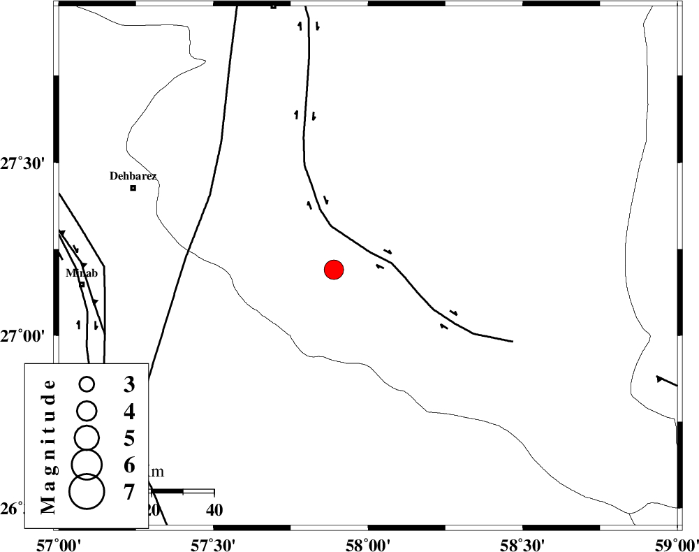
:4 |
| Date & Time (UTC) | 2021-01-13 22:56:47.1 |
| Date & Time (Local) | 1399/10/25 02:26:47.1 |
| Location | Lat:27.2 Lon: 58 |
| Region | Kerman Province, 55 km South-East of Manujan |
Nearest Cities |
|
| 13 km North of Keshmiran, Kerman Province | |
| 38 km South East of Qalehy-eganj, Kerman Province | |
| 55 km South East of Manujan, Kerman Province | |
| 59 km South East of Bargah, Kerman Province | |
| 67 km South East of Nodezh, Kerman Province | |
| Depth | 15 km |
| Agency | |
Faults within 150 km: |
|
| JIROFT_F (Length: 144 km) , Distance to epicenter: 5 km | |
| SABZEVARAN_F (Length: 190 km) , Distance to epicenter: 46 km | |
| ZENDAN_MINAB_F_Z1 (Length: 183 km) , Distance to epicenter: 74 km | |
| Number of Phases | 6 |
| RMS | 0.3 |
| Number of Stations | 4 |
| Error in Latitude | >0 km |
| Error in Longitude | 0 km |
| Error in Depth | 0 km |
Download waveform in seisan format
to download seisan software Click here
to access information about IIEES stations Click here
Amplitude | ||||||||
| UID | Agency | Station | Component | Amplitude | Period | Arrival Time | Proccessing Time | Signal Clip |
| 160951 | IIEES SC | BNDS | Z | 670 | 1 | 2021-01-13 22:58:17 | 2021-01-16 02:09:00 | n |
| 160952 | IIEES SC | CHBR | Z | 400 | 1 | 2021-01-13 22:59:12 | 2021-01-16 02:09:00 | n |
| 160953 | IIEES SC | KRBR | Z | 550 | 1 | 2021-01-13 22:58:55 | 2021-01-16 02:09:00 | n |
| 160954 | IIEES SC | BSRN | Z | 81 | 1 | 2021-01-13 23:00:13 | 2021-01-16 02:09:00 | n |
Phase | ||||||||||||
| Agency | Station | Component | Phase Type | Phase Quality | First Motion | Observed Arrival Time | Time Residual | Loc. Flag | Input Weight | Distance | Azimuth | |
| IIEES SC | BNDS | Z | IP | I | 2021-01-13 22:57:16 | -0.1 | y | 177 | 277 | |||
| IIEES SC | CHBR | Z | IP | I | 2021-01-13 22:57:32 | 0 | y | 300 | 126 | |||
| IIEES SC | KRBR | Z | IP | I | 2021-01-13 22:57:36 | 0.5 | y | 333 | 339 | |||
| IIEES SC | BSRN | Z | IP | I | 2021-01-13 22:58:01 | -0.6 | y | 544 | 12 | |||
| IIEES SC | MEH | Z | IP | I | 2021-01-13 22:58:07 | 2 | n | 4 | 567 | 325 | ||
| IIEES SC | YZKH | Z | IP | I | 2021-01-13 22:58:13 | -3.8 | n | 4 | 667 | 330 | ||
کلیه حقوق مادی و معنوی این سایت متعلق به پژوهشگاه بین المللی زلزله شناسی و مهندسی زلزله می باشد.
