خانه / مشخصات زلزله
Magnitude |
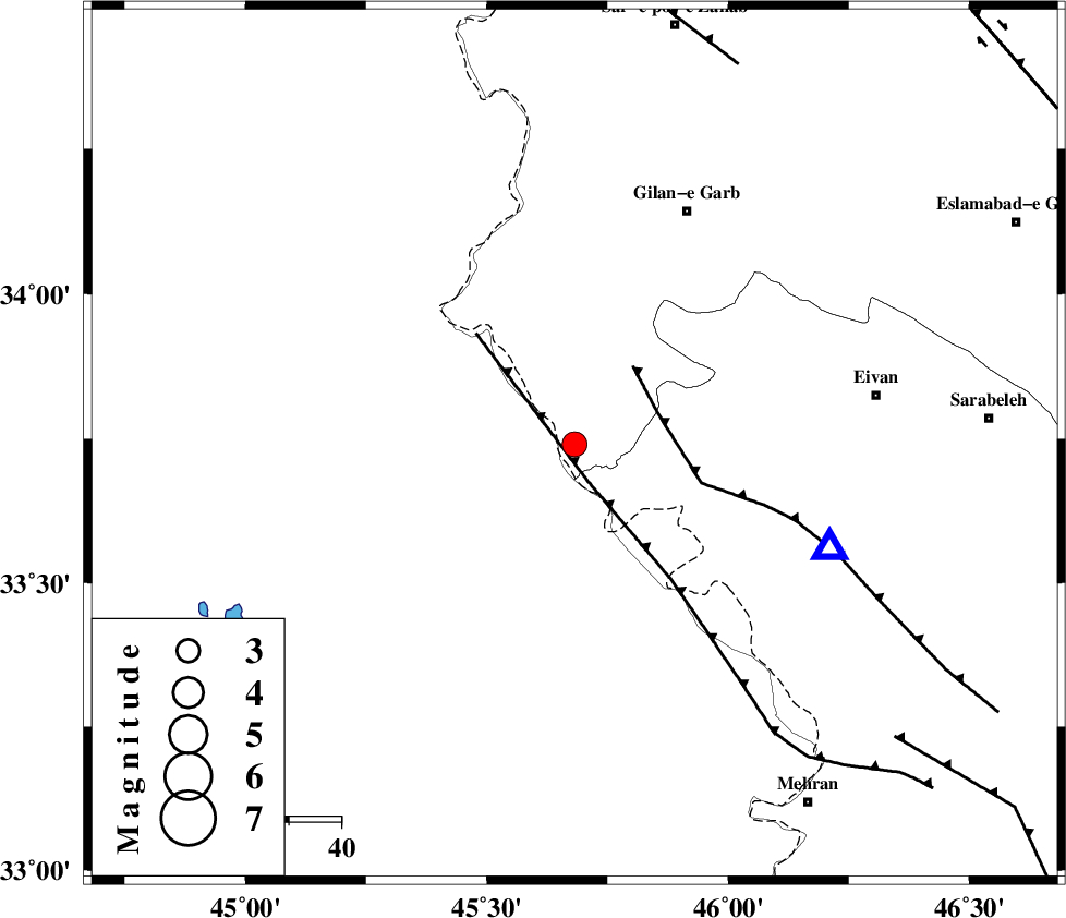
:3.3 |
| Date & Time (UTC) | 2021-02-15 22:36:03.0 |
| Date & Time (Local) | 1399/11/28 02:06:03.0 |
| Location | Lat:33.74 Lon: 45.682 |
| Region | Kermanshah Province, 50 km South-West of Gilan-E-Gharb |
Nearest Cities |
|
| 16 km South of Sumar, Kermanshah Province | |
| 41 km South West of Nian, Kermanshah Province | |
| 47 km South West of Teran, Ilam Province | |
| 50 km South West of Gilan-E-Gharb, Kermanshah Province | |
| 51 km South West of Zarneh, Ilam Province | |
| Depth | 12 km |
| Agency | |
Faults within 150 km: |
|
| ZFF4 (Length: 128 km) , Distance to epicenter: 7 km | |
| MFF7 (Length: 99 km) , Distance to epicenter: 17 km | |
| MFF8 (Length: 48 km) , Distance to epicenter: 79 km | |
| Number of Phases | 8 |
| RMS | 0.3 |
| Number of Stations | 8 |
| Error in Latitude | >5.4 km |
| Error in Longitude | 5.4 km |
| Error in Depth | 4.4 km |
Download waveform in seisan format
to download seisan software Click here
to access information about IIEES stations Click here
Amplitude | ||||||||
| UID | Agency | Station | Component | Amplitude | Period | Arrival Time | Proccessing Time | Signal Clip |
Phase | ||||||||||||
| Agency | Station | Component | Phase Type | Phase Quality | First Motion | Observed Arrival Time | Time Residual | Loc. Flag | Input Weight | Distance | Azimuth | |
| IIEES SC | ILBA | Z | EPg | E | 2021-02-15 22:36:12 | -0.1 | y | 0 | 50 | 105 | ||
| IIEES SC | SNGE | Z | EPn | E | 2021-02-15 22:36:37 | 0.2 | y | 0 | 214 | 46 | ||
| IIEES SC | SRSL | Z | EPn | E | 2021-02-15 22:36:45 | 0.5 | y | 0 | 275 | 355 | ||
| IIEES SC | MAHB | Z | EPn | E | 2021-02-15 22:36:52 | -0.6 | y | 0 | 336 | 0 | ||
| IIEES SC | GTMR | Z | EPn | E | 2021-02-15 22:36:54 | 0 | y | 0 | 350 | 114 | ||
| IIEES SC | ASAO | Z | EPn | E | 2021-02-15 22:37:01 | -0.3 | y | 0 | 410 | 77 | ||
| IIEES SC | QABG | Z | EPn | E | 2021-02-15 22:37:03 | -0.1 | y | 0 | 419 | 59 | ||
| IIEES SC | GHVR | Z | EPn | E | 2021-02-15 22:37:15 | 0.3 | y | 0 | 520 | 81 | ||
کلیه حقوق مادی و معنوی این سایت متعلق به پژوهشگاه بین المللی زلزله شناسی و مهندسی زلزله می باشد.
