خانه / مشخصات زلزله
Magnitude |
:3.2 |
| Date & Time (UTC) | 2021-03-01 01:30:14.8 |
| Date & Time (Local) | 1399/12/11 05:00:14.8 |
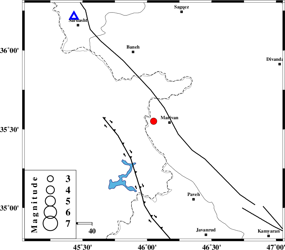
| Location | Lat:35.551 Lon: 46.05 |
| Region | Kurdistan Province, 11 km -West of Marivan |
Nearest Cities |
|
| 5 km North of Ney, Kurdistan Province | |
| 6 km of Bardeh rasheh, Kurdistan Province | |
| 11 km North West of Marivan, Kurdistan Province | |
| 13 km South of Savoji, Kurdistan Province | |
| 17 km North West of Kanidinar, Kurdistan Province | |
| Depth | 10 km |
| Agency | |
Faults within 150 km: |
|
| PIRANSHAHR_F (Length: 253 km) , Distance to epicenter: 12 km | |
| HZF4 (Length: 492 km) , Distance to epicenter: 27 km | |
| SARTAKHT_F (Length: 78 km) , Distance to epicenter: 87 km | |
| Number of Phases | 10 |
| RMS | 0.5 |
| Number of Stations | 10 |
| Error in Latitude | >2.7 km |
| Error in Longitude | 2.7 km |
| Error in Depth | 14 km |
Download waveform in seisan format
to download seisan software Click here
to access information about IIEES stations Click here
Amplitude | ||||||||
| UID | Agency | Station | Component | Amplitude | Period | Arrival Time | Proccessing Time | Signal Clip |
| 162208 | IIEES SC | MAHB | Z | 0.9 | 1 | 2021-03-01 01:30:37 | 2021-03-01 05:44:00 | n |
| 162209 | IIEES SC | ILBA | Z | 0.2 | 1 | 2021-03-01 01:30:49 | 2021-03-01 05:44:00 | n |
| 162210 | IIEES SC | ASAO | Z | 0.06 | 1 | 2021-03-01 01:31:09 | 2021-03-01 05:44:00 | n |
| 162211 | IIEES SC | GTMR | Z | 0.06 | 1 | 2021-03-01 01:31:18 | 2021-03-01 05:44:00 | n |
Phase | ||||||||||||
| Agency | Station | Component | Phase Type | Phase Quality | First Motion | Observed Arrival Time | Time Residual | Loc. Flag | Input Weight | Distance | Azimuth | |
| IIEES SC | SNGE | Z | EPg | E | 2021-03-01 01:30:34 | -2.2 | n | 4 | 128 | 113 | ||
| IIEES SC | MAHB | Z | EPg | E | 2021-03-01 01:30:37 | -0.3 | y | 0 | 138 | 347 | ||
| IIEES SC | ILBA | Z | EPn | E | 2021-03-01 01:30:49 | 0.1 | y | 0 | 214 | 176 | ||
| IIEES SC | AZR | Z | EPn | E | 2021-03-01 01:30:53 | 1 | y | 0 | 236 | 359 | ||
| IIEES SC | ZNJK | Z | EPn | E | 2021-03-01 01:30:56 | 0.3 | y | 0 | 268 | 62 | ||
| IIEES SC | QABG | Z | EPn | E | 2021-03-01 01:31:01 | -1 | y | 0 | 320 | 87 | ||
| IIEES SC | ASAO | Z | EPn | E | 2021-03-01 01:31:09 | -0.4 | y | 0 | 379 | 107 | ||
| IIEES SC | GZV | Z | EPn | E | 2021-03-01 01:31:11 | 0.6 | y | 0 | 387 | 76 | ||
| IIEES SC | GRMI | Z | EPn | E | 2021-03-01 01:31:13 | 0.8 | y | 0 | 397 | 24 | ||
| IIEES SC | GTMR | Z | EPn | E | 2021-03-01 01:31:18 | 0.2 | y | 0 | 444 | 140 | ||
کلیه حقوق مادی و معنوی این سایت متعلق به پژوهشگاه بین المللی زلزله شناسی و مهندسی زلزله می باشد.
