خانه / مشخصات زلزله
Magnitude |
:3.3 |
| Date & Time (UTC) | 2021-03-08 14:11:38.0 |
| Date & Time (Local) | 1399/12/18 17:41:38.0 |
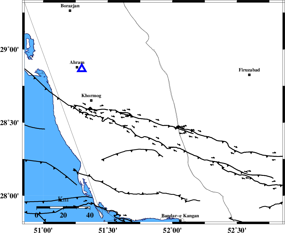
| Location | Lat:28.569 Lon: 51.854 |
| Region | Bushehr Province, 40 km South-West of Farashband |
Nearest Cities |
|
| 22 km North of Shanbeh, Bushehr Province | |
| 40 km North East of Baduleh, Bushehr Province | |
| 40 km South West of Farashband, Fars Province | |
| 42 km North East of Kaki, Bushehr Province | |
| 44 km South West of Aviz, Fars Province | |
| Depth | 12 km |
| Agency | |
Faults within 150 km: |
|
| MFF5 (Length: 74 km) , Distance to epicenter: 14 km | |
| MFF3 (Length: 292 km) , Distance to epicenter: 39 km | |
| BORAZJAN_F (Length: 168 km) , Distance to epicenter: 46 km | |
| Number of Phases | 6 |
| RMS | 0.2 |
| Number of Stations | 6 |
| Error in Latitude | >3.4 km |
| Error in Longitude | 3.4 km |
| Error in Depth | 11.3 km |
Download waveform in seisan format
to download seisan software Click here
to access information about IIEES stations Click here
Amplitude | ||||||||
| UID | Agency | Station | Component | Amplitude | Period | Arrival Time | Proccessing Time | Signal Clip |
| 162362 | IIEES SC | LMD1 | Z | 0.7 | 1 | 2021-03-08 14:12:08 | 2021-03-09 08:19:00 | n |
| 162363 | IIEES SC | KLNJ | Z | 0.2 | 1 | 2021-03-08 14:12:20 | 2021-03-09 08:19:00 | n |
| 162364 | IIEES SC | GTMR | Z | 0.04 | 1 | 2021-03-08 14:12:49 | 2021-03-09 08:19:00 | n |
| 162365 | IIEES SC | KHMZ | Z | 0.02 | 1 | 2021-03-08 14:13:00 | 2021-03-09 08:19:00 | n |
Phase | ||||||||||||
| Agency | Station | Component | Phase Type | Phase Quality | First Motion | Observed Arrival Time | Time Residual | Loc. Flag | Input Weight | Distance | Azimuth | |
| IIEES SC | AHRM | Z | EPg | E | 2021-03-08 14:11:49 | 0 | y | 0 | 64 | 301 | ||
| IIEES SC | GHIR | Z | EPg | E | 2021-03-08 14:11:57 | 0 | y | 0 | 115 | 106 | ||
| IIEES SC | LMD1 | Z | EPg | E | 2021-03-08 14:12:08 | -0.1 | y | 0 | 188 | 137 | ||
| IIEES SC | KLNJ | Z | EPn | E | 2021-03-08 14:12:20 | 0.1 | y | 0 | 272 | 355 | ||
| IIEES SC | GTMR | Z | EPn | E | 2021-03-08 14:12:49 | 0.9 | y | 0 | 506 | 329 | ||
| IIEES SC | KHMZ | Z | EPn | E | 2021-03-08 14:13:00 | -0.8 | y | 0 | 601 | 343 | ||
کلیه حقوق مادی و معنوی این سایت متعلق به پژوهشگاه بین المللی زلزله شناسی و مهندسی زلزله می باشد.
