خانه / مشخصات زلزله
Magnitude |
:3.3 |
| Date & Time (UTC) | 2021-04-17 07:56:21.1 |
| Date & Time (Local) | 1400/1/28 12:26:21.1 |
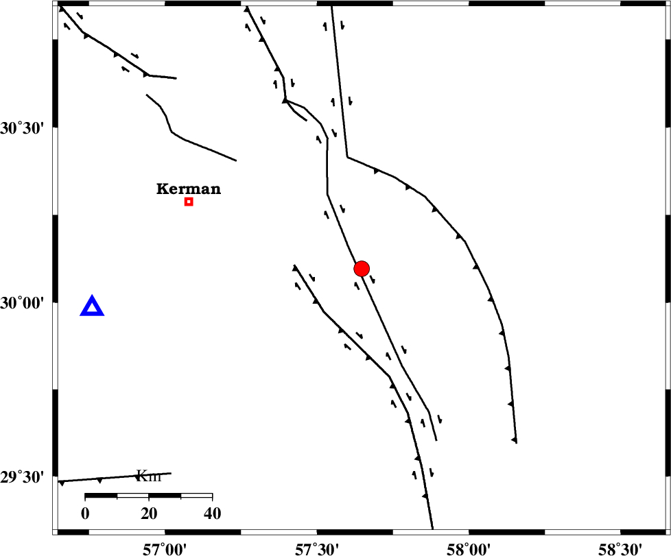
| Location | Lat:30.096 Lon: 57.647 |
| Region | Kerman Province, 59 km South-East of Kerman |
Nearest Cities |
|
| 3 km of Jushan, Kerman Province | |
| 14 km of Sirch, Kerman Province | |
| 28 km North West of Golbaft, Kerman Province | |
| 35 km North East of Mahan, Kerman Province | |
| 35 km North East of Langar, Kerman Province | |
| Depth | 12 km |
| Agency | |
Faults within 150 km: |
|
| GOLBAF_SIRCH_F (Length: 114 km) , Distance to epicenter: 8 km | |
| GOWK_F (Length: 152 km) , Distance to epicenter: 18 km | |
| SHAHDAD_F (Length: 108 km) , Distance to epicenter: 30 km | |
| Number of Phases | 6 |
| RMS | 0.5 |
| Number of Stations | 6 |
| Error in Latitude | >0.7 km |
| Error in Longitude | 0.7 km |
| Error in Depth | 3.3 km |
Download waveform in seisan format
to download seisan software Click here
to access information about IIEES stations Click here
Amplitude | ||||||||
| UID | Agency | Station | Component | Amplitude | Period | Arrival Time | Proccessing Time | Signal Clip |
| 162627 | IIEES SC | KRBR | Z | 2 | 1 | 2021-04-17 07:56:35 | 2021-04-17 10:52:00 | n |
| 162628 | IIEES SC | BNDS | Z | 0.1 | 1 | 2021-04-17 07:57:10 | 2021-04-17 10:52:00 | n |
| 162629 | IIEES SC | YZKH | Z | 0.09 | 1 | 2021-04-17 07:57:17 | 2021-04-17 10:52:00 | n |
Phase | ||||||||||||
| Agency | Station | Component | Phase Type | Phase Quality | First Motion | Observed Arrival Time | Time Residual | Loc. Flag | Input Weight | Distance | Azimuth | |
| IIEES SC | KRBR | Z | EPg | E | 2021-04-17 07:56:35 | -1.1 | y | 0 | 86 | 262 | ||
| IIEES SC | BSRN | Z | EPn | E | 2021-04-17 07:57:00 | -0.2 | y | 0 | 251 | 34 | ||
| IIEES SC | MEH | Z | EPn | E | 2021-04-17 07:57:10 | 0.7 | y | 0 | 324 | 296 | ||
| IIEES SC | BNDS | Z | EPn | E | 2021-04-17 07:57:10 | 0.1 | y | 0 | 332 | 206 | ||
| IIEES SC | YZKH | Z | EPn | E | 2021-04-17 07:57:17 | 0.5 | y | 0 | 386 | 311 | ||
| IIEES SC | TABS | Z | EPn | E | 2021-04-17 07:57:18 | 0 | y | 0 | 397 | 353 | ||
کلیه حقوق مادی و معنوی این سایت متعلق به پژوهشگاه بین المللی زلزله شناسی و مهندسی زلزله می باشد.
