خانه / مشخصات زلزله
Magnitude |
:3.4 |
| Date & Time (UTC) | 2021-05-07 10:20:56.2 |
| Date & Time (Local) | 1400/2/17 14:50:56.2 |
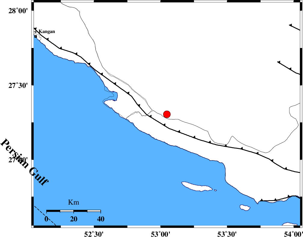
| Location | Lat:27.305 Lon: 53.047 |
| Region | Fars Province, 12 km -West of Lamerd |
Nearest Cities |
|
| 12 km West of Lamerd, Fars Province | |
| 17 km South of Khoozi, Fars Province | |
| 26 km East of Chah-e mobarak, Bushehr Province | |
| 31 km South East of Mehr, Fars Province | |
| 36 km South of Alamarvdasht, Fars Province | |
| Depth | 10 km |
| Agency | |
Faults within 150 km: |
|
| MFF3 (Length: 292 km) , Distance to epicenter: 11 km | |
| LAR_F (Length: 99 km) , Distance to epicenter: 91 km | |
| ZFF1 (Length: 165 km) , Distance to epicenter: 95 km | |
| Number of Phases | 7 |
| RMS | 0.5 |
| Number of Stations | 7 |
| Error in Latitude | >5.7 km |
| Error in Longitude | 5.7 km |
| Error in Depth | 18.2 km |
Download waveform in seisan format
to download seisan software Click here
to access information about IIEES stations Click here
Amplitude | ||||||||
| UID | Agency | Station | Component | Amplitude | Period | Arrival Time | Proccessing Time | Signal Clip |
| 162823 | IIEES SC | KLNJ | Z | 0.08 | 1 | 2021-05-07 10:21:58 | 2021-05-08 07:42:00 | n |
| 162824 | IIEES SC | KRBR | Z | 0.07 | 1 | 2021-05-07 10:22:03 | 2021-05-08 07:42:00 | n |
| 162825 | IIEES SC | YZKH | Z | 0.02 | 1 | 2021-05-07 10:22:16 | 2021-05-08 07:42:00 | n |
| 162826 | IIEES SC | TABS | Z | 0.01 | 1 | 2021-05-07 10:22:43 | 2021-05-08 07:42:00 | n |
Phase | ||||||||||||
| Agency | Station | Component | Phase Type | Phase Quality | First Motion | Observed Arrival Time | Time Residual | Loc. Flag | Input Weight | Distance | Azimuth | |
| IIEES SC | GHIR | Z | EPg | E | 2021-05-07 10:21:15 | 0.8 | y | 0 | 109 | 357 | ||
| IIEES SC | AHRM | Z | EPn | E | 2021-05-07 10:21:36 | 0 | y | 0 | 256 | 312 | ||
| IIEES SC | BNDS | Z | EPn | E | 2021-05-07 10:21:42 | -0.2 | y | 0 | 309 | 88 | ||
| IIEES SC | KLNJ | Z | EPn | E | 2021-05-07 10:21:58 | -0.4 | y | 0 | 434 | 341 | ||
| IIEES SC | KRBR | Z | EPn | E | 2021-05-07 10:22:03 | 0.6 | y | 0 | 469 | 51 | ||
| IIEES SC | YZKH | Z | EPn | E | 2021-05-07 10:22:16 | -0.1 | y | 0 | 583 | 15 | ||
| IIEES SC | TABS | Z | EPn | E | 2021-05-07 10:22:43 | -0.9 | y | 0 | 805 | 29 | ||
کلیه حقوق مادی و معنوی این سایت متعلق به پژوهشگاه بین المللی زلزله شناسی و مهندسی زلزله می باشد.
