خانه / مشخصات زلزله
Magnitude |
:3.4 |
| Date & Time (UTC) | 2022-01-22 21:54:29.7 |
| Date & Time (Local) | 1400/11/3 01:24:29.7 |
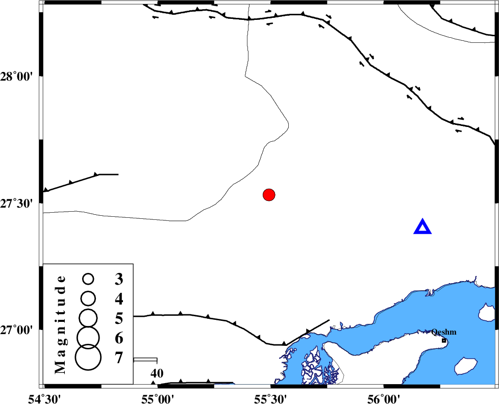
| Location | Lat:27.532 Lon: 55.492 |
| Region | Hormozgan Province, 87 km North-West of Bandar-e abbas |
Nearest Cities |
|
| 37 km South of Darz, Fars Province | |
| 42 km South West of Fin, Hormozgan Province | |
| 65 km North of Bandar-e khamir, Hormozgan Province | |
| 81 km South East of Fadami, Fars Province | |
| 87 km North West of Bandar-e abbas, Hormozgan Province | |
| Depth | 12 km |
| Agency | |
Faults within 150 km: |
|
| MFF1 (Length: 180 km) , Distance to epicenter: 58 km | |
| LAR_F (Length: 99 km) , Distance to epicenter: 66 km | |
| HZF2 (Length: 437 km) , Distance to epicenter: 72 km | |
| Number of Phases | 9 |
| RMS | 0.2 |
| Number of Stations | 9 |
| Error in Latitude | >1.4 km |
| Error in Longitude | 1.4 km |
| Error in Depth | 232 km |
Download waveform in seisan format
to download seisan software Click here
to access information about IIEES stations Click here
Amplitude | ||||||||
| UID | Agency | Station | Component | Amplitude | Period | Arrival Time | Proccessing Time | Signal Clip |
| 168445 | IIEES SC | KLNJ | Z | 0.06 | 1 | 2022-01-22 21:55:44 | 2022-01-23 07:30:00 | n |
| 168446 | IIEES SC | YZKH | Z | 0.03 | 1 | 2022-01-22 21:55:45 | 2022-01-23 07:30:00 | n |
| 168447 | IIEES SC | NASN | Z | 0.02 | 1 | 2022-01-22 21:55:56 | 2022-01-23 07:30:00 | n |
Phase | ||||||||||||
| Agency | Station | Component | Phase Type | Phase Quality | First Motion | Observed Arrival Time | Time Residual | Loc. Flag | Input Weight | Distance | Azimuth | |
| IIEES SC | GHIR | Z | EPn | E | 2022-01-22 21:55:10 | 0.1 | y | 0 | 260 | 289 | ||
| IIEES SC | JSSH | Z | EPn | E | 2022-01-22 21:55:09 | 0 | y | 0 | 260 | 134 | ||
| IIEES SC | KRBR | Z | EPn | E | 2022-01-22 21:55:15 | 0.4 | y | 0 | 298 | 25 | ||
| IIEES SC | KLNJ | Z | EPn | E | 2022-01-22 21:55:44 | -0.3 | y | 0 | 540 | 315 | ||
| IIEES SC | YZKH | Z | EPn | E | 2022-01-22 21:55:45 | 0 | y | 0 | 546 | 351 | ||
| IIEES SC | NASN | Z | EPn | E | 2022-01-22 21:55:56 | -0.6 | y | 0 | 639 | 336 | ||
| IIEES SC | KHMZ | Z | EPn | E | 2022-01-22 21:56:25 | -0.1 | y | 0 | 869 | 322 | ||
| IIEES SC | ASAO | Z | EPn | E | 2022-01-22 21:56:33 | -0.4 | y | 0 | 937 | 326 | ||
| IIEES SC | ILBA | Z | EPn | E | 2022-01-22 21:56:54 | -2.3 | n | 4 | 1118 | 307 | ||
کلیه حقوق مادی و معنوی این سایت متعلق به پژوهشگاه بین المللی زلزله شناسی و مهندسی زلزله می باشد.
