خانه / مشخصات زلزله
Magnitude |
:3.3 |
| Date & Time (UTC) | 2022-02-10 06:18:12.0 |
| Date & Time (Local) | 1400/11/21 09:48:12.0 |
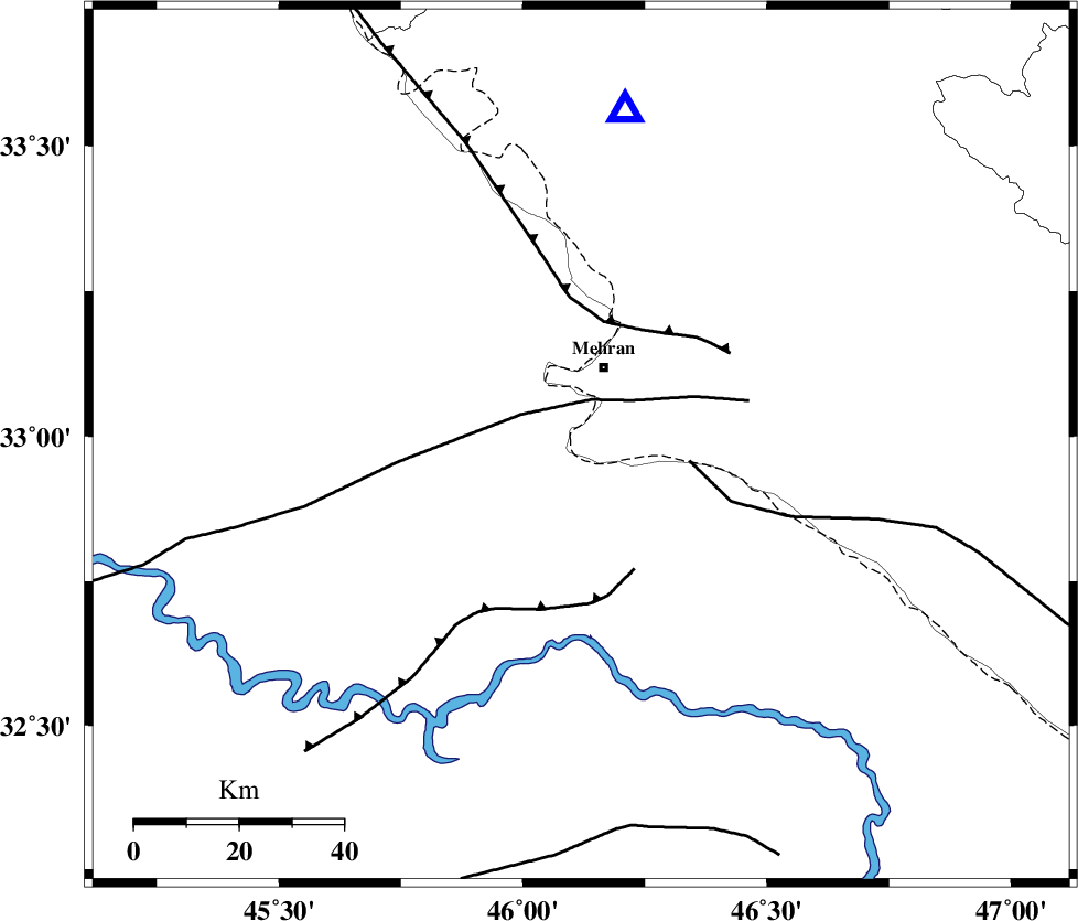
| Location | Lat:32.984 Lon: 46.119 |
| Region | Ilam Province, 16 km South of Mehran |
Nearest Cities |
|
| 16 km South of Mehran, Ilam Province | |
| 49 km South West of Galeh-yedarre-hemalakshahi, Ilam Province | |
| 50 km South West of Gonbad-e pirmohammad, Ilam Province | |
| 55 km South of Salehabad, Ilam Province | |
| 60 km South West of Mehr, Ilam Province | |
| Depth | 12 km |
| Agency | |
Faults within 150 km: |
|
| ZFF4 (Length: 128 km) , Distance to epicenter: 24 km | |
| MFF6 (Length: 144 km) , Distance to epicenter: 35 km | |
| MFF7 (Length: 99 km) , Distance to epicenter: 51 km | |
| Number of Phases | 7 |
| RMS | 0.4 |
| Number of Stations | 7 |
| Error in Latitude | >5.7 km |
| Error in Longitude | 5.7 km |
| Error in Depth | 7.4 km |
Download waveform in seisan format
to download seisan software Click here
to access information about IIEES stations Click here
Amplitude | ||||||||
| UID | Agency | Station | Component | Amplitude | Period | Arrival Time | Proccessing Time | Signal Clip |
| 168777 | IIEES SC | SNGE | Z | 0.3 | 1 | 2022-02-10 06:18:53 | 2022-02-12 05:25:00 | n |
| 168778 | IIEES SC | SNGE | Z | 0.3 | 1 | 2022-02-10 06:19:21 | 2022-02-12 05:25:00 | n |
| 168779 | IIEES SC | GTMR | Z | 0.2 | 1 | 2022-02-10 06:18:55 | 2022-02-12 05:25:00 | n |
| 168780 | IIEES SC | KHMZ | Z | 0.09 | 1 | 2022-02-10 06:19:05 | 2022-02-12 05:25:00 | n |
| 168781 | IIEES SC | ASAO | Z | 0.1 | 1 | 2022-02-10 06:19:10 | 2022-02-12 05:25:00 | n |
Phase | ||||||||||||
| Agency | Station | Component | Phase Type | Phase Quality | First Motion | Observed Arrival Time | Time Residual | Loc. Flag | Input Weight | Distance | Azimuth | |
| IIEES SC | ILBA | Z | EPg | E | 2022-02-10 06:18:24 | -0.3 | y | 0 | 72 | 7 | ||
| IIEES SC | SNGE | Z | EPn | E | 2022-02-10 06:18:53 | 0.6 | y | 0 | 260 | 26 | ||
| IIEES SC | SNGE | Z | ES | E | 2022-02-10 06:19:21 | -0.1 | y | 0 | 260 | 26 | ||
| IIEES SC | GTMR | Z | EPn | E | 2022-02-10 06:18:55 | -0.5 | y | 0 | 286 | 101 | ||
| IIEES SC | SRSL | Z | EPn | E | 2022-02-10 06:19:05 | 0.1 | y | 0 | 364 | 350 | ||
| IIEES SC | KHMZ | Z | EPn | E | 2022-02-10 06:19:05 | -0.1 | y | 0 | 368 | 77 | ||
| IIEES SC | ASAO | Z | EPn | E | 2022-02-10 06:19:10 | 0.4 | y | 0 | 401 | 64 | ||
کلیه حقوق مادی و معنوی این سایت متعلق به پژوهشگاه بین المللی زلزله شناسی و مهندسی زلزله می باشد.
