خانه / مشخصات زلزله
Magnitude |
:2.6 |
| Date & Time (UTC) | 2022-05-12 06:54:22.8 |
| Date & Time (Local) | 1401/2/22 11:24:22.8 |
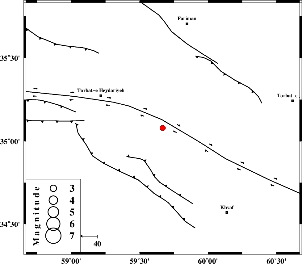
| Location | Lat:35.08 Lon: 59.669 |
| Region | Khorasan(center) Province, 46 km South-East of Torbat-e heydariyeh |
Nearest Cities |
|
| 11 km North of Rashtkhvar, Khorasan(center) Province | |
| 12 km North of Hoseynabad, Khorasan(center) Province | |
| 21 km East of Basfar, Khorasan(center) Province | |
| 26 km South West of Choqmaq, Khorasan(center) Province | |
| 31 km North West of Chamanabad, Khorasan(center) Province | |
| Depth | 12 km |
| Agency | |
Faults within 150 km: |
|
| DORUNEH_F (Length: 713 km) , Distance to epicenter: 6 km | |
| KHAF_F (Length: 58 km) , Distance to epicenter: 25 km | |
| JANGAL_F (Length: 111 km) , Distance to epicenter: 38 km | |
| Number of Phases | 8 |
| RMS | 0.4 |
| Number of Stations | 8 |
| Error in Latitude | >4.5 km |
| Error in Longitude | 4.5 km |
| Error in Depth | 11.5 km |
Download waveform in seisan format
to download seisan software Click here
to access information about IIEES stations Click here
Amplitude | ||||||||
| UID | Agency | Station | Component | Amplitude | Period | Arrival Time | Proccessing Time | Signal Clip |
| 170236 | IIEES SC | SHRT | Z | 0.2 | 1 | 2022-05-12 06:54:51 | 2022-05-16 03:17:00 | n |
| 170237 | IIEES SC | TABS | Z | 0.05 | 1 | 2022-05-12 06:55:06 | 2022-05-16 03:17:00 | n |
| 170238 | IIEES SC | MRVT | Z | 0.01 | 1 | 2022-05-12 06:55:25 | 2022-05-16 03:17:00 | n |
Phase | ||||||||||||
| Agency | Station | Component | Phase Type | Phase Quality | First Motion | Observed Arrival Time | Time Residual | Loc. Flag | Input Weight | Distance | Azimuth | |
| IIEES SC | TBJM | Z | EPg | E | 2022-05-12 06:54:33 | -0.3 | y | 0 | 64 | 71 | ||
| IIEES SC | SHRT | Z | EPg | E | 2022-05-12 06:54:51 | 0.5 | y | 0 | 169 | 160 | ||
| IIEES SC | KAGH | Z | EPn | E | 2022-05-12 06:54:56 | 0.4 | y | 0 | 208 | 7 | ||
| IIEES SC | TABS | Z | EPn | E | 2022-05-12 06:55:06 | 0.1 | y | 0 | 283 | 236 | ||
| IIEES SC | SHRO | Z | EPn | E | 2022-05-12 06:55:13 | -0.7 | y | 0 | 347 | 287 | ||
| IIEES SC | BSRN | Z | EPn | E | 2022-05-12 06:55:14 | -0.1 | y | 0 | 349 | 188 | ||
| IIEES SC | BJRD | Z | EPn | E | 2022-05-12 06:55:14 | -0.1 | y | 0 | 354 | 325 | ||
| IIEES SC | MRVT | Z | EPn | E | 2022-05-12 06:55:25 | 0.8 | y | 0 | 430 | 312 | ||
کلیه حقوق مادی و معنوی این سایت متعلق به پژوهشگاه بین المللی زلزله شناسی و مهندسی زلزله می باشد.
