خانه / مشخصات زلزله
Magnitude |
:3 |
| Date & Time (UTC) | 2021-03-11 11:13:54.2 |
| Date & Time (Local) | 1399/12/21 14:43:54.2 |
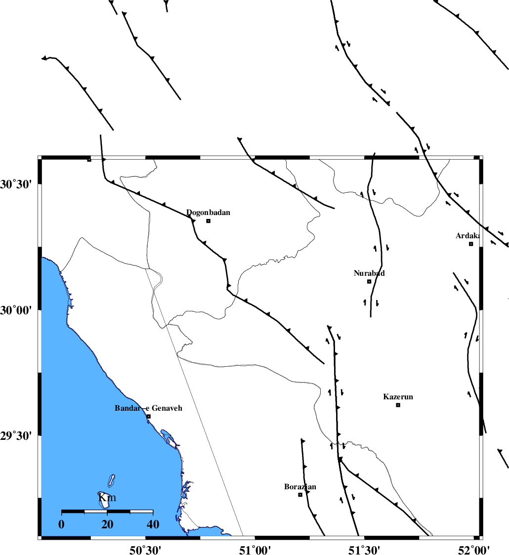
| Location | Lat:29.847 Lon: 51.025 |
| Region | Fars Province, 61 km South-East of Dogonbadan |
Nearest Cities |
|
| 30 km South West of Babamonir, Fars Province | |
| 41 km North East of Chehar rustaee, Bushehr Province | |
| 42 km North of Dehkohneh, Bushehr Province | |
| 44 km North West of Khesht, Fars Province | |
| 46 km North East of Mohammad salehi, Bushehr Province | |
| Depth | 12 km |
| Agency | |
Faults within 150 km: |
|
| ZFF3 (Length: 125 km) , Distance to epicenter: 32 km | |
| BORAZJAN_F (Length: 168 km) , Distance to epicenter: 40 km | |
| MISHAN_F (Length: 76 km) , Distance to epicenter: 45 km | |
| Number of Phases | 8 |
| RMS | 0.9 |
| Number of Stations | 8 |
| Error in Latitude | >4.7 km |
| Error in Longitude | 4.7 km |
| Error in Depth | 16.1 km |
Download waveform in seisan format
to download seisan software Click here
to access information about IIEES stations Click here
Amplitude | ||||||||
| UID | Agency | Station | Component | Amplitude | Period | Arrival Time | Proccessing Time | Signal Clip |
| 190418 | IIEES SC | KLNJ | Z | 0.6 | 1 | 2021-03-11 11:14:18 | 2024-01-27 04:52:00 | n |
| 190419 | IIEES SC | GTMR | Z | 0.08 | 1 | 2021-03-11 11:14:43 | 2024-01-27 04:52:00 | n |
| 190420 | IIEES SC | YZKH | Z | 0.02 | 1 | 2021-03-11 11:14:57 | 2024-01-27 04:52:00 | n |
Phase | ||||||||||||
| Agency | Station | Component | Phase Type | Phase Quality | First Motion | Observed Arrival Time | Time Residual | Loc. Flag | Input Weight | Distance | Azimuth | |
| IIEES SC | AHRM | Z | EPg | E | 2021-03-11 11:14:14 | 1.1 | y | 0 | 112 | 166 | ||
| IIEES SC | KLNJ | Z | EPg | E | 2021-03-11 11:14:18 | 0.9 | y | 0 | 140 | 23 | ||
| IIEES SC | GHIR | Z | EPn | E | 2021-03-11 11:14:33 | -0.9 | y | 0 | 258 | 132 | ||
| IIEES SC | GTMR | Z | EPn | E | 2021-03-11 11:14:43 | -0.8 | y | 0 | 343 | 328 | ||
| IIEES SC | MEH | Z | EPn | E | 2021-03-11 11:14:53 | 3 | n | 4 | 384 | 64 | ||
| IIEES SC | YZKH | Z | EPn | E | 2021-03-11 11:14:57 | 0.6 | y | 0 | 442 | 50 | ||
| IIEES SC | KHMZ | Z | EPn | E | 2021-03-11 11:14:58 | 1.4 | n | 4 | 443 | 347 | ||
| IIEES SC | ASAO | Z | EPn | E | 2021-03-11 11:15:08 | 0.3 | y | 0 | 530 | 350 | ||
کلیه حقوق مادی و معنوی این سایت متعلق به پژوهشگاه بین المللی زلزله شناسی و مهندسی زلزله می باشد.
