خانه / مشخصات زلزله
Magnitude |
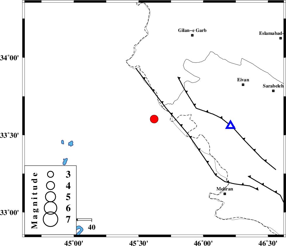
:3.9 |
| Date & Time (UTC) | 2019-04-01 10:21:59.1 |
| Date & Time (Local) | 1398/1/12 14:51:59.1 |
| Location | Lat:33.603 Lon: 45.62 |
| Region | Iraq, 66 km South-West of Gilan-E-Gharb |
Nearest Cities |
|
| 31 km South of Sumar, Kermanshah Province | |
| 55 km North West of Salehabad, Ilam Province | |
| 57 km South West of Nian, Kermanshah Province | |
| 61 km South West of Teran, Ilam Province | |
| 61 km West of Chavar, Ilam Province | |
| Depth | 12 km |
| Agency | |
Faults within 150 km: |
|
| ZFF4 (Length: 128 km) , Distance to epicenter: 12 km | |
| MFF7 (Length: 99 km) , Distance to epicenter: 30 km | |
| MFF6 (Length: 144 km) , Distance to epicenter: 79 km | |
| Number of Phases | 7 |
| RMS | 0.2 |
| Number of Stations | 7 |
| Error in Latitude | >5.1 km |
| Error in Longitude | 5.1 km |
| Error in Depth | 6.3 km |
Download waveform in seisan format
to download seisan software Click here
to access information about IIEES stations Click here
Amplitude | ||||||||
| UID | Agency | Station | Component | Amplitude | Period | Arrival Time | Proccessing Time | Signal Clip |
| 194145 | IIEES SC | SRSL | Z | 0.9 | 1 | 2019-04-01 10:23:15 | 2024-07-21 06:34:00 | n |
| 194146 | IIEES SC | SRSL | Z | 0.9 | 1 | 2019-04-01 10:22:43 | 2024-07-21 06:34:00 | n |
| 194147 | IIEES SC | GTMR | Z | 0.5 | 1 | 2019-04-01 10:22:50 | 2024-07-21 06:34:00 | n |
| 194148 | IIEES SC | KHMZ | Z | 0.2 | 1 | 2019-04-01 10:22:56 | 2024-07-21 06:34:00 | n |
| 194149 | IIEES SC | ASAO | Z | 0.2 | 1 | 2019-04-01 10:22:59 | 2024-07-21 06:34:00 | n |
Phase | ||||||||||||
| Agency | Station | Component | Phase Type | Phase Quality | First Motion | Observed Arrival Time | Time Residual | Loc. Flag | Input Weight | Distance | Azimuth | |
| IIEES SC | SRSL | Z | EPn | E | 2019-04-01 10:22:43 | -0.1 | y | 0 | 290 | 357 | ||
| IIEES SC | SRSL | Z | ES | E | 2019-04-01 10:23:15 | 0.1 | y | 0 | 290 | 357 | ||
| IIEES SC | GTMR | Z | EPn | E | 2019-04-01 10:22:50 | 0.1 | y | 0 | 350 | 111 | ||
| IIEES SC | KHMZ | Z | EPn | E | 2019-04-01 10:22:56 | -0.5 | y | 0 | 403 | 88 | ||
| IIEES SC | ASAO | Z | EPn | E | 2019-04-01 10:22:59 | 0 | y | 0 | 420 | 76 | ||
| IIEES SC | GHVR | Z | EPn | E | 2019-04-01 10:23:13 | 0.2 | y | 0 | 528 | 79 | ||
| IIEES SC | BNDS | Z | EPn | E | 2019-04-01 10:24:34 | -4.5 | n | 4 | 1224 | 124 | ||
کلیه حقوق مادی و معنوی این سایت متعلق به پژوهشگاه بین المللی زلزله شناسی و مهندسی زلزله می باشد.
