خانه / مشخصات زلزله
Magnitude |
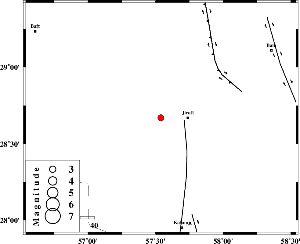
:3 |
| Date & Time (UTC) | 2020-06-16 08:04:26.6 |
| Date & Time (Local) | 1399/3/27 12:34:26.6 |
| Location | Lat:28.67 Lon: 57.539 |
| Region | Kerman Province, 20 km -West of Jiroft |
Nearest Cities |
|
| 19 km North West of Khatunabad-e zangian, Kerman Province | |
| 20 km North West of Jiroft, Kerman Province | |
| 28 km North West of Dolatabad, Kerman Province | |
| 35 km North West of Khesrabad, Kerman Province | |
| 37 km South of Delfard, Kerman Province | |
| Depth | 12 km |
| Agency | |
Faults within 150 km: |
|
| SABZEVARAN_F (Length: 190 km) , Distance to epicenter: 17 km | |
| GOWK_F (Length: 152 km) , Distance to epicenter: 54 km | |
| JIROFT_F (Length: 144 km) , Distance to epicenter: 73 km | |
| Number of Phases | 7 |
| RMS | 0.3 |
| Number of Stations | 7 |
| Error in Latitude | >0.4 km |
| Error in Longitude | 0.4 km |
| Error in Depth | 1.7 km |
Download waveform in seisan format
to download seisan software Click here
to access information about IIEES stations Click here
Amplitude | ||||||||
| UID | Agency | Station | Component | Amplitude | Period | Arrival Time | Proccessing Time | Signal Clip |
| 194997 | IIEES SC | KRBR | Z | 0.5 | 1 | 2020-06-16 08:04:52 | 2024-09-16 05:40:00 | n |
| 194998 | IIEES SC | TABS | Z | 0.01 | 1 | 2020-06-16 08:05:43 | 2024-09-16 05:40:00 | n |
| 194999 | IIEES SC | SHRT | Z | 0.007 | 1 | 2020-06-16 08:05:50 | 2024-09-16 05:40:00 | n |
Phase | ||||||||||||
| Agency | Station | Component | Phase Type | Phase Quality | First Motion | Observed Arrival Time | Time Residual | Loc. Flag | Input Weight | Distance | Azimuth | |
| IIEES SC | KRBR | Z | EPg | E | 2020-06-16 08:04:52 | -0.8 | y | 0 | 164 | 333 | ||
| IIEES SC | BNDS | Z | EPg | E | 2020-06-16 08:04:58 | -0.3 | y | 0 | 195 | 224 | ||
| IIEES SC | ZHSF | Z | EPn | E | 2020-06-16 08:05:15 | 0.1 | y | 0 | 331 | 72 | ||
| IIEES SC | GHIR | Z | EPn | E | 2020-06-16 08:05:30 | 0.3 | y | 0 | 448 | 265 | ||
| IIEES SC | YZKH | Z | EPn | E | 2020-06-16 08:05:24 | -12 | n | 4 | 500 | 326 | ||
| IIEES SC | TABS | Z | EPn | E | 2020-06-16 08:05:43 | 0.2 | y | 0 | 554 | 356 | ||
| IIEES SC | SHRT | Z | EPn | E | 2020-06-16 08:05:50 | 0.1 | y | 0 | 611 | 25 | ||
کلیه حقوق مادی و معنوی این سایت متعلق به پژوهشگاه بین المللی زلزله شناسی و مهندسی زلزله می باشد.
